Q3. Given below is a map of some countries which were parts of the erstwhile Soviet Union, with water bodies shown by shaded areas: The countries marked 1, 2, 3, 4 and 5 are respectively

Loading...
Our archive has 53 Prelims questions that came with a map, all from the 1995–2002 papers. We show 26 of them below, each with its map and answer.
We hold no UPSC answer key for these papers, so a note under each answer says so.
Q3. Given below is a map of some countries which were parts of the erstwhile Soviet Union, with water bodies shown by shaded areas: The countries marked 1, 2, 3, 4 and 5 are respectively

Not from a UPSC answer key: we hold none for the 1995 paper.
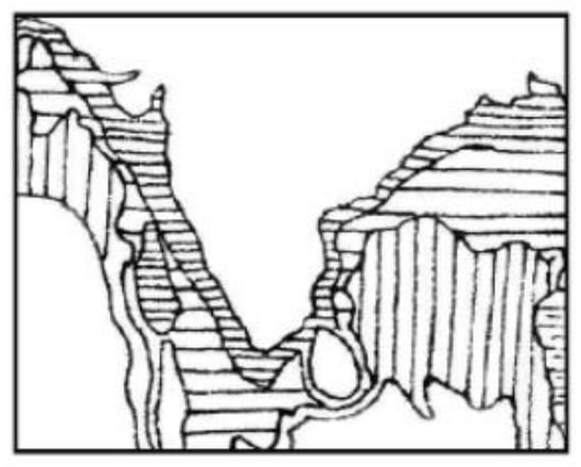
Q22. Consider the map given below: The divisions along India’s coastal region indicate

Not from a UPSC answer key: we hold none for the 1995 paper.
Q25. In the map given below, three out of the four places marked indicate places where a thermal power station is located. The place where there is no thermal power station is marked

Not from a UPSC answer key: we hold none for the 1995 paper.
Q17. A rough outline map of northern Sri Lanka is shown in the figure. Jaffna is located at the point marked

Not from a UPSC answer key: we hold none for the 1996 paper.
Q23. Consider the map given below: The dotted (broken) line in the map is the

Not from a UPSC answer key: we hold none for the 1996 paper.
Q32. Consider the map given below: The predominant languages spoken in the areas marked A, B, C and D are respectively

Not from a UPSC answer key: we hold none for the 1997 paper.
Q38. Consider the map given below: The places marked A, B, C and D in the map are respectively

Not from a UPSC answer key: we hold none for the 1997 paper.
Q43. Consider the map given below: The places marked A, B, C and D in the map are respectively known for the cultivation of

Not from a UPSC answer key: we hold none for the 1997 paper.
Q74. Consider the geographical details given in the following figure: The point marked by A in the above figure indicates a country in

Not from a UPSC answer key: we hold none for the 1997 paper.
Q76. In the map shown in the given figure, rivers labelled as 1, 2, 3 and 4 are respectively

Not from a UPSC answer key: we hold none for the 1997 paper.
Q82. Consider the map given below: Of the four shaded areas in the map, that which is characterised by hot dry summers, mild and moist winters and seasonal reversal of winds is the area labelled

Not from a UPSC answer key: we hold none for the 1997 paper.
Q4. The four railway junctions shown by numerals 1, 2, 3 and 4 on the rough outline map of Gujarat are respectively

Not from a UPSC answer key: we hold none for the 1998 paper.
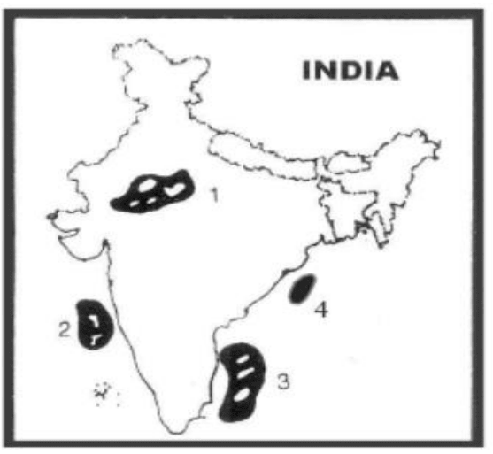
Q75. Commercial production of mineral oil has started recently in which one of the areas of India, labelled 1, 2, 3 and 4 in the rough map given below:

Not from a UPSC answer key: we hold none for the 1998 paper.
Q95. The rough outline map given shows centres of cement industry labelled 1, 2, 3 and 4. Match these centres with the following sets of names: Names A. Katni B. Tirunelveli C. Sikka D. Churk Select the correct answer using the codes given below: Codes:

Not from a UPSC answer key: we hold none for the 1998 paper.
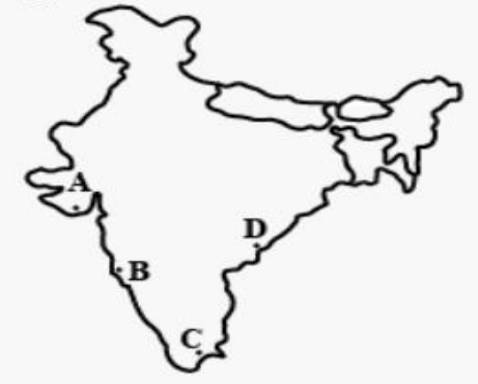
Q98. Which one of the following ports shown on the rough outline map of India is a riverine port?

Not from a UPSC answer key: we hold none for the 1998 paper.
Q17. In the given map, which one of the following pairs of ocean currents is shown?

Not from a UPSC answer key: we hold none for the 1999 paper.
Q64. In the given figure, the site of the Tehri dam has been labelled as

Not from a UPSC answer key: we hold none for the 1999 paper.
Q65. In which one of the following areas in the given map was there a recent discovery of copper deposits by the Atomic Minerals Division of Department of Atomic Energy?

Not from a UPSC answer key: we hold none for the 1999 paper.
Q61. Match the cities labelled as 1, 2, 3, 4 and 5 in the given map with the names of the institutes located in these cities and select the correct answer using the codes given below the names of the institutes. Names of Institutes A) Central Marine Fisheries Research Institute B) Central Sheep Breeding Farm C) National Dairy Research Institute D) National Institute of Agricultural Extension Management Codes:

Not from a UPSC answer key: we hold none for the 2000 paper.
Q69. Match the locations of ports labelled as A, B, C and D in the given map with the names of those ports and select the correct answer using the codes given below the names of the ports: Names of Ports: 1. Kakinada 2. Karwar 3. Mangalore 4. Tuticorin 5. Veraval Codes:

Not from a UPSC answer key: we hold none for the 2000 paper.
Q70. Consider the map given below: The route indicated in the map was followed, during the course of his military exploits, by

Not from a UPSC answer key: we hold none for the 1995 paper.
Q53. In the given map, the shaded part represents Akbar’s empire at a certain juncture: ‘A’ stands for an independent country and ‘B’ marks the site of a city. Which one of the following alternatives gives all correct information?

Not from a UPSC answer key: we hold none for the 1998 paper.
Q54. Consider the map given below indicating four places frequently figuring in the news: Which one of them is Chechenya? Choose the correct answer from the codes given below:

Not from a UPSC answer key: we hold none for the 1995 paper.
Q78. Examine the map given below: The places marked 1, 2, 3 and 4 were respectively the seats of powers of the

Not from a UPSC answer key: we hold none for the 1995 paper.
Q85. The following map shows four of the sixteen mahajanapadas that existed in ancient India. The places marked A, B, C and D respectively are

Not from a UPSC answer key: we hold none for the 1997 paper.
Q72. Forest areas have been labelled as 1, 2, 3 and 4 in the rough outline map given. Among these, those which were threatened in 1997 by a serious epidemic include

Not from a UPSC answer key: we hold none for the 1998 paper.
UPSC printed these with a map we do not hold. Each links to its own page, which has the question and answer but not the map.
We hold back 12 more map questions until we have a clean copy of their map.
Papers after 2002 ask about places in text: how many of four countries border the North Sea (2024), the order of South-East Asian cities from south to north (2014), and the city on a longitude closest to Delhi's (2018).
Practise them by Geography sub-topic:
For history maps, see the History NCERT Maps compilation.