
The river Subarnarekha originates near which of the following villages?
- (a)Ormanjhi
- (b)Mandar
- (c)Hehal
- (d)Nagri
Answer
Why
Correct: D, Nagri. India-WRIS, the Central Water Commission's national water-resources information wiki, states it without qualification, and states it twice on the same basin page: "The Subernarekha River rises near Nagri village in the Ranchi District of Jharkhand at an elevation of 600 m. It flows for a length of 395 km before outfalling into the Bay of Bengal", and again in the basin summary, "It originates near Nagri village in Ranchi district of Jharkhand at an elevation of 600 m." Nagri is a village in the Nagri community development block of the Ranchi Sadar subdivision, roughly 15–16 km west of Ranchi city on the Chota Nagpur plateau; the spring itself is the Rani Chuan at Piska/Nagri, and you will meet the source written both ways: Piska–Nagri is one locality pair, not two rival claims. (Where sources differ it is only by a few metres of elevation: the Commission prints 600 m, some gazetteer-derived accounts 610 m. Nothing turns on that; the village name is not in dispute.) The 600 m figure is itself a check on the answer, because it places the source on the plateau rim that India-WRIS names as the basin's own northern and western boundary: the river then loses that entire 600 m over its 395 km run to sea level. From Nagri it goes south-east across Ranchi, Seraikela-Kharsawan and East Singhbhum districts, cuts through Paschim Medinipur in West Bengal and Balasore in Odisha, and reaches the Bay of Bengal near Talsari. The Commission gives the basin 29,196 sq km across Jharkhand, Odisha and a smaller part of West Bengal, lying between 85°8′ and 87°32′ E and 21°15′ and 23°34′ N, with a maximum length of about 297 km and width of 119 km, average annual rainfall near 1,800 mm and an average water-resource potential of 12,370 MCM of which 6,800 MCM is rated utilizable. Its principal tributaries all join from the right: the Kharkai (136 km, 6,611 sq km, the largest tributary catchment, meeting the main stream at Domuhani in Jamshedpur), the Karkari (110 km, 1,341 sq km) and the Kanchi (76 km, 1,096 sq km): with the Dulang (84 km, 1,200 sq km) the one left-bank entrant. The name itself records the source: subarna means gold and rekha a streak or line, after the gold traditionally panned in the riverbed near its origin.
Why the others are wrong
- (a)Ormanjhi: The best-constructed decoy, because Ormanjhi genuinely sits on the Subarnarekha: just about 50 km downstream of the source. Ormanjhi is a village and CD block of Ranchi Sadar subdivision, on the eastern side of Ranchi, and the Getalsud (Rukka) Dam, opened in 1971 and 35.5 m high, was thrown across the river there to supply Ranchi city's drinking water and to feed the Sikidiri hydel units below it. A candidate who remembers 'Ormanjhi = Subarnarekha' but not the direction of flow will pick it. The geometry settles it: the river rises west of the city at 600 m and runs east and south-east, so a place east of Ranchi is by definition downstream, and a dam site is chosen for the storage a river has already accumulated, never for its first trickle.
- (b)Mandar: Mandar is a village and CD block in Ranchi Sadar subdivision, north-west of Ranchi, off the Subarnarekha's headwater catchment. The name is doing double duty as a trap for Bihar candidates, who know Mandar Hill (Mandar Parvat) at Bounsi in Banka district, Bihar: the roughly 700-foot pilgrimage hill of the Samudra Manthan tradition, an isolated hill carrying Jain and Hindu shrines, which stands roughly 230 km north-east of Ranchi in a different state and a different drainage, and is nowhere near any river source. Two different places with one name in two different states is exactly the shape of trap a state commission builds.
- (c)Hehal: Hehal is not a village outside Ranchi at all but a locality inside Ranchi city, on its north-western side: the address of DAV Public School, Hehal and of a CIPET campus. The stem asks for a village, and Hehal is urban ward territory, which is a structural reason to drop it before any hydrology is considered. No gazetteer and no Central Water Commission document associates it with the Subarnarekha's source; India-WRIS names exactly one place, and it is not this one.
Concept
The Subarnarekha is one of the east-flowing rivers of the Chota Nagpur plateau: a compact, rain-fed, inter-state system that never touches the Gangetic plain. It rises on the plateau near Ranchi, runs 395 km south-east and empties independently into the Bay of Bengal instead of joining the Ganga or the Mahanadi. India-WRIS describes the basin as sitting in the north-east corner of peninsular India, bounded by the Chhotanagpur plateau on the north and west, by the ridges separating it from the Baitarani basin on the south, by the Bay of Bengal on the south-east and by the Kasai valley of the Kangsabati on the east: a basin fenced by watersheds on every land side, which is why nothing drains out of it into a bigger river. It is a two-river basin, not one: the Commission counts the Subernarekha and the Burhabalang as the basin's two major systems, the Burhabalang rising south of Similipal village in Mayurbhanj district of Odisha at about 800 m and running 164 km to the sea on its own. The main stem is not even the dominant catchment: it accounts for 7,383 sq km or 39.0% of the tributary-wise total, against the Kharkai's 6,611 sq km or 34.9%, which is why Jamshedpur's water politics has always been about two rivers meeting rather than one arriving. Land use is 53.76% agricultural with 2.39% under water bodies, and the geology is Pre-Cambrian/Archaean gneiss, mica schist, phyllite, dolomite and granite in the Jharkhand and West Bengal reaches, giving way to Tertiary rocks and alluvium in Odisha: the same formations that carry the region's coal, iron and bauxite. That is what makes a 'minor' 29,196 sq km basin economically heavy: Jamshedpur, Ghatshila and the Singhbhum copper-uranium belt all sit on it, and the Subarnarekha Multipurpose Project (Chandil dam on the main stem, Icha dam on the Kharkai, the Galudih barrage) was built to irrigate and supply that belt. A BPSC candidate meets it because the entire Chota Nagpur plateau was part of Bihar until Jharkhand was carved out on 15 November 2000 under the Bihar Reorganisation Act, 2000, and the Commission has never dropped the region from its geography syllabus.
The examiner has not offered four random names: all four are places in Ranchi district, so 'which one is in Jharkhand' does not separate them and neither does eliminating anything obviously foreign. There is no category test available here of the kind that cracks most list questions; the discrimination has to come from the river's own geometry, or from the gazetteer line itself. The Subarnarekha rises on the western edge of the Ranchi plateau at 600 m and flows east and south-east, which immediately reverses the two most attractive wrong answers: Ormanjhi lies east of Ranchi and is therefore downstream (50 km downstream, with a dam on it) and Hehal is a ward inside the city, also below the divide. Mandar is north-west, but off the Subarnarekha's headwater catchment altogether. A second, structural filter is the word the stem uses: it asks for a village, which Hehal is not. The one discriminating fact to hold is the Central Water Commission's own wording: 'rises near Nagri village in the Ranchi District at an elevation of 600 m'. If the name will not come at all, the fallback is the source's alternative spelling: the origin is conventionally written as Piska/Nagri, and since Piska–Nagri is a single locality pair, an option naming Nagri is the one every gazetteer supports. The wider habit this question rewards is reading a river as a profile rather than as a name (source elevation, length, direction, outfall) because that profile is what tells you instantly whether a named place can be a source at all.
Key facts
- India-WRIS (Central Water Commission): the Subarnarekha rises near Nagri village, Ranchi district, Jharkhand, at an elevation of 600 m and runs 395 km to the Bay of Bengal near Talsari
- Basin area 29,196 sq km across Jharkhand, Odisha and West Bengal; maximum length 297 km, maximum width 119 km; average annual rainfall about 1,800 mm; average water-resource potential 12,370 MCM
- Principal tributaries, all right-bank: Kharkai 136 km / 6,611 sq km (joins at Domuhani, Jamshedpur), Karkari 110 km / 1,341 sq km, Kanchi 76 km / 1,096 sq km, plus the Raru 52 km and Garru 58 km; the Dulang, 84 km / 1,200 sq km, is the only left-bank entrant
- The main stem carries only 39.0% of the tributary-wise catchment (7,383 sq km) against the Kharkai's 34.9% (6,611 sq km): the two are near-equal partners, which is why the Subarnarekha Multipurpose Project needed the Chandil dam on the main stem and the Icha dam on the Kharkai
- Basin boundaries per India-WRIS: Chhotanagpur plateau north and west, the ridges dividing it from the Baitarani basin to the south, the Bay of Bengal south-east, the Kasai valley of the Kangsabati to the east; extent 85°8′–87°32′ E, 21°15′–23°34′ N
- The Burhabalang is the basin's second major river: it rises south of Similipal village in Mayurbhanj district, Odisha, at about 800 m and runs 164 km to the Bay of Bengal independently of the Subarnarekha
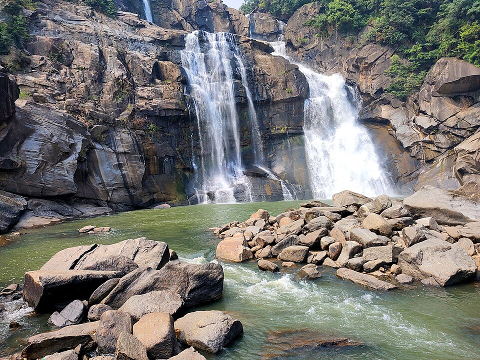
- Hundru Falls, a 98-metre drop in Ranchi district, is on the Subarnarekha itself; Dassam Falls belongs to its tributary the Kanchi
- The Getalsud (Rukka) reservoir at Ormanjhi, completed 1971 and 35.5 m high, is about 40 km east of Ranchi, supplies the city's water and feeds the Sikidiri hydel units downstream
- Live storage in the basin: 764.0 MCM in completed projects and 2,388.00 MCM under construction, 3,152.0 MCM in all, against a utilizable surface-water resource of 6,800 MCM; the CWC runs 12 hydrological observation stations and 2 flood-forecasting stations here
- Land use is 53.76% agricultural with 2.39% water bodies; the rock is Pre-Cambrian/Archaean gneiss, mica schist, phyllite, dolomite and granite in Jharkhand and West Bengal, Tertiary and alluvium in the Odisha reach: the formations that carry the region's coal, iron and bauxite
- Subarna (gold) + rekha (streak): the name comes from gold traditionally panned near the origin at Piska/Nagri, and the river drains Jharkhand's copper and uranium mining belt
Study next
Common traps
- Confusing the place where a dam or a famous waterfall sits with the place where the river rises: Ormanjhi has the Getalsud dam and is still 50 km downstream of the source
- Reading 'Mandar' as Mandar Hill in Banka district, Bihar, which is a pilgrimage hill and not a river source
- Assuming the Subarnarekha is a tributary of the Ganga or the Mahanadi; it reaches the Bay of Bengal on its own, in Balasore district of Odisha
BPSC asks river-source questions as bare one-liners with four near-identical local place names: the 71st CCE did the same thing in 2025 with 'Karmanasa river originates in: ', so the marks go to whoever has memorised the actual gazetteer entry, not to whoever can reason regionally. Note also the scale BPSC picks: the 69th asks for a village and the 71st for a district, so 'Ranchi district' would not have been a sufficient answer here. UPSC prefers to make the source do analytical work: which river originates at Amarkantak, which river does not originate in India, which place gives rise to two rivers flowing to opposite seas. The preparation that satisfies both is a four-item profile per river (source place and elevation, length, states crossed, outfall) which is exactly the row India-WRIS prints for every basin.
Related PYQs
Which one among the following rivers originates at Amarkantak?
- (a) Damodar
- (b) Mahanadi
- (c) Narmada
- (d) Tapi
Answer(c) Narmada
The same one-fact test in mirror image: UPSC names the source place and asks for the river, BPSC names the river and asks for the source village. Both reward having the gazetteer pairing memorised rather than reasoned.
Which one of the following rivers does not originate in India ?
- (a) Beas
- (b) Chenab
- (c) Ravi
- (d) Sutlej
Answer(d) Sutlej
Also a source-location question, but pitched at the scale of the country rather than the village. It is the habit worth building: for every major river, know the point of rise, the states it crosses and where it ends.
Karmanasa river originates in -
- (a) Kaimur District
- (b) Vaishali District
- (c) Patna District
- (d) Bikram District
Answer(a) Kaimur District
BPSC asked the identical question type again two years later, and again about a river of the plateau fringe rather than the Himalayan north bank. If you prepared river origins after the 69th, the 71st paid you back directly.
Practice
- practice, not a real PYQ
Hundru Falls, with a drop of about 98 metres, lies on which river?
- (a)Kanchi
- (b)Subarnarekha
- (c)Damodar
- (d)Burha
Answer(b) Subarnarekha: Hundru Falls is on the main stream in Ranchi district; Dassam Falls belongs to its tributary the Kanchi and Lodh Falls to the Burha in Latehar. - practice, not a real PYQ
The Subarnarekha river finally drains into which of the following?
- (a)The Ganga, near Sahibganj
- (b)The Mahanadi delta
- (c)The Bay of Bengal, near Talsari in Balasore district
- (d)The Hooghly, near Diamond Harbour
Answer(c) The Bay of Bengal, near Talsari in Balasore district: the Central Water Commission records a 395 km course from Nagri to an independent outfall into the sea, not into any larger river.