
Consider the following statements : 1. Lake Victoria is the third largest freshwater lake in the world by surface area. 2. It is one of the great lakes of Africa. 3. It is bordered by four countries—Tanzania, Uganda, Rwanda and Kenya. 4. The only outflow from Lake Victoria is the Nile River, which exits the lake near Jinja, Uganda. Which of the above statements are incorrect?
- (a)1 and 2
- (b)2 and 4
- (c)3 and 4
- (d)1 and 3
Answer
Why
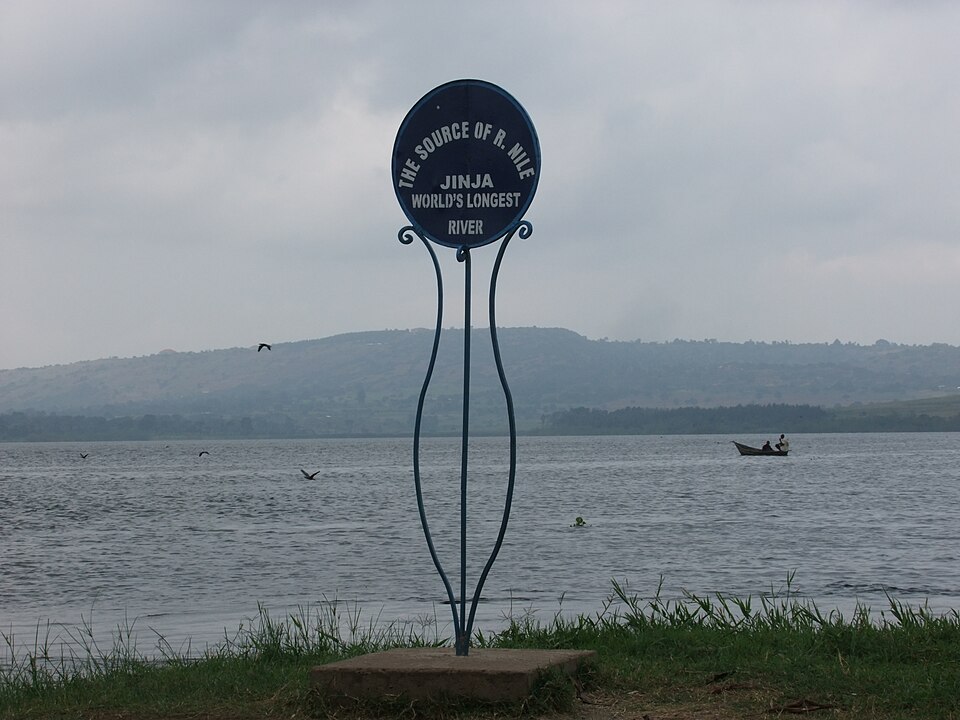
Correct: D, 1 and 3. Statement 1 is wrong by exactly one rank. The Lake Victoria Basin Commission, the East African Community's own specialised institution for the lake, states it plainly: 'Lake Victoria is the 2nd largest freshwater body in the world.' Its surface is about 68,800 sq km, behind Lake Superior at roughly 82,100 sq km and ahead of Lake Huron at about 59,600 sq km. Victoria is called third-largest only when the Caspian Sea (about 371,000 sq km, and saline) is counted as a lake, and the word 'freshwater' in the statement rules that out. Statement 3 is wrong on the count and on one name. Lake Victoria has three riparian states, not four: Tanzania holds roughly 49 per cent of the water surface, Uganda about 45 per cent and Kenya about 6 per cent. Rwanda has no shoreline at all. Where it does belong is the basin, and the two are separate things with separate numbers: the same LVBC page records that the lake is 'hydrologically delineated and covers an area of approximately 183,000 square kilometers with lake surface of covering about 68,800 square kilometers' (a catchment nearly three times the water) and that the Commission's mandate runs to that basin 'in the 5 EAC Partner States', which are Kenya, Uganda, Tanzania, Rwanda and Burundi. Rwanda reaches the lake only through the Kagera, Victoria's largest feeder; the Nile Basin Initiative describes the White Nile as having 'upstream catchments fed by rivers originating in Burundi and in Rwanda', and it puts its Nile Equatorial Lakes office in Kigali. Being in the catchment, and even hosting the basin secretariat, is not the same as having a shore. The other two statements stand. Victoria is the largest member of the African Great Lakes group (statement 2), and its sole surface outflow is the Victoria Nile, which leaves the lake at Jinja in Uganda over what were Ripon Falls, now drowned behind the Nalubaale (Owen Falls) Dam (statement 4). The incorrect pair is therefore 1 and 3, and note the count the setter is testing: five basin states, four named in the stem, three actually on the shore, one outflow.
Why the others are wrong
- (a)1 and 2: Correctly flags the ranking error in statement 1 but then condemns statement 2, which is unarguable. Lake Victoria is not merely one of the African Great Lakes, it is the largest of them by area, ahead of Tanganyika, Malawi, Turkana, Albert, Edward and Kivu, and it is the only one of the group the Equator crosses. A candidate picks (a) by treating 'great lakes' as a North American term and doubting that Africa has a formally named group, but the group is standard usage, and the East African Community and the Nile Basin Initiative both organise their institutions around it.
- (b)2 and 4: The exact inverse of the answer: it rejects the only two statements that are true, which is the signature of having answered the wrong question. This is what option (d) becomes if you read the stem as 'which are correct' instead of 'which are incorrect', so a candidate who has done all the geography right can still land here. Statement 4 in particular is textbook: the Victoria Nile is the lake's single surface outflow and leaves at Jinja, the point John Hanning Speke identified as the source of the Nile in 1862.
- (c)3 and 4: Spots the Rwanda error, which is the harder half, then throws away the marks by rejecting the Jinja outflow. Two thoughts tempt a candidate into doubting statement 4: that a lake of 68,800 sq km must surely drain at more than one point, and that the Kagera and the other feeders imply a matching set of exits. Neither holds. Victoria has one surface outlet and loses the bulk of the rest of its water to evaporation from that vast, shallow surface, which is also why the lake level responds so sharply to rainfall over the lake itself.
Concept
The African Great Lakes lie along the East African Rift, but Lake Victoria is the odd one out among them. Tanganyika and Malawi occupy rift troughs and are extraordinarily deep: Tanganyika reaches about 1,470 m, the second-deepest lake on Earth after Baikal. Victoria sits between the two arms of the rift, in a shallow basin created when uplift of the rift shoulders ponded back rivers that had drained westwards. The result is a lake that is huge in area but shallow for its size: mean depth about 40 m, maximum about 80 m, surface at roughly 1,134 m above sea level. It is the largest tropical lake in the world and the chief reservoir of the White Nile, whose waters leave at Jinja and travel north through Lake Kyoga and Lake Albert before joining the Blue Nile at Khartoum. The second idea the question needs is institutional, and it is the one candidates skip: a lake has a shoreline, a basin has a catchment, and Africa's Great Lakes are governed through bodies built on the second, not the first. The Lake Victoria Basin Commission is a specialised institution of the East African Community, seated at Kisumu in Kenya, reporting to a Sectoral Council of Ministers on Lake Victoria, and its mandate covers the basin 'in the 5 EAC Partner States'. Above it sits the Nile Basin Initiative, formed on 22 February 1999 as a partnership of ten Nile countries (Burundi, DR Congo, Egypt, Ethiopia, Kenya, Rwanda, South Sudan, Sudan, Tanzania and Uganda, with Eritrea as an observer) covering a drainage area of about 3.2 million sq km, close to a tenth of Africa's land, and home to over 257 million people. Membership of those bodies tracks the catchment, so a country can be a full Nile and Lake Victoria basin state without a metre of lakefront.
Both errors are planted in a single word each, which is what makes this a good statement question. In statement 1 the load-bearing word is 'freshwater': drop it and Victoria really is the third largest lake on Earth, behind the Caspian and Superior, so the statement reads plausibly to anyone who has memorised a ranked list without its qualifier. In statement 3 the load-bearing word is 'bordered'. The four-country list is not random and it is not careless: it is the three real riparians with one basin state slipped in, and Rwanda is the right country to slip in because Rwanda genuinely belongs to the Lake Victoria basin through the Kagera, is a full member of both the Nile Basin Initiative and the Lake Victoria Basin Commission, and hosts the Nile Equatorial Lakes office at Kigali. Every basin map you have seen colours Rwanda in. The discriminating question is therefore not 'is Rwanda connected to the lake' but 'does Rwanda have a shoreline on it', and the answer is no, nor does Burundi, the fifth EAC partner state in the basin, which is why Burundi and Rwanda are so often swapped for each other in this exact error. A quick way to fix the true list is the three big lake ports, one per country: Mwanza and Bukoba in Tanzania, Entebbe and Jinja in Uganda, Kisumu in Kenya. Once you have both errors, note that the stem asks which statements are incorrect, not correct: reversing that instruction converts option (d) into option (b), which is exactly why that distractor is there.
Key facts
- The Lake Victoria Basin Commission, a specialised institution of the East African Community seated at Kisumu, Kenya, states that 'Lake Victoria is the 2nd largest freshwater body in the world' and that the basin covers about 183,000 sq km against a lake surface of about 68,800 sq km
- By surface area the freshwater ranking runs Lake Superior about 82,100 sq km, Lake Victoria about 68,800 sq km, Lake Huron about 59,600 sq km; the saline Caspian Sea at about 371,000 sq km is not in the freshwater list
- Three riparian states share the water surface: Tanzania about 49 per cent, Uganda about 45 per cent and Kenya about 6 per cent: Mwanza and Bukoba, Entebbe and Jinja, and Kisumu are their respective lake ports
- The LVBC's mandate runs to the basin 'in the 5 EAC Partner States' (Kenya, Uganda, Tanzania, Rwanda and Burundi) so two of the five basin countries have no shoreline at all
- The Nile Basin Initiative, formed on 22 February 1999, is a partnership of ten countries (Burundi, DR Congo, Egypt, Ethiopia, Kenya, Rwanda, South Sudan, Sudan, Tanzania, Uganda) with Eritrea as observer; it describes the White Nile's 'upstream catchments' as 'fed by rivers originating in Burundi and in Rwanda', the Kagera being Lake Victoria's largest inflowing river
- The Nile drains about 3.2 million sq km, close to 10 per cent of Africa's landmass, across 11 countries, and the basin holds over 257 million people: about 54 per cent of those countries' combined population
- The single surface outflow is the Victoria Nile at Jinja, Uganda; Ripon Falls there was reached and named by John Hanning Speke in 1862 and now lies submerged behind the Nalubaale (Owen Falls) Dam
- Victoria is shallow for its area: mean depth about 40 m, maximum about 80 m, surface at roughly 1,134 m above sea level, against Lake Tanganyika's maximum of about 1,470 m: because it occupies a downwarp between the rift's two arms rather than a rift trough
- The lake is the standard case study in invasion biology: the Nile perch, introduced in the mid-twentieth century, and the water hyacinth that choked its bays in the 1990s both appear on the IUCN Invasive Species Specialist Group's list of 100 of the world's worst invasive alien species, and the perch is held responsible for the collapse of Victoria's endemic haplochromine cichlids
Study next
Common traps
- Missing the word 'freshwater': Victoria is third among all lakes by area only because the saline Caspian is counted, but second among freshwater lakes, as the Lake Victoria Basin Commission itself says
- Treating a basin state as a riparian state: Rwanda and Burundi are both in the Lake Victoria basin through the Kagera and both are EAC partner states in the LVBC, but neither has a shore on the lake
- Answering which statements are CORRECT when the stem asks which are INCORRECT, which flips the answer to option (b)
BPSC frames world geography as a bundle of checkable statements about one named feature and buries the error in a qualifier or a country count, so the marks go to precise reading rather than to breadth, and it then asks which statements are INCORRECT, so the last step is to invert your own working. UPSC prefers a spatial test on the same lakes: whether the Equator passes through Lake Tanganyika (2025), which hemisphere a water body sits in, which river drains which basin. The same knowledge therefore has to be held twice: as a table of figures and shares for BPSC, and as a map for UPSC.
Related PYQs
Consider the following water bodies: I. Lake Tanganyika II. Lake Tonlé Sap III. Patos Lagoon Through how many of them does the equator pass?
- (a) Only one
- (b) Only two
- (c) All the three
- (d) None
Answer(d) None
The same demand for exact placement of an African Great Lake. Tanganyika lies wholly south of the Equator; Victoria is the one the Equator actually crosses, in its northern part: the kind of detail that separates a memorised list from a mental map.
Which is the largest river Island in the world?
- (a) Srirangam Island
- (b) Majuli Island
- (c) Bhavani Island
- (d) Agatti Island
Answer(b) Majuli Island
BPSC returned to the same habit two years later: a world superlative whose answer depends entirely on the qualifier attached to it. 'Largest river island' behaves exactly like 'largest freshwater lake': change one word and the correct name changes with it.
Practice
- practice, not a real PYQ
Which of the following is the largest freshwater lake in the world by surface area?
- (a)Lake Superior
- (b)Lake Victoria
- (c)Lake Baikal
- (d)Lake Huron
Answer(a) Lake Superior: about 82,100 sq km, ahead of Lake Victoria (about 68,800 sq km); Baikal is the deepest and largest by volume, not by area. - practice, not a real PYQ
The Victoria Nile leaves Lake Victoria near which of the following towns?
- (a)Kisumu
- (b)Mwanza
- (c)Jinja
- (d)Entebbe
Answer(c) Jinja: in Uganda, at the former Ripon Falls now submerged behind the Nalubaale Dam; Kisumu (Kenya), Mwanza (Tanzania) and Entebbe (Uganda) are lakeside towns with no outflow.