
Maginot Line exists between which countries?
- (a)U.S.A. & Canada
- (b)France & Germany
- (c)Namibia and Angola
- (d)South Korea & North Korea
Answer
Why
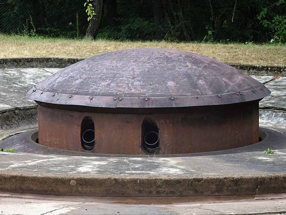
Correct — B, France & Germany. The Maginot Line is the belt of concrete fortifications that France built along its eastern frontier between the two World Wars, and the frontier it was designed to seal is the one facing Germany. It is named after André Maginot, the French Minister of War who forced the money through the Chamber (he held that office in 1922–24, 1929–30 and 1931–32). Construction began in 1929 and the main works were largely complete by 1939, at a cost of roughly 3 billion French francs. What was built was not a wall but a system: 142 ouvrages (major underground forts), 352 casemates, 78 shelters, 17 observatories and around 5,000 blockhouses — strongest around the industrial regions of Metz, the Lauter and Alsace, which are precisely the sectors that look across at Germany. The reasoning behind it was demographic: France could not match German manpower after the bloodletting of 1914–18, so it substituted concrete and firepower for men, meaning to hold the German frontier cheaply while the army mobilised. Germany then built its mirror image on the other side of the same border, the Siegfried Line (Westwall) — the surest confirmation that this is a Franco-German line and not a line anywhere else. In the event the Germans never assaulted it frontally: the attack of 10 May 1940 drove through the Ardennes into Belgium and Luxembourg, around the strong sector, and France signed the armistice at Compiègne on 22 June 1940. Lighter extensions did run along the Italian, Swiss and Belgian frontiers and, after 1934, towards the Strait of Dover — but 'the Maginot Line' in every exam sense means the heavy Franco-German sector from Switzerland to Luxembourg.
Why the others are wrong
- (a)U.S.A. & Canada — The Canada–United States boundary is the longest border between any two countries in the world at 8,891 km, its western half running along the 49th parallel — UPSC asked exactly this in Prelims 2024. It is the most famous border on any general-knowledge list, which is why it tempts; but its fame is for being *undefended*. No fortified line of any name has ever been built along it.
- (c)Namibia and Angola — No named fortification or demarcation line divides these two. The Namibia–Angola boundary is a colonial-era river line — the Kunene in the west, the Okavango further east — together with the panhandle of the Caprivi Strip. This option is on the paper as filler: it is the only African pair, placed there to absorb guesses from candidates who cannot locate the name 'Maginot' at all.
- (d)South Korea & North Korea — The most dangerous distractor, because Korea genuinely does have a fortified line between two countries. But that line is the Demilitarised Zone, created by the Korean Armistice Agreement of 27 July 1953: 250 km long and about 4 km wide, with the Military Demarcation Line running down its centre. The DMZ crosses the 38th parallel at an angle rather than following it, and it has nothing to do with Maginot — different continent, different war, different name.
Concept
'Lines' in political and military geography come in two families, and examiners mix them deliberately. The first is a fortification — a built defensive system, normally named after the man or government that raised it. The Maginot Line (France, facing Germany) and its German counterpart the Siegfried Line or Westwall are the interwar pair; the Hindenburg Line was Germany's defensive position in the First World War, the Atlantic Wall its coastal fortification in the Second, and the Mannerheim Line was Finland's defence across the Karelian Isthmus against the Soviet Union. The second family is a boundary — a surveyed or negotiated line on a map: the Durand Line of 1893 between British India and Afghanistan (today the Pakistan–Afghanistan border), the McMahon Line drawn at the Simla Convention of 1914, the Radcliffe Line of 1947 dividing India and Pakistan, the 49th parallel between Canada and the United States, and the 38th parallel with its Military Demarcation Line in Korea. A fortification line is built to stop an army; a boundary line is drawn to allocate territory. Maginot belongs firmly to the first family, and that is also why it can be said to 'exist between' two countries at all. The name has since passed into ordinary English as an idiom: a 'Maginot Line mentality' means trusting a fixed, expensive defence that the enemy simply walks around — which is exactly what happened in May 1940, and is the reason this particular line is remembered while the Siegfried Line and the Atlantic Wall are not.
The name itself is the fastest route to the answer. André Maginot was a French Minister of War, so the line is French; and a defensive line is always built facing the enemy its builder fears. In 1929 that enemy could only be Germany, so 'France & Germany' follows from the name alone, without any map work. The eliminations work the same way. The Canada–United States border is the textbook example of the world's longest *undefended* boundary, so a fortified line there is close to a contradiction in terms. Namibia and Angola are separated by rivers and by the Caprivi Strip, with no named line at all. Korea is the trap worth naming out loud, because it really does have a fortified line between two states — but that line is the DMZ around the 38th parallel, dating from 1953, not from the 1930s. The single fact that discriminates is the twin: the Maginot Line has a mirror image staring back at it across the same frontier, Germany's Siegfried Line. A defensive line acquires a twin only when two neighbouring states each fortify the border they share, and in the interwar years that pair was France and Germany.
Key facts
- Named after André Maginot, French Minister of War in 1922–24, 1929–30 and 1931–32; construction began in 1929, the main works were largely complete by 1939, and the cost was roughly 3 billion French francs.
- The line comprises 142 ouvrages (major forts), 352 casemates, 78 shelters, 17 observatories and around 5,000 blockhouses, and was strongest around Metz, the Lauter and Alsace — the sectors facing Germany.
- Germany's mirror-image fortification on the far side of the same frontier was the Siegfried Line (Westwall); the French line also had lighter extensions towards Italy, Switzerland, Belgium and, after 1934, the Strait of Dover.
- The line was never breached frontally. Germany attacked on 10 May 1940 through the Ardennes in Belgium and Luxembourg, bypassing the strong sector, and France signed the armistice at Compiègne on 22 June 1940.
- The distractor borders in figures: Canada–USA is 8,891 km, the longest international border in the world; the Korean DMZ is 250 km long and about 4 km wide, created by the Armistice Agreement of 27 July 1953, with the Military Demarcation Line at its centre.
Study next
Common traps
- Choosing Korea because it is the world's best-known fortified frontier today — that is the DMZ of 1953, not the Maginot Line of 1929–39
- Assuming the line ran only along the German border; it had lighter extensions facing Italy, Switzerland and Belgium, but the heavy sector — the one the name denotes — faces Germany
- Saying the line 'failed' because France fell. It was never attacked head-on; it was bypassed through the Ardennes, which is a different criticism
BPSC keeps this at bare recall — one named line, four country pairs scattered across four continents, nothing to read or reason. UPSC almost never asks a line's name directly: it asks which two countries a named region lies between (Ogaden, 2008), which pair shares the world's longest border (2024), or supplies a map and asks what the broken line on it is (1996).
Related PYQs
Ogaden region has been a source of conflict between which countries?
- (a) Morocco and Algeria
- (b) Nigeria and Cameroon
- (c) Angola and Zambia
- (d) Ethiopia and Somalia
Answer(d) Ethiopia and Somalia
The identical question form — a named place fixed to the two countries it lies between, with four country pairs as options — which is exactly the recall the Maginot question tests.
The longest border between any two countries in the world is between:
- (a) Canada and the United States of America
- (b) Chile and Argentina
- (c) China and India
- (d) Kazakhstan and Russian Federation
Answer(a) Canada and the United States of America
Tests the very border offered here as distractor (a): the Canada–USA line is the world's longest at 8,891 km and the standard example of an undefended frontier, the opposite of a fortified line.
Practice
- practice — not a real PYQ
The Siegfried Line, built as the counterpart of the Maginot Line, was constructed by which country?
- (a)France
- (b)Germany
- (c)Italy
- (d)Belgium
Answer(b) Germany — the Westwall, raised along the German side of the Franco-German frontier facing the Maginot Line. - practice — not a real PYQ
The Durand Line is the boundary between which two countries?
- (a)United States and Mexico
- (b)Pakistan and Afghanistan
- (c)India and China
- (d)North Korea and South Korea
Answer(b) Pakistan and Afghanistan — negotiated in 1893 between British India and Afghanistan and inherited by Pakistan in 1947.