
Munger Hilly region is a part of which of the following physiographic region ?
- (a)North Bihar Plain
- (b)Southern Hilly Region
- (c)South Bihar Plain
- (d)Someshwar Hilly Range
Answer
Why
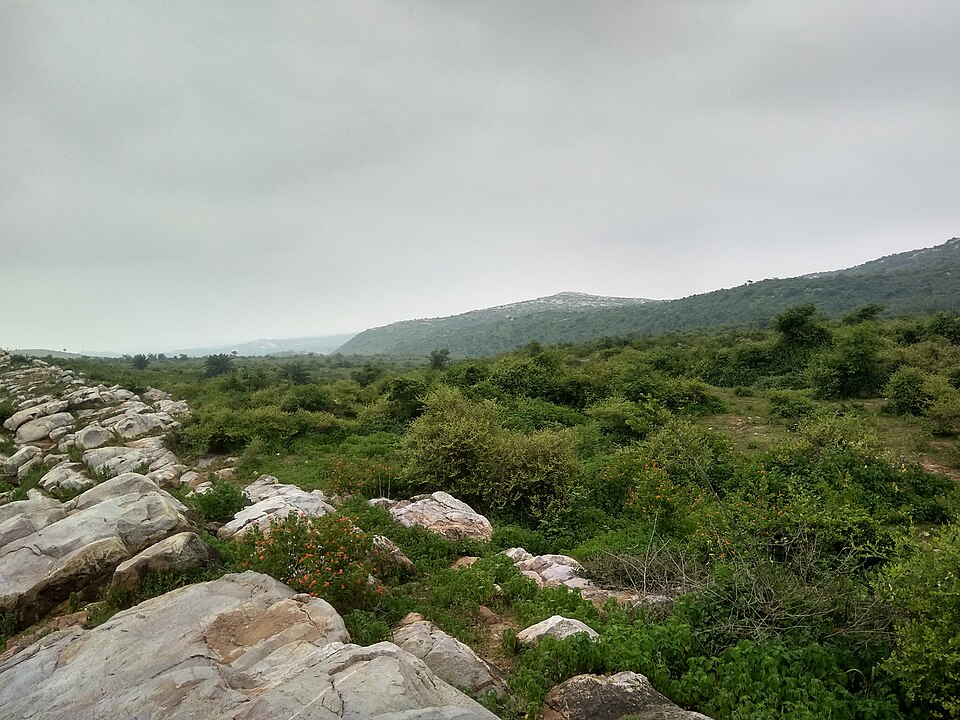
Correct: B, Southern Hilly Region. Bihar's physiography is conventionally divided into four units, and the Munger hills belong to the last of them. Running north to south these are: the Shivalik or Someshwar hills along the Nepal border in West Champaran; the North Bihar Plain, the alluvial tract between those hills and the Ganga, drained by the Gandak, Burhi Gandak, Bagmati, Kamla and Kosi; the South Bihar Plain, the narrower alluvial belt south of the Ganga carried by the Sone, Punpun, Phalgu and Kiul; and, along the southern margin, the hilly and plateau tract that is the northern fringe of the Chotanagpur plateau. The Munger or Kharagpur hills are part of that southern tract: a block of old crystalline and metamorphic rock rising abruptly above the alluvium in Munger, Jamui and Banka in the east of the state, matched in the west by the Kaimur range in Rohtas and Kaimur and in the middle by the Rajgir and Gaya hills. They are geologically continuous with the ancient peninsular shield rather than with the Ganga's sediment, which is the whole basis of the classification: the two plains are Quaternary alluvium laid down by rivers, while the southern hills are Precambrian rock. Munger district itself sits astride the boundary, with its headquarters on the south bank of the Ganga and its forested hill country to the south, home to the Bhimbandh Wildlife Sanctuary, notified in 1976 and covering about 682 sq km.
Why the others are wrong
- (a)North Bihar Plain: This is the alluvial tract north of the Ganga, between the river and the Nepal border, and it contains no hills at all except the Someshwar range at its far north-western corner. Munger lies south of the Ganga, so it cannot belong to a northern unit.
- (c)South Bihar Plain: The genuinely tempting option, and the one on which reference sources actually differ. Munger district straddles the boundary (its plain along the Ganga is South Bihar Plain) and some descriptions treat the Kharagpur hills as residual outcrops standing within that plain rather than as a separate unit. But as a landform the hills are plateau fringe, not plain, and the question asks about the hilly region specifically.
- (d)Someshwar Hilly Range: A real range, but at the opposite end of the state. The Someshwar hills are the sub-Himalayan Shivalik ridge in West Champaran on the Nepal frontier, and they carry Bihar's highest point at Someshwar Fort, about 880 m. They lie roughly 300 km north-west of Munger and belong to a completely different geological system.
Concept
Bihar's landscape is the product of two very different geological histories meeting along a line. Everything from the Ganga northwards, and most of the belt immediately south of it, is Quaternary alluvium: some of the deepest and youngest sediment in India, laid down by rivers descending from the Himalaya, which is why north Bihar is so flat and so flood-prone. The southern margin of the state is the other India entirely: the northern edge of the Chotanagpur plateau, Precambrian crystalline rock belonging to the peninsular shield, worn down into low ranges and isolated residual hills. After the reorganisation of 2000, when Jharkhand was created, Bihar retained only this fringe of the plateau, so the 'Southern Hilly Region' of the state's physiography is a thin discontinuous band rather than a broad upland: the Kaimur range in the west, the Rajgir and Gaya hills in the centre, and the Kharagpur hills around Munger in the east.
Answer this by orientation before geology. Munger is on the Ganga in south-eastern Bihar, so anything with 'North' in it is out, and Someshwar is out because it is a Nepal-border range at the far north-west. That leaves the real contest, South Bihar Plain against Southern Hilly Region, and here the stem does the work: it does not ask where Munger district is, it asks where the 'Munger Hilly region' is. A hill tract belongs to the hilly unit even when it is surrounded by plain. Be aware, and this is worth stating plainly, that reference sources are not unanimous: some Bihar geography material assigns the Kharagpur and Munger hills to the Southern Plateau or Hilly region as a continuation of the Rajmahal trend, while some general summaries treat them as residual hills lying within the South Bihar Plain. Our answer follows the four-fold division used in Bihar state geography, on which the hills form their own unit; a candidate who marked (c) was not being careless.
Key facts
- The four physiographic units of Bihar: the Shivalik/Someshwar hills of West Champaran, the North Bihar Plain, the South Bihar Plain, and the southern hilly-plateau fringe of the Chotanagpur plateau
- The Munger or Kharagpur hills are the eastern member of that southern fringe, extending across Munger, Jamui and Banka districts
- The southern hills are Precambrian crystalline rock of the peninsular shield; both Bihar plains are Quaternary alluvium built by Himalayan rivers
- Bihar's highest point is Someshwar Fort in the Someshwar range, West Champaran, at about 880 m: sub-Himalayan Shivalik country on the Nepal border, not part of the southern hills
- Bhimbandh Wildlife Sanctuary in Munger district, notified in 1976, covers about 682 sq km of this hill tract
- Bihar's reorganisation on 15 November 2000 transferred most of the Chotanagpur plateau to Jharkhand, leaving the state only the plateau's northern rim
Study next
Common traps
- Assuming the district's name settles the landform: Munger district contains both plain and hills, and the stem asks about the hilly part
- Placing the Someshwar range in south Bihar; it is the Shivalik ridge of West Champaran on the Nepal border, and carries the state's highest point
- Forgetting that Bihar kept only the northern fringe of the Chotanagpur plateau after 2000, so the 'Southern Hilly Region' is a narrow discontinuous band
BPSC asks Bihar physiography as direct placement (which region does a named hill, river or district belong to) and expects the state's own four-fold division rather than a national scheme. UPSC does not ask state-level physiography at all; its equivalent is national, matching a landform to a region or reading relief from a map, so a Bihar candidate has to prepare this layer separately from any UPSC syllabus.
Related PYQs
No directly related past PYQ was found.
Practice
- practice, not a real PYQ
The highest point in the State of Bihar lies in which of the following ranges ?
- (a)Kaimur range
- (b)Rajgir hills
- (c)Someshwar range
- (d)Kharagpur hills
Answer(c) Someshwar range: Someshwar Fort in West Champaran, at about 880 m, is the highest point in Bihar; the other three are all southern hill groups of much lower elevation. - practice, not a real PYQ
Bhimbandh Wildlife Sanctuary, notified in 1976, lies in which district of Bihar ?
- (a)West Champaran
- (b)Rohtas
- (c)Munger
- (d)Nalanda
Answer(c) Munger: the sanctuary covers about 682 sq km of the Kharagpur hill tract in Munger district; West Champaran has Valmiki Tiger Reserve and Rohtas has the Kaimur sanctuary.