
Which of the following ports is an artificial port ?
- (a)Mumbai
- (b)Marmugao
- (c)Chennai
- (d)Kochi
Answer
Why
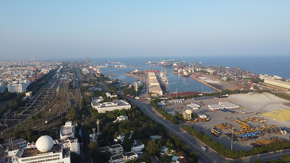
Correct: C, Chennai. A port is called natural when the coast itself provides the shelter (a drowned valley, an estuary, a bay screened by islands or a lagoon behind a sandbar) and artificial when engineers had to build that shelter because the coastline offered none. Chennai sits on the Coromandel Coast, which is a smooth, emergent, surf-beaten shoreline with almost no indentation: there was nothing to shelter a ship. The harbour there was therefore manufactured. Masonry work on the L-shaped breakwaters began in 1876; the first structures were wrecked in 1877 and rebuilt with concrete blocks, and the enclosed artificial harbour began operating in 1881, which is why Chennai counts as the third-oldest of India's major ports by date of formal operation even though trade on that beach goes back to 1639. The design still had a flaw (the entrance faced east, straight into the drift and the cyclonic surf) so Sir Francis Spring, chief engineer from 1906, shifted the entrance round to the north-east, which is the arrangement that made it a workable all-weather port. Everything that shelters a ship at Chennai today is built: the breakwaters, the wet docks, the dredged approach. That is the definition of an artificial port, and Chennai is the standard Indian textbook example of one.
Why the others are wrong
- (a)Mumbai: Mumbai is India's classic natural harbour: a deep, land-locked inlet on the Konkan coast sheltered on its seaward side by the islands that were merged to form the city, so ships lie in calm water without any breakwater. Later engineering (docks, dredging, the satellite port at Nhava Sheva) was added to a shelter the coast already provided.
- (b)Marmugao: Marmugao in Goa stands at the mouth of the Zuari estuary, on a headland that shields the anchorage: a natural estuarine harbour, historically the outlet for Goan iron ore. Candidates pick it because it is less familiar than the other three, but unfamiliarity is not the same as artificiality.
- (d)Kochi: Kochi is a natural lagoon harbour on the Vembanad backwaters, entered through a gap in the sandbar that the floods of 1341 are traditionally said to have opened. It is the subtlest distractor, because Willingdon Island: the port's main facility: really is man-made, built up from dredged spoil under Robert Bristow in the 1920s and 1930s. But the harbour itself is a natural lagoon; only the island inside it was built.
Concept
Ports are classified in several overlapping ways, and Indian geography papers test all of them. By origin of shelter: natural harbours, where the coast provides protection (Mumbai, Kochi, Marmagao, Visakhapatnam), and artificial harbours, where breakwaters create it (Chennai). By tidal behaviour: tidal ports such as Kandla and Diamond Harbour, which depend on the high tide to float deep-draught ships in and out, against ports usable at any state of the tide. By administration: 'major' ports governed by the Centre under the Major Port Authorities Act, 2021, and 'non-major' or minor ports run by the maritime board of a coastal state. And by traffic: bulk, container, oil and ore terminals. The origin question is decided almost entirely by the shape of the coast: India's western coast is a submerged, indented coast with drowned valleys and lagoons, which is why almost every natural harbour in the country lies on it, while the eastern coast is an emergent, smooth, delta-fringed and silt-laden coast that gives shipping nothing to shelter behind.
You can answer this without knowing a single date, purely from the coastline. Three of the four options (Mumbai, Marmugao, Kochi) are on the west coast; one, Chennai, is on the east. The west coast is submerged and deeply indented, so it hands over harbours ready-made; the east coast is emergent, straight and silting, so a port there has to be built. That single contrast puts Chennai out on its own. The trap that costs marks is Kochi, and it costs marks for a genuinely good reason: Willingdon Island, where the Cochin Port's berths sit, is an artificial island raised out of dredged material, so a student who remembers 'Kochi: man-made island' can talk himself into (d). Hold the distinction: the question asks about the port's harbour, not about the land alongside it, and Kochi's harbour is the natural Vembanad lagoon. The same discipline applies on the east coast: Visakhapatnam is a natural harbour behind the Dolphin's Nose headland, and Paradip and Ennore were engineered, so 'east coast' is a strong prior, not a law.
Key facts
- Chennai Port is an artificial, all-weather harbour: breakwater masonry began in 1876, the first works were destroyed in 1877 and rebuilt in concrete, and harbour operations began in 1881
- Sir Francis Spring, chief engineer at Madras from 1906, shifted the harbour entrance from the east to the north-east to shelter it from the surf and drift of the Coromandel Coast
- Chennai is the third-oldest of India's major ports by date of formal port operation, although sea trade on that shore dates from 1639
- Mumbai, Marmagao (Zuari estuary mouth) and Kochi (Vembanad lagoon) are natural harbours; Kochi's Willingdon Island, however, is man-made from dredged spoil, developed under Robert Bristow in the 1920s-30s
- Kandla and Diamond Harbour are tidal ports: a separate axis of classification from natural versus artificial, and a favourite UPSC discriminator
Study next
Common traps
- Choosing Kochi because Willingdon Island is artificial: the island is built, the harbour is a natural lagoon
- Confusing 'artificial port' with 'modern port' or 'largest port'; age and size have nothing to do with the classification
- Assuming every east-coast port is artificial: Visakhapatnam is a natural harbour sheltered by the Dolphin's Nose
BPSC asks this as a single-line identification with four port names and one discriminating adjective (artificial, tidal, riverine, landlocked) and the whole question turns on that one word. UPSC prefers to make it a classification or matching test instead: which of these is a non-major port, which pairs of port and characteristic are correctly matched, or how many of three port statements are right, so the UPSC version needs the administrative and traffic facts as well as the physical ones.
Related PYQs
Consider the following statements: I. Tides are of great help in navigation and fishing. II. High tide enables big ships to enter or leave the harbour safely. III. Tide prevents siltation in the harbours. IV. Kandla and Diamond Harbour are tidal ports. Which of these statements are correct?
- (a) I and IV
- (b) II, III and IV
- (c) I, II and III
- (d) I, II, III and IV
Answer(d) I, II, III and IV
The same idea of classifying a port by the physical conditions that make it usable: here the tidal axis rather than the natural-versus-artificial one, with Kandla and Diamond Harbour named as tidal ports.
In India, the ports are categorized as major and non-major ports. Which one of the following is a non-major port?
- (a) Kochi (Cochin)
- (b) Dahej
- (c) Paradip
- (d) New Mangalore
Answer(b) Dahej
Port classification asked the other way round (by administration rather than by origin of shelter) and it uses the same four-name single-odd-one-out format that BPSC used here.
Practice
- practice, not a real PYQ
Which one of the following Indian ports is a natural harbour sheltered by the Dolphin's Nose headland ?
- (a)Paradip
- (b)Visakhapatnam
- (c)Ennore (Kamarajar)
- (d)Tuticorin
Answer(b) Visakhapatnam: the Dolphin's Nose promontory shelters the harbour, making it the one large natural harbour on the east coast; Paradip and Ennore are engineered. - practice, not a real PYQ
Kandla and Diamond Harbour are classified as which type of port ?
- (a)Tidal ports
- (b)Artificial ports
- (c)Landlocked ports
- (d)Free ports
Answer(a) Tidal ports: both depend on the high tide to let deep-draught ships move in and out, Kandla on the Gulf of Kachchh and Diamond Harbour on the Hooghly.