
Gold is found in which of the following districts of Bihar?
- (a)Munger
- (b)Saran
- (c)Siwan
- (d)Jamui
Answer
Why
Correct: D, Jamui. Two written parliamentary replies by the Ministry of Mines settle this, and neither leaves room for a second district. On 1 December 2021 the Union Minister of Coal, Mines and Parliamentary Affairs told the Lok Sabha, in one flat sentence: 'The entire resource of gold ore in Bihar is located in Sono area of Jamui district.' Sono is one of the ten blocks of Jamui, in the broken hill country where the Chotanagpur plateau pushes north across the Bihar–Jharkhand border. The same reply gives the numbers behind that sentence, drawn from the National Mineral Inventory as on 1 April 2015: India's total resources of primary gold ore stand at 501.83 million tonnes containing 654.74 tonnes of gold metal, of which 'Bihar is endowed with 222.885 million tonnes (44%) of ore containing 37.6 tonnes of metal'. Every tonne of the Bihar figure is then classified under the United Nations Framework Classification as code 333 (128.885 million tonnes of ore with 21.6 tonnes of metal) or code 334, 94 million tonnes with 16 tonnes of metal. Those are the inferred and reconnaissance classes; nothing in Bihar is a proved reserve, and no gold is mined in the state. The earlier reply, given in the Rajya Sabha on 26 July 2021, puts Bihar at the head of the national table: 'largest resources of gold ore (primary) are located in Bihar (44%) followed by Rajasthan (25%), Karnataka (21%), West Bengal (3%), Andhra Pradesh (3%), Jharkhand (2%)', and records that of India's 501.83 million tonnes only 17.22 million tonnes sit in the reserves category, the remaining 484.61 million tonnes being remaining resources. The Commission wanted the district, and on the Government of India's own record there is exactly one: Jamui, and inside Jamui, Sono. The 1 December 2021 reply does name two other Bihar districts, but only as ground GSI has walked over: a G4 reconnaissance survey for placer gold in the Siwalik foothills of West Champaran, where the average concentration ran between 0.0061 and 1.96 ppm and 'no resource has been estimated', and a G3 preliminary exploration in Gaya district. Neither appears among the options, and neither Munger, Saran nor Siwan is credited with a single tonne of gold ore anywhere in the National Mineral Inventory.
Why the others are wrong
- (a)Munger: The sharpest trap on the paper, because it was true in an administrative sense within living memory. Munger has had five districts partitioned off its territory (Begusarai in 1972, Khagaria in 1988, Jamui in 1991, and Lakhisarai and Sheikhpura in 1994) and the Sono tract went out with Jamui on 21 February 1991. Any account of Bihar's gold written before that date, and a great deal of coaching material copied from such accounts since, therefore places the deposit in 'Munger'. Thirty-two years separated that reorganisation from this paper, and the National Mineral Inventory records no gold-ore resource against Munger. Munger is a real answer to other Bihar questions: the 1,419 sq km district holds Bhimbandh Wildlife Sanctuary and its hot springs, and Jamalpur is one of the state's industrial towns, but gold is not its fact.
- (b)Saran: Saran lies in the north-western Gangetic plain, in the doab between the Gandak and the Ghaghara, under hundreds of metres of Quaternary river alluvium with no crystalline basement anywhere near the surface. That is the wrong geology for a lode deposit, which needs old vein-bearing rock in place and reachable. The official record treats the district accordingly: India-WRIS lists Saran (Chhapra) among the districts commanded by the Gandak canal system, and the National Mineral Inventory credits it with no gold-ore resource at all. Saran's claims on a general studies paper are agrarian, riverine and political (Chhapra its headquarters, and Sonepur at the Ganga–Gandak confluence with its famous fair) not mineral. A candidate marking it is reasoning from the sound of a Bihar district name rather than from where old rock actually surfaces.
- (c)Siwan: The same geology and the same disqualifier as Saran, which is no accident: Siwan was a subdivision of Saran district before it became a district in its own right, and it shares Saran's deep alluvial cover north-west of the Ganga inside the same Gandak canal command. It covers 2,219 sq km of that plain, and the National Mineral Inventory records no gold ore for it. Siwan's standing in general studies is historical rather than geological: it is the birthplace of Dr Rajendra Prasad, at Ziradei, and the district administration's own list of eminent personalities runs to Maulana Mazharul Haque and Khuda Baksh Khan. Nothing in its record points at mining, and a candidate who marks it has not applied the geological filter that removes both north-western options in one step.
Concept
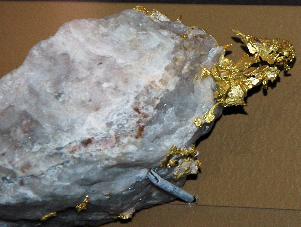
Gold occurs in two very different settings, and the distinction runs through this whole question. Primary or lode gold sits inside the rock in which it crystallised, typically in quartz veins threading ancient Precambrian greenstone belts. Placer gold has already been weathered out of such rock and re-concentrated by rivers or waves in loose sand and gravel. India's inventory of the primary kind is compiled by the Indian Bureau of Mines as the National Mineral Inventory and graded under the United Nations Framework Classification, in which exploration runs through four stages (G4 reconnaissance, G3 preliminary, G2 general and G1 detailed) and the three-digit codes fall away from proved material towards merely reconnoitred material as you move from 331 to 334. A 'reserve' is what can be economically extracted on today's technology and prices; a 'remaining resource' is everything else that is known to be there. Bihar's gold is the textbook illustration of the gap between the two: the state tops the national table for the quantity of ore and contributes nothing whatever to national output, because all of its resource sits at codes 333 and 334 and the metal locked in each tonne of rock is too little to pay for moving the rock.
Reason from geology first and administrative history second, because the first step disposes of half the options for free. Lode gold needs old crystalline basement at or near the surface, and in Bihar that exists in one place only: the south-eastern fringe where the Chotanagpur plateau pushes north across the Jharkhand border through Jamui and its neighbours. Saran and Siwan sit two hundred kilometres away in the opposite corner of the state, on the alluvial plain north-west of the Ganga where the basement lies buried under hundreds of metres of river sediment and no vein reaches daylight. Both can be struck out on structure alone, before any recall is attempted. That leaves Munger against Jamui, and here the discriminating fact is not geological at all but a date: Jamui was carved out of Munger on 21 February 1991 and the Sono tract went with it. A candidate who remembers only that Bihar's gold lies on the Jharkhand border in the old Munger country will mark Munger, and the district reorganisation is the entire trap. Carry one further guard away from this question. Gold-ore quantity is not gold. Bihar holds 44 per cent of India's primary gold ore but under six per cent of India's contained gold metal, which works out at roughly 0.17 grams of gold per tonne of rock against about 1.30 g/t for the national inventory as a whole and about 4.85 g/t in the reserve that Hutti actually mines in Karnataka. That arithmetic, not any policy failure, is why the state at the head of the resource table has no working gold mine.
Key facts
- Ministry of Mines, written reply in the Lok Sabha, 1 December 2021 (PIB release 1776759), verbatim: 'The entire resource of gold ore in Bihar is located in Sono area of Jamui district.'
- National Mineral Inventory as on 1 April 2015: India holds 501.83 million tonnes of primary gold ore containing 654.74 tonnes of gold metal; only 17.22 million tonnes of that ore is classed as reserves, the other 484.61 million tonnes as remaining resources (Rajya Sabha reply, 26 July 2021)
- Bihar's share of the same inventory: 222.885 million tonnes of ore, 44 per cent and the largest of any state, but just 37.6 tonnes of contained metal: split as UNFC code 333 (128.885 Mt of ore, 21.6 t of metal) and code 334 (94 Mt, 16 t), that is, entirely inferred or reconnaissance grade with no proved reserve
- State-wise share of India's primary gold-ore resources as read into the record: Bihar 44%, Rajasthan 25%, Karnataka 21%, West Bengal 3%, Andhra Pradesh 3%, Jharkhand 2%, with the last 2% in Chhattisgarh, Madhya Pradesh, Kerala, Maharashtra and Tamil Nadu
- Grade arithmetic behind those figures: Bihar's ore averages about 0.17 g of gold per tonne against roughly 1.30 g/t for the whole national inventory and about 4.85 g/t in Hutti's working reserve in Raichur district, Karnataka, which is why 44 per cent of the ore supports no mining at all
- Jamui district was created out of Munger district on 21 February 1991; it covers 3,122 sq km, recorded 1,760,405 people at the 2011 Census, and has ten blocks: Jamui, Khaira, Sikandra, Aliganj, Laxmipur, Gidhaur, Barhat, Sono, Chakai and Jhajha
- Elsewhere in Bihar the same 2021 reply records a GSI G4 reconnaissance survey for placer gold in the Siwalik foothills of West Champaran, where concentrations of 0.0061 to 1.96 ppm produced the finding that 'no resource has been estimated', and a G3 preliminary exploration in Gaya district
- The July 2021 reply also notes the amendment of the MEMC Rules to allow auction of a composite licence at G4 level for deep-seated minerals including gold, and states flatly that 'There is no proposal to restart the closed gold mines': Kolar Gold Fields having closed in 2001, leaving Hutti Gold Mines Limited, owned by the Government of Karnataka, as India's primary gold producer
Study next
Common traps
- The '222 million tonnes of gold' story that circulated in May 2022, that figure is ORE, not gold; GSI publicly denied ever estimating gold reserves of 222.88 million tonnes in Jamui, and the contained metal is only 37.6 tonnes
- Confusing resources with production: Bihar leads the resource table but mines no gold at all, while Karnataka mines almost all of India's primary gold: exactly the distinction BPSC drew again on the 71st over pyrite
- Marking Munger because Jamui was part of it until 21 February 1991: the same reorganisation trap works for Begusarai (1972), Khagaria (1988), Lakhisarai and Sheikhpura (1994), all also carved out of Munger
BPSC asks this as a bare district-identification single-liner, and has now asked it twice: here on the 69th against Munger, Saran and Siwan, and again on the 71st in 2025 against Gaya, Jamui, Nalanda and Bhagalpur, the same answer behind a fresh set of wrong options. Both times the distractors were Bihar districts with no mineral profile whatever, so the Commission is testing recall of a single name rather than any reasoning about rock. UPSC almost never names an Indian district in isolation. It asks mineral-to-locality matching, as with Hutti in 1997, or frames statements that test whether you can separate where a mineral is found from where it is actually produced, as in 2018. Prepare the Bihar name for BPSC and the resource-versus-production distinction for UPSC; they are the same paragraph read two ways.
Related PYQs
Match List I with List II and select the correct answer by using the codes given below the lists: List I (Minerals) I. Coal II. Gold III. Mica IV. Manganese List II (Typical areas of Occurrence) A) Bhandara B) Karanpura C) Hutti D) Nellore Codes:
- (a) I-A, II-C, III-B, IV-D
- (b) I-B, II-C, III-D, IV-A
- (c) I-C, II-D, III-B, IV-A
- (d) I-B, II-A, III-D, IV-C
Answer(b) I-B, II-C, III-D, IV-A
The same skill: pin a mineral to the precise place it occurs. Gold there points to Hutti in Raichur district, Karnataka, which is where India's gold is actually mined; Bihar's Sono block is where India's gold ore mostly sits unmined.
Consider the following statements: 1. In India, State Governments do not have the power to auction non-coal mines. 2. Andhra Pradesh and Jharkhand do not have gold mines. 3. Rajasthan has iron ore mines. Which of the statements given above is/are correct?
- (a) 1 and 2
- (b) 2 only
- (c) 1 and 3
- (d) 3 only
Answer(d) 3 only
Tests the same distinction from the other side, which States have gold and who controls the concessions. Bihar's case is the extreme version of it: the largest ore resource in the country, no working mine, and a State auction regime opened up by the MMDR amendment of 2015.
Gold is found in which district of Bihar?
- (a) Gaya District
- (b) Jamui District
- (c) Nalanda District
- (d) Bhagalpur District
Answer(b) Jamui District
Two years later the Commission repeated the question almost word for word, changing only the wrong options: Gaya, Nalanda and Bhagalpur in place of Munger, Saran and Siwan. Jamui is one of the most reliably repeated single facts in the BPSC Bihar-geography section.
Practice
- practice, not a real PYQ
The entire gold-ore resource of Bihar recorded in the National Mineral Inventory lies in which area of Jamui district?
- (a)Sono
- (b)Chakai
- (c)Sikandra
- (d)Gidhaur
Answer(a) Sono: the Ministry of Mines told the Lok Sabha on 1 December 2021 that the whole of Bihar's gold-ore resource is located in the Sono area of Jamui district. - practice, not a real PYQ
As per the National Mineral Inventory (as on 1.4.2015), which State holds the largest resources of primary gold ore in India?
- (a)Karnataka
- (b)Rajasthan
- (c)Bihar
- (d)Andhra Pradesh
Answer(c) Bihar: about 44 per cent of India's primary gold-ore resources, ahead of Rajasthan (25%) and Karnataka (21%), even though Karnataka is the country's leading gold producer.