
The Andes extends along which of the following ?
- (a)West Coast of North America
- (b)West Coast of India
- (c)West Coast of South America
- (d)East Coast of Australia
Answer
Why
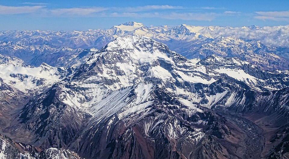
Correct: C, West Coast of South America. The Andes run for roughly 7,000 kilometres down the entire Pacific margin of South America (through Venezuela, Colombia, Ecuador, Peru, Bolivia, Chile and Argentina) which makes them the longest continental mountain range on Earth. They exist because of what is happening at the sea floor just offshore: the oceanic Nazca Plate is being subducted eastwards beneath the continental South American Plate, and the crumpling, uplift and melting produced at that convergent boundary have raised a young fold-mountain belt studded with active volcanoes. Aconcagua in Argentina, at 6,961 metres, is the highest peak in the range and the highest anywhere outside Asia, and the belt forms the eastern arc of the Pacific Ring of Fire. The range shapes the continent's climate as decisively as its relief. It blocks moisture from the Amazon on its eastern flank; on the western side, working with the cold Peru current offshore, it produces the Atacama, one of the driest deserts in the world. Between the two main ranges in Peru and Bolivia lies the Altiplano, a high plateau carrying Lake Titicaca, and along the range's length lie the porphyry copper deposits that make Chile the world's leading copper producer and Peru another major one. Every one of those facts is a possible follow-up question, and all of them follow from the single structural fact this question asks for: a subduction-built cordillera on the western edge of South America.
Why the others are wrong
- (a)West Coast of North America: The correct continent's mirror image, and the most attractive wrong answer because North America genuinely does have a great western mountain system: the Rockies, with the Sierra Nevada and the Cascades nearer the coast. The two cordilleras are continuous in a broad sense as the American Cordillera, but the name Andes belongs to the southern continent alone.
- (b)West Coast of India: India's west coast carries the Western Ghats, or Sahyadri, running about 1,600 kilometres from the Tapi valley to Kanyakumari: a block-faulted escarpment of the peninsular plateau, geologically ancient and quite unlike a young folded range. It is a biodiversity hotspot and a UNESCO World Heritage site, but it is not the Andes.
- (d)East Coast of Australia: Australia's eastern rim carries the Great Dividing Range, running roughly 3,500 kilometres from Queensland to Victoria, with Mount Kosciuszko at 2,228 metres as its highest point. It is old, worn and low by Andean standards, and it separates the coastal strip from the interior: a genuine range on the wrong continent, which is exactly how this distractor is meant to work.
Concept
The world's great mountain ranges divide into two families by age and origin, and knowing which family a range belongs to answers most questions about it. YOUNG FOLD MOUNTAINS were raised in the Cenozoic by plate convergence and are high, sharp, seismically active and often volcanic: the Himalayas, the Alps, the Rockies and the Andes. OLD FOLD or BLOCK MOUNTAINS were raised far earlier and have been worn down: the Appalachians, the Urals, the Aravallis, the Great Dividing Range and, in a different way, the Western Ghats, which are the faulted edge of an ancient plateau rather than a folded belt at all. The Andes belong to the young family and to a specific sub-type: an oceanic-continental convergent margin, where dense oceanic crust dives beneath lighter continental crust. That single mechanism explains the whole package: the deep Peru-Chile trench offshore, the earthquakes, the chain of andesitic volcanoes (andesite is literally named for the range), the porphyry copper mineralisation, and the great height achieved in a relatively narrow belt. The Himalayas, by contrast, come from continental-continental collision, which is why they have no volcanic arc.
This question can be answered by elimination even by a candidate who has never studied South America, and that is worth practising because the same technique clears many world-geography items. Each wrong option names a coast that already has a well-known range attached to it: North America's west has the Rockies, India's west has the Western Ghats, Australia's east has the Great Dividing Range. If three of the four slots are already occupied by ranges you can name, the fourth is where the range in the stem must go. The technique works because examiners build distractors from real geography rather than from nonsense, that is what makes them plausible, and also what makes them checkable. A second cue is linguistic: the Andes give their name to andesite and to the Andean condor, and both are South American. And a third, for candidates who prefer structure to memory, is that the entire western rim of the Americas faces a subduction zone, so a long, high, volcanic range along a Pacific coast is exactly what plate tectonics predicts: the only question is which of the two American continents the name belongs to.
Key facts
- The Andes run about 7,000 km along the western margin of South America through Venezuela, Colombia, Ecuador, Peru, Bolivia, Chile and Argentina: the longest continental mountain range in the world
- They were raised by the subduction of the oceanic Nazca Plate beneath the South American Plate, and form part of the Pacific Ring of Fire
- Aconcagua in Argentina, 6,961 m, is the highest peak of the Andes and the highest mountain outside Asia
- The range creates the Atacama Desert in its rain shadow, working with the cold Peru current, and encloses the Altiplano plateau with Lake Titicaca
- Andean porphyry copper deposits (Chuquicamata and Escondida among them) make Chile the world's leading copper producer
- The distractor ranges: Rockies on North America's west coast, Western Ghats on India's west coast, Great Dividing Range on Australia's east coast
Study next
Common traps
- Answering 'west coast of North America', that is the Rockies and the Cascades; the Andes name belongs to the southern continent
- Treating the Western Ghats as a fold mountain range; they are the faulted western edge of the ancient peninsular plateau
- Assuming every long coastal range is young and volcanic: Australia's Great Dividing Range is old, worn and non-volcanic
BPSC asks world physical geography as one-line placement (which coast, which continent, which country) and builds the distractors from other real ranges, so the answer comes from a mental map rather than from any analysis. UPSC assumes the placement is known and asks what follows from it: why Chile produces copper, which local wind blows off which mountain, which continent has the highest mean elevation. Learn the range with its plate boundary, its climate effects and its minerals attached, and both styles are covered.
Related PYQs
Assertion (A): Chile continues to be an important producer of copper in the world. Reason (R): Chile is endowed with the world’s largest deposit of porphyry copper.
- (a) Both A and R are true, and R is the correct explanation of A
- (b) Both A and R are true, but R is not a correct explanation of A
- (c) A is true, but R is false
- (d) A is false, but R is true
Answer(a) Both A and R are true, and R is the correct explanation of A
The economic consequence of the same range: Chile's porphyry copper (Chuquicamata, Escondida) lies in the Andean belt, mineralised by the very subduction that raised the mountains along South America's west coast.
Match List I with List II and select the correct answer using the codes given below the Lists: List I (Local Wind) I. Fohn II. Samun III. Santa Ana IV. Zonda List II (Region) A) Argentina B) Kurdistan C) California D) Alps Codes:
- (a) I-B, II-D, III-A, IV-C
- (b) I-D, II-B, III-C, IV-A
- (c) I-B, II-D, III-C, IV-A
- (d) I-D, II-B, III-A, IV-C
Answer(b) I-D, II-B, III-C, IV-A
Its Zonda is the warm dry wind that descends the leeward side of the Andes into Argentina: the climatic signature of the same barrier, and a reminder that placing a range on a map is only the first of the facts examiners want.
The theory that states “pieces of the Earth’s crust are in constant, slow motion driven by movement in the mantle” is called
- (a) the theory of continental drift
- (b) the theory of Pangaea
- (c) the theory of plate tectonics
- (d) the theory of plate boundaries
Answer(c) the theory of plate tectonics
The mechanism behind the map: the Commission asked for the theory in 2023 and for one of its most conspicuous products in 2024, and the Andes are the textbook example of what a converging plate boundary builds.
Practice
- practice, not a real PYQ
The Andes were formed mainly by the subduction of which plate beneath the South American Plate ?
- (a)The Cocos Plate
- (b)The Nazca Plate
- (c)The Caribbean Plate
- (d)The Antarctic Plate
Answer(b) The Nazca Plate: its eastward subduction along the Peru-Chile trench raised the range and produced its volcanic arc; the Cocos Plate subducts under Central America instead. - practice, not a real PYQ
Aconcagua, the highest peak of the Andes, lies in which country ?
- (a)Chile
- (b)Peru
- (c)Argentina
- (d)Bolivia
Answer(c) Argentina: at 6,961 metres in Mendoza Province, it is the highest mountain in the world outside Asia.