
With reference to Borneo Island, located in South-East Asia, which of the following statements is/are true ? 1. It is divided among three countries. 2. It has been formed due to volcano deposition. Select the correct answer from the code given below : Code :
- (a)Both 1 and 2
- (b)Only 1
- (c)Neither 1 nor 2
- (d)Only 2
Answer
Why
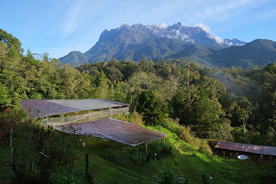
Correct — B, Only 1. Read this paper's code before deciding anything: in the UPPSC 2022 Paper-I two-statement items the four options are (a) Both 1 and 2, (b) Only 1, (c) Neither 1 nor 2 and (d) Only 2. 'Only 1' sits at (b) here, not at the (a) or (d) that candidates from other years expect, and 'Only 2' has been moved to (d). Statement 1 is true. Borneo, the third-largest island in the world at 748,168 sq km, is divided among three sovereign states: Indonesia holds about 73 per cent as the five Kalimantan provinces, Malaysia about 26 per cent as the states of Sabah and Sarawak together with the federal territory of Labuan, and Brunei about 1 per cent in four districts on the northern coast. That three-way division is what makes Borneo unusual — it is the only large island in the region shared by three countries. Statement 2 is false. Borneo was not built by volcanic deposition. It formed during the Mesozoic by the accretion of microcontinental fragments, ophiolite terranes and island-arc crust, and it later formed part of Sundaland, the exposed continental shelf that connected it to mainland Asia until rising sea levels after the last ice age isolated it. The island lacks significant volcanic activity, and its highest point, Mount Kinabalu in Sabah at 4,095 m, is not a volcano. With statement 1 true and statement 2 false, the answer is 'Only 1' — which this paper prints at (b).
Why the others are wrong
- (a)Both 1 and 2 — It accepts the volcanic-origin claim. Indonesia's volcanoes are real but they lie elsewhere — along the Sunda arc through Sumatra, Java, Bali and the Lesser Sunda Islands, where the Indo-Australian plate is subducted. Borneo sits away from that line, on the stable Sunda Shelf, and lacks significant volcanic activity.
- (c)Neither 1 nor 2 — It rejects the three-country division, which is the one statement in the question that is plainly correct. Indonesian Kalimantan, Malaysian Sabah and Sarawak, and Brunei together account for the whole island.
- (d)Only 2 — The exact inversion of the truth: it keeps the false volcanic-origin statement and discards the true three-country statement. In many other papers 'Only 2' is printed at (b) or (c), so a candidate reading option positions from memory rather than reading the option text can land here.
Concept
The islands of maritime South-East Asia have two very different origins and it pays to keep them apart. Sumatra, Java, Bali and the Lesser Sundas lie along an active volcanic arc created where the Indo-Australian plate is subducted beneath the Eurasian plate — this is the belt of Krakatoa, Tambora and Merapi. Borneo lies behind that arc on the Sunda Shelf, a shallow submerged extension of the Asian continent. Geologically it is a continental island, assembled in the Mesozoic by accretion of microcontinental fragments, ophiolite terranes and island-arc crust, and during Pleistocene low sea levels it stood joined to the mainland as part of Sundaland. Politically it is the only large island in the region partitioned among three sovereign states, with Indonesia holding roughly three-quarters of it and Brunei a coastal sliver in the north.
The trap works through a chain of loose association: Borneo is largely Indonesian, Indonesia is the country of volcanoes, therefore Borneo must be volcanic. Break the chain by remembering that Indonesia's volcanic belt is a line, not a blanket — it runs through Sumatra and Java and out along the Lesser Sundas, and Borneo is not on it. The island's highest point, Mount Kinabalu, is the giveaway: it stands 4,095 m above Sabah and is not a volcanic cone. A second useful anchor is the river system. The Kapuas at 1,143 km, the Barito at 1,090 km and the Mahakam at 980 km are among the longest rivers in the region, and long, low-gradient, sediment-laden rivers of that kind belong to a continental land mass, not to a young volcanic pile. As of the June 2022 exam, Indonesia had recently legislated to move its capital to Nusantara in East Kalimantan, on Borneo — a decision that has kept the island in the news since, and that is worth knowing as the current-affairs hook attached to this geography.
Key facts
- Borneo is the third-largest island in the world, with an area of 748,168 sq km.
- It is divided among three countries — Indonesia about 73 per cent (five Kalimantan provinces), Malaysia about 26 per cent (Sabah, Sarawak and Labuan), and Brunei about 1 per cent (four districts in the north).
- It formed by the accretion of microcontinental fragments, ophiolite terranes and island-arc crust in the Mesozoic, was part of Sundaland connected to mainland Asia, and lacks significant volcanic activity.
- Its highest point is Mount Kinabalu in Sabah, Malaysia, at 4,095 m; its longest rivers are the Kapuas (1,143 km), Barito (1,090 km) and Mahakam (980 km).
- Indonesia's planned new capital, Nusantara, is in East Kalimantan province on Borneo.
Study next
Common traps
- Assuming Borneo is volcanic because Indonesia is. The volcanic arc runs through Sumatra, Java and the Lesser Sundas; Borneo sits off it, on the continental Sunda Shelf.
- Counting only Indonesia and Malaysia and forgetting Brunei, whose small northern territory makes the island a three-country island rather than a two-country one.
- Reading option positions from another year's paper. In UPPSC 2022 'Only 1' is at (b) and 'Only 2' is at (d), in all eleven two-statement items.
UPPSC sets South-East Asian geography as two-statement true-false items or as ordering questions on the Indonesian islands, and it likes to pair a political fact with a physical one so that a candidate who knows only one half still cannot answer. UPSC prefers descriptive-passage identification or map-based reasoning — a paragraph of clues about an archipelago, followed by 'this description best fits'.
Related PYQs
“From Aceh in the far north-west to Torres Strait in the east is 5000 miles, almost as far as from London to Baghdad. The Archipelago has 14,000 islands, some mere equatorial rocks, others some of the largest in the world.” This description best fits
- (a) West Indies
- (b) Japan
- (c) Philippines
- (d) Indonesia
Answer(d) Indonesia
The archipelago that contains three-quarters of Borneo, tested through its extent — 'others some of the largest in the world' points straight at Borneo and Sumatra, the two continental giants of the chain.
Consider the following countries : 1. Brunei Darussalam 2. East Timor 3. Laos Which of the above is/are member/members of ASEAN ?
- (a) 1 only
- (b) 2 and 3 only
- (c) 1 and 3 only
- (d) 1, 2 and 3
Answer(c) 1 and 3 only
Puts Brunei — the smallest of Borneo's three states, and the one candidates most often forget — at the centre of the question, which is the surest way to fix that the island is shared three ways.
Which of the following is the correct sequence of the Islands of Indonesia from West to East?
- (a) Java, Sumatra, Lombok, Bali
- (b) Sumatra, Java, Bali, Lombok
- (c) Sumatra, Java, Lombok, Bali
- (d) Bali, Sumatra, Java, Lombok
Answer(b) Sumatra, Java, Bali, Lombok
The same archipelago tested spatially, and it lists exactly the islands that lie on the volcanic Sunda arc — the belt Borneo does not belong to, which is why statement 2 here is false.
Practice
- practice — not a real PYQ
Which one of the following islands is divided among three sovereign countries?
- (a)Sumatra
- (b)Borneo
- (c)Sulawesi
- (d)Java
Answer(b) Borneo — Indonesia holds about 73 per cent as Kalimantan, Malaysia about 26 per cent as Sabah and Sarawak, and Brunei about 1 per cent in the north. - practice — not a real PYQ
Mount Kinabalu, the highest point of Borneo, lies in
- (a)Sarawak, Malaysia
- (b)East Kalimantan, Indonesia
- (c)Sabah, Malaysia
- (d)Brunei
Answer(c) Sabah, Malaysia — it rises to 4,095 m and is not a volcano, Borneo having no significant volcanic activity.