
Suez canal connects which of the following ? 1. Atlantic Ocean 2. Red Sea 3. Mediterranean Sea 4. Indian Ocean Select the correct answer from the code given below :
- (a)1 and 3
- (b)2 and 3
- (c)3 and 4
- (d)1 and 2
Answer
Why
Correct — B, 2 and 3 (the Red Sea and the Mediterranean Sea). The Suez Canal is an artificial waterway about 193.3 km long cut across the Isthmus of Suez in Egypt. Its northern mouth is at Port Said on the Mediterranean Sea; its southern mouth is at the city of Suez on the Gulf of Suez, which is the north-western arm of the Red Sea. Those two water bodies — and only those two — are what the canal itself joins. Opened on 17 November 1869, it is a sea-level canal with no locks, so seawater flows freely along it, and it threads through a chain of natural lakes (Lake Manzala, Lake Timsah, the Great Bitter Lake and the Little Bitter Lake) that were incorporated into the cut. Its importance is that it removes the voyage around Africa's Cape of Good Hope from the Europe-to-Asia route.
Why the others are wrong
- (a)1 and 3 — This keeps the correct northern terminus (the Mediterranean) but pairs it with the Atlantic Ocean. The Mediterranean does reach the Atlantic — but through the natural Strait of Gibraltar, at the far western end of the sea, roughly 3,000 km from Port Said. The Atlantic is therefore two steps beyond the canal, not one of the water bodies it connects.
- (c)3 and 4 — Again the Mediterranean end is right, but the southern end is given as the Indian Ocean. The canal ends at the Gulf of Suez on the Red Sea; a ship must still run the full length of the Red Sea and pass the Bab-el-Mandeb strait into the Gulf of Aden before it reaches the Arabian Sea and the open Indian Ocean. This is the most tempting wrong option because the canal is popularly described as the Europe-to-Asia short cut.
- (d)1 and 2 — Half right and half wrong: the Red Sea is indeed the canal's southern terminus, but the Atlantic Ocean is not its northern one — that is the Mediterranean Sea, at Port Said. Since the code demands both items be correct, this fails.
Concept
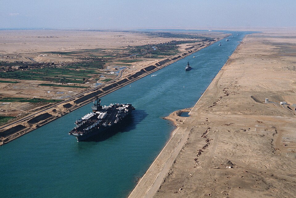
The Suez Canal is a man-made, sea-level, lock-free waterway across the narrow Isthmus of Suez, joining the Mediterranean Sea in the north to the Red Sea in the south. Because it has no locks, water moves freely through it and tidal differences between the two ends drive weak currents. It was dug between 1859 and 1869 by the Suez Canal Company promoted by the French diplomat Ferdinand de Lesseps, and it turned the Red Sea from a dead end into the main artery between Europe and Asia.
The trap in this question is the difference between what the canal JOINS and what the canal ROUTE serves. It is perfectly true that the canal links Atlantic Europe with the Indian Ocean and East Asia — but that is the journey, not the canal's two mouths. Fix the two terminal cities in memory: Port Said on the Mediterranean at the north, Suez on the Red Sea at the south. Everything past those — the Atlantic through the Strait of Gibraltar, the Indian Ocean through Bab-el-Mandeb — lies outside the canal, and the code-based option set is built precisely to punish a candidate who does not draw that line.
Key facts
- The Suez Canal is about 193.3 km long and runs across the Isthmus of Suez in Egypt, from Port Said (Mediterranean Sea) in the north to Suez, on the Gulf of Suez (Red Sea), in the south
- It opened on 17 November 1869; the Suez Canal Company that built it (1859-1869) was promoted by Ferdinand de Lesseps
- It is a sea-level canal with no locks — unlike the Panama Canal, which lifts ships through a lock system
- Egyptian President Gamal Abdel Nasser nationalised the canal on 26 July 1956, precipitating the Suez Crisis
- From north to south the canal passes Lake Manzala, Lake Timsah, the Great Bitter Lake and the Little Bitter Lake
- The 'New Suez Canal' — a 35 km parallel channel with the Ballah bypass widened from about 61 m to 312 m — was declared open on 6 August 2015, allowing two-way transit along part of the route
Study next
Common traps
- Marking 'Atlantic Ocean' because the canal is described as the Europe-Asia link — the Mediterranean reaches the Atlantic only through the Strait of Gibraltar
- Marking 'Indian Ocean' because Indian ships use the canal — its southern terminus is the Red Sea, and Bab-el-Mandeb still lies ahead
- Confusing the Suez Canal (sea level, no locks) with the Panama Canal (locks and Gatun Lake)
UPPSC asks the canal's termini, the north-to-south order of its lakes and the 1956 nationalisation as direct factual items; UPSC prefers the applied form — which voyage would or would not pass through it, and which cut would actually shorten which route.
Related PYQs
One will NOT have to pass through the Suez Canal while going from Mumbai to
- (a) Alexandria
- (b) Suez
- (c) Port Said
- (d) Benghazi
Answer(b) Suez
Same canal, tested from the other side: you can only answer it if you know that the canal runs from Port Said on the Mediterranean to the city of Suez on the Red Sea, so a ship from Mumbai reaches Suez without ever entering the canal.
Between India and East Asia, the navigation-time and distance can be greatly reduced by which of the following? 1. Deepening the Malacca straits between Malaysia and Indonesia. 2. Opening a new canal across the Kra isthmus between the Gulf of Siam and Andaman Sea. Which of the statements given above is/are correct?
- (a) 1 only
- (b) 2 only
- (c) Both 1 and 2
- (d) Neither 1 nor 2
Answer(b) 2 only
The same underlying idea — cutting a canal across a narrow isthmus to delete a long detour from a sea route. The Kra Isthmus proposal is to East Asia what the Isthmus of Suez cut was to the Europe-Asia trade.
In the Suez canal region, the correct order of lakes lying from North to South direction is
- (a) Lake Timsah – Little Bitter Lake – Great Bitter Lake – Lake Manzala
- (b) Great Bitter Lake – Little Bitter Lake – Lake Timsah – Lake Manzala
- (c) Lake Manzala – Great Bitter Lake – Little Bitter Lake – Lake Timsah
- (d) Lake Manzala – Lake Timsah – Great Bitter Lake – Little Bitter Lake
Answer(d) Lake Manzala – Lake Timsah – Great Bitter Lake – Little Bitter Lake
The same canal in the same commission's paper. That item needs the north-to-south sequence inside the canal; this one needs the water bodies at its two ends — together they fix the canal's geography from Port Said down to the Gulf of Suez.
Practice
- practice — not a real PYQ
Which one of the following statements about the Suez Canal is correct?
- (a)It is a lock canal, like the Panama Canal
- (b)It is a sea-level canal without locks
- (c)It connects the Black Sea with the Mediterranean Sea
- (d)It was opened to shipping in 1914
Answer(b) It is a sea-level canal without locks — the Panama Canal, opened in 1914, is the lock canal; the Black Sea connects to the Mediterranean through the Bosphorus and Dardanelles, not the Suez. - practice — not a real PYQ
The Suez Canal was nationalised in 1956 by
- (a)Anwar Sadat
- (b)Ferdinand de Lesseps
- (c)Gamal Abdel Nasser
- (d)Hosni Mubarak
Answer(c) Gamal Abdel Nasser — he announced the nationalisation on 26 July 1956, triggering the Suez Crisis; de Lesseps had promoted the company that built the canal in the 1860s.