
With reference to hydroelectricity in North India, which of the following statements is/are correct ? 1. There are huge possibilities of hydroelectricity in the Himalayan region. 2. Eastern Uttar Pradesh and Bihar cannot utilise this potential because the Himalayas situated to their North lies in boundary of Nepal. Select the correct answer from the code given below : Code :
- (a)Only 2
- (b)Both 1 and 2
- (c)Neither 1 nor 2
- (d)Only 1
Correct — B, Both 1 and 2. Statement 1 is straightforwardly true. Hydro generation needs two things — a dependable year-round flow and a large fall, or head — and the Himalayan region supplies both, because its rivers are fed by snow and glaciers as well as rain and they descend through deep, steep gorges. India's economically exploitable hydroelectric potential is assessed at roughly 1,48,700 MW, and the largest shares of it lie in the Himalayan basins: the Brahmaputra first, then the Indus, then the Ganga. Against that, installed hydro capacity is only a fraction of the assessment, so 'possibilities' is exactly the right word. Statement 2 is the commission's regional-geography argument, and it is the one the key accepts. What lies immediately north of eastern Uttar Pradesh and Bihar is Nepalese territory: the Ghaghara, Gandak, Bagmati and Kosi all cut their high-gradient courses inside Nepal and enter India already spent, flowing across the Indo-Gangetic plain, which has almost no slope. So the head-bearing mountain reaches of these rivers are outside Indian jurisdiction, and what these two regions hold instead is a flat alluvial plain where barrages can be built for irrigation and flood control but not high-head power stations. Read as the standard argument of regional economic geography — the reason these particular states are not hydro states — statement 2 stands with statement 1.
- (a)Only 2 — It rejects the least controversial half of the question. That the Himalayan region holds very large hydroelectric possibilities is settled: the assessment of India's exploitable potential is dominated by the Brahmaputra, Indus and Ganga basins, and the country's biggest hydro schemes — Tehri, Nathpa Jhakri, Bhakra, the Chenab valley projects, Subansiri — are all Himalayan.
- (c)Neither 1 nor 2 — Both halves cannot be dismissed. Statement 1 is a textbook fact about Himalayan river regimes and relief, and statement 2 rests on an equally plain geographic observation — the Himalayan segment directly north of eastern Uttar Pradesh and Bihar lies inside Nepal, and Uttar Pradesh has held no Himalayan territory at all since Uttarakhand was carved out of it in November 2000.
- (d)Only 1 — This is the tempting option for a candidate who reads statement 2 as too absolute — after all, low-head units do exist on canals and barrages in the plains, and India does develop Himalayan hydro across the border through treaties with Nepal, such as the Mahakali Treaty of 1996 and its Pancheshwar Multipurpose Project. But the statement is about eastern Uttar Pradesh and Bihar tapping the Himalayan potential themselves, and on their own territory they have neither the mountains nor the gradient to do it. The commission's key therefore marks both statements correct.
Hydroelectric potential is a function of two variables: discharge (how much water flows, and how reliably) and head (how far it falls). The Himalayan rivers score high on both — snow-melt and glacier-melt keep them perennial even in the dry months, and the young, still-rising mountains give them steep gradients and deep gorges in which a dam creates a large head over a short distance. The peninsular rivers, by contrast, are rain-fed and seasonal, and their hydro sites depend on waterfalls at the edge of the plateau such as Shivanasamudra on the Cauvery or Jog on the Sharavathi. The Indo-Gangetic plain has the opposite problem from the mountains: enormous discharge, almost no head. That is why the plain is the country's granary and its flood-control theatre, not its power house.
The trap in this question is a habit of thought, not a fact. Statement 2 sounds like the kind of over-strong sentence UPPSC usually plants to make you say 'false', and 'cannot' is a strong word. But read it as regional economic geography rather than as an engineering impossibility and it is the standard textbook explanation. The political-geography half is easy to verify on a map: Bihar's northern boundary is with Nepal, and the seven Terai districts of Uttar Pradesh that touch Nepal touch it in the plains, with the mountains lying beyond the border. The historical half is worth remembering too — until 9 November 2000 Uttar Pradesh did include the Himalaya, with the Tehri project on the Bhagirathi inside it; that tract is now Uttarakhand, so present-day Uttar Pradesh is a plains state throughout. Treat the phrasing as the commission's paraphrase of the standard argument and mark both statements correct.
- India's economically exploitable hydroelectric potential is assessed at about 1,48,700 MW, with the Brahmaputra basin holding the largest share, followed by the Indus and the Ganga — all Himalayan basins
- Utility-scale installed hydro capacity was around 46,000 MW, about 12 per cent of India's utility power capacity, as on 31 March 2020 — far below the assessed potential
- Himalayan rivers are perennial because they are fed by snow and glacier melt as well as the monsoon, and they carry a steep gradient — the two conditions hydro power needs
- The Ghaghara, Gandak, Bagmati and Kosi rise in or beyond Nepal and cross their mountain sections inside Nepalese territory before entering the plains of eastern Uttar Pradesh and Bihar
- Uttar Pradesh has had no Himalayan territory since 9 November 2000, when Uttarakhand — which holds Tehri on the Bhagirathi and the Alaknanda valley projects — was carved out of it
- India pursues the Himalayan potential that lies across the border by treaty: the Mahakali Treaty of 12 February 1996 with Nepal envisages the Pancheshwar Multipurpose Project for power, irrigation and flood control
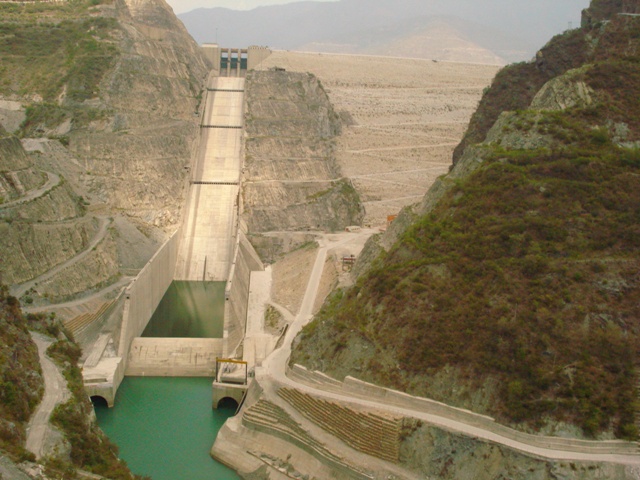
- Rejecting statement 2 because the word 'cannot' feels too absolute — here it is the standard regional-geography argument, and the key accepts it
- Assuming Uttar Pradesh still contains Himalayan territory; the Himalayan districts left the state with the creation of Uttarakhand in 2000
- Confusing large discharge with large potential — the Ganga in Bihar carries a huge volume of water but almost no gradient, and hydro power needs head, not merely water
UPPSC frames this as a cause-and-effect statement pair about a region of the state's own hinterland; UPSC prefers the concrete anchors behind it — which river a named project sits on, the west-to-east order of the Himalayan tributaries of the Ganga, or what pumped-storage hydropower is for.
On which one of the following rivers is the Tehri Hydropower Complex located?
- (a) Alaknanda
- (b) Bhagirathi
- (c) Dhauliganga
- (d) Mandakini
Answer(b) Bhagirathi
The concrete instance of statement 1 — India's largest Himalayan hydro complex sits high on the Bhagirathi in Uttarakhand, in exactly the gorge terrain that eastern Uttar Pradesh and Bihar do not possess.
With reference to the Himalayan rivers joining the Ganga downstream of Prayagraj from West to East, which one of the following sequences is correct?
- (a) Ghaghara — Gomati — Gandak — Kosi
- (b) Gomati — Ghaghara — Gandak — Kosi
- (c) Ghaghara — Gomati — Kosi — Gandak
- (d) Gomati — Ghaghara — Kosi — Gandak
Answer(b) Gomati — Ghaghara — Gandak — Kosi
These are precisely the rivers of statement 2. The Ghaghara, Gandak and Kosi reach eastern Uttar Pradesh and Bihar only after completing their mountain descent inside Nepal, which is why the two regions receive the Himalayan water but not the Himalayan head.
Which hydropower plant in Bhutan was inaugurated recently by Indian Prime Minister Narendra Modi
- (a) Chhukha Power Plant
- (b) Dagachhu Power Plant
- (c) Kurichha Power Plant
- (d) Mangdechhu Power Plant
Answer(d) Mangdechhu Power Plant
The same logic as statement 2, seen from the policy end — a large slice of the Himalayan hydro potential relevant to India lies inside neighbouring countries, so India reaches it through bilateral projects such as Mangdechhu in Bhutan rather than by building on the Gangetic plain.
Shivanasamudra and Kalpakkam are respectively important for -
- (a) Thermal Power and Nuclear Energy
- (b) Hydel Power and Nuclear Energy
- (c) Nuclear Energy and Hydel Power
- (d) Solar Power and Nuclear Energy
Answer(b) Hydel Power and Nuclear Energy
The peninsular counterpart of the same siting principle — Shivanasamudra generates hydel power from a fall on the Cauvery at the plateau edge. Whether Himalayan gorge or plateau waterfall, a hydro site needs a drop, and that is exactly what the alluvial plain of eastern Uttar Pradesh and Bihar lacks.
- practice — not a real PYQ
Which of the following is the principal reason that the Himalayan rivers offer far greater hydroelectric potential than the peninsular rivers?
- (a)They carry a much larger load of silt
- (b)They are perennial and flow through steep gorges, giving both dependable discharge and a large head
- (c)They flow through more densely populated regions
- (d)They are longer and have wider deltas
Answer(b) They are perennial and flow through steep gorges, giving both dependable discharge and a large head — peninsular rivers are rain-fed and seasonal, and their hydro sites depend on plateau-edge waterfalls.
- practice — not a real PYQ
The Pancheshwar Multipurpose Project, envisaged under a 1996 treaty between India and Nepal, is proposed on which river?
- (a)Kosi
- (b)Gandak
- (c)Mahakali (Sharda)
- (d)Bagmati
Answer(c) Mahakali (Sharda) — the Mahakali Treaty of 12 February 1996 provides for the Pancheshwar project for power generation, irrigation and flood control.