
Match List-I with List-II and choose the correct answer using the codes given below the lists : List-I (Pass) A. Debsa B. Rohtang C. Bara-lacha D. Banihal List-II (Height from Sea Level) 1. 5360 metres 2. 4850 metres 3. 3978 metres 4. 2832 metres Codes :
- (a)A-1, B-3, C-2, D-4
- (b)A-3, B-1, C-2, D-4
- (c)A-1, B-4, C-2, D-3
- (d)A-3, B-1, C-4, D-2
Correct — A, A-1, B-3, C-2, D-4: Debsa 5360 m, Rohtang 3978 m, Bara-lacha 4850 m, Banihal 2832 m. Notice first what this item really is. List-II is simply four heights in descending order, so the question is not asking you to remember four numbers — it is asking you to rank four passes from highest to lowest. Do that with geography rather than arithmetic. Debsa is the deepest inside the mountains of the four: it is a high col in the Himalaya between Kullu and Spiti districts of Himachal Pradesh, linking the Parbati valley on the Kullu side to the Parahio valley in Spiti across glaciated ground, and it is a trekking route, not a road — so it takes the highest figure, 5360 m. Bara-lacha la comes next. It sits on the Zanskar range in Lahaul, at the point the article on it calls a crossroads where roads from Spiti, Ladakh, Zanskar and Lahaul meet, and it is the pass the Leh–Manali highway climbs after Keylong; the Chandra flows away to the south-east from near it and the Bhaga rises to its north-west. That earns 4850 m. Rohtang is third. It lies on the Pir Panjal range just above Manali and connects the Kullu valley with the Lahaul and Spiti valleys — a road pass so heavily used that a tunnel, the Atal Tunnel, was driven beneath it and opened on 3 October 2020. Its figure is 3978 m, the one number in this set most Indian geography students already carry. Banihal is lowest at 2832 m: also on the Pir Panjal, but far to the north-west, where the range is lower and where the Jammu–Srinagar road crossed into the Kashmir Valley until the Jawahar Tunnel was bored under it in 1956. So the descending order Debsa → Bara-lacha → Rohtang → Banihal maps onto 1 → 2 → 3 → 4, giving A-1, B-3, C-2, D-4, which is option (a). One honesty note on the numbers themselves: published elevations for Himalayan passes disagree by a hundred metres or so between sources — Bara-lacha la, for instance, is quoted as 4850 m in some places and about 4890 m in others. Learn the ordering, which is stable; treat the exact metres as the figure UPPSC chose to use.
- (b)A-3, B-1, C-2, D-4 — It swaps the top and third positions, making Debsa 3978 m and Rohtang 5360 m. Rohtang at 5360 m is the giveaway error: Rohtang is a motorable pass on the Pir Panjal reached by road from Manali in a few hours, and its height, 3978 m (about 13,050 ft), is one of the most quoted numbers in Indian physical geography. No PASS on the Pir Panjal in that sector sits at 5360 m (the range itself does rise higher — Indrasan 6,221 m and Deo Tibba 6,001 m stand above the same Kullu valley); that is Greater-Himalaya-and-glacier country, which is where Debsa lies.
- (c)A-1, B-4, C-2, D-3 — It gets Debsa and Bara-lacha right but exchanges Rohtang and Banihal, making Rohtang the lowest pass at 2832 m and Banihal the higher at 3978 m. That inverts the real relationship. Both are on the Pir Panjal, but the range loses height as it runs north-west: at Rohtang, above Manali, it still stands near 4000 m, while at Banihal, on the Jammu–Srinagar route, the crest is down to roughly 2800 m — which is exactly why a road tunnel could be driven through Banihal as early as 1956, while a tunnel under Rohtang had to wait until 2020.
- (d)A-3, B-1, C-4, D-2 — Wrong on all four pairs. It repeats option (b)'s error of putting Rohtang at the top with 5360 m and Debsa at 3978 m, and then compounds it by dropping Bara-lacha to 2832 m and lifting Banihal to 4850 m. Bara-lacha la carries the Leh–Manali highway across the Zanskar range into Ladakh and is one of the highest road passes in the country; Banihal is the low gateway into the Kashmir Valley. This option reverses that pair completely.
A Himalayan pass is a saddle — the lowest crossing point on a ridge — so a pass's height is set by the height of the range it cuts through and by where along that range it sits. Working outward from the plains, the Shivalik or Outer Himalaya is lowest, then the Lesser or Middle Himalaya (of which the Pir Panjal is the great north-western arm), then the Greater Himalaya or Himadri, and beyond that the trans-Himalayan Zanskar and Ladakh ranges. Passes therefore climb as you move from the Jammu side towards Spiti and Ladakh, and the same range can offer a low pass at one end and a high one at another.
The examiner has laid out List-II as four descending heights, which is a gift if you spot it: the task collapses into ranking the four passes, and you can rank them by how far into the mountains each one lies. Debsa is a glacier-country trekking col between Kullu and Spiti and must be highest. Bara-lacha la is a trans-Himalayan road pass on the Zanskar range on the way to Leh, so it is second. Rohtang is a Pir Panjal road pass above Manali, third. Banihal is on the same Pir Panjal but at its low north-western end on the Jammu–Srinagar road, so it is lowest. The trap the wrong options exploit is name-familiarity: Rohtang is the most famous of the four, and candidates who have not fixed its height instinctively hand it the biggest number. Anchor on Rohtang = 3978 m and Banihal = the lowest, and every option except (a) collapses.
- Debsa Pass, about 5360 m, lies in the Himalaya between Kullu and Spiti districts of Himachal Pradesh, joining the Parbati valley to the Parahio valley; it is a high trekking route, located in 1993 and first crossed in September 1995, not a road pass.
- Bara-lacha la, commonly given as 4850 m (some sources about 4890 m), crosses the Zanskar range in Lahaul on the Leh–Manali highway; roads from Lahaul, Spiti, Zanskar and Ladakh meet near it, the Chandra flows south-east and the Bhaga rises north-west of it.
- Rohtang Pass, 3978 m (about 13,050 ft), is on the Pir Panjal range and connects the Kullu valley with the Lahaul and Spiti valleys; the 9-km Atal Tunnel beneath it became operational on 3 October 2020, cutting a 4–6 hour crossing to roughly half an hour.
- Banihal Pass, 2832 m (about 9,291 ft), is also on the Pir Panjal and was the crossing from the Jammu side into the Kashmir Valley until the Jawahar Tunnel was opened under it in 1956; the pass itself is no longer used for road traffic.
- Published elevations for Himalayan passes vary by roughly a hundred metres between sources, so the reliable examinable unit is the ordering — Debsa > Bara-lacha > Rohtang > Banihal — not the last digit of any single figure.
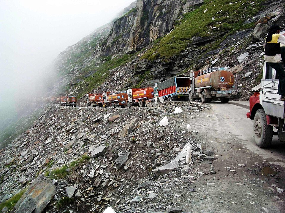
- Handing the highest figure to the most famous pass. Rohtang is the best known of these four and the lowest but one; its height is 3978 m.
- Assuming one range means one height. Banihal and Rohtang are both on the Pir Panjal, yet they differ by more than 1100 m because the range falls away towards the north-west.
- Quoting a pass elevation to the metre. Sources differ by around a hundred metres — for example Bara-lacha la appears as both 4850 m and about 4890 m — so carry the rank order, and reproduce the figure the paper itself uses.
UPPSC likes passes as a match-list — pass against height, or pass against State/UT as in 2023 — while UPSC prefers a single identification with a hook to current affairs or to the range in which a feature lies; in both cases the examinable unit is pass + range + State + what it connects.
Which one of the following Himalayan passes was reopened in the middle of the year 2006 to facilitate trade between India and China?
- (a) Chang La
- (b) Jara La
- (c) Nathu La
- (d) Shipki La
Answer(c) Nathu La
The same examinable unit from the other direction — you are given four Himalayan passes and must know which State and which frontier each belongs to, exactly the knowledge that lets you rank Debsa, Bara-lacha, Rohtang and Banihal by height.
Consider the following pairs: Peak — Mountains 1. Namcha Barwa — Garhwal Himalaya 2. Nanda Devi — Kumaon Himalaya 3. Nokrek — Sikkim Himalaya Which of the pairs given above is/are correctly matched?
- (a) 1 and 2
- (b) 2 only
- (c) 1 and 3
- (d) 3 only
Answer(b) 2 only
Tests the same underlying skill as this UPPSC item — placing a named Himalayan feature on the correct range and in the correct sector — which is what tells you that Debsa sits in Greater-Himalaya glacier country while Banihal is on the low north-western Pir Panjal.
Which one of the following (Passes - States/U.T.) is correctly matched?
- (a) Mana – Himachal Pradesh
- (b) Aghil – Arunachal Pradesh
- (c) Niti – Uttarakhand
- (d) Diphu – Ladakh
Answer(c) Niti – Uttarakhand
UPPSC asked the pass topic as a pass-to-State match only a year earlier; run the two together and you build the single table — pass, range, State, what it connects, roughly how high — that answers either version.
Valley of Kashmir is situated between
- (a) Kangara and Dhauladhar ranges
- (b) Pir-Panjal and Himadri ranges
- (c) Mahabharat and Dhauladhar ranges
- (d) Pir-Panjal and Mahabharat ranges
Answer(b) Pir-Panjal and Himadri ranges
Fixes the range that carries two of the four passes here — Banihal is the crossing of the Pir Panjal that lets the Jammu–Srinagar road into the Kashmir Valley, and Rohtang is the same range far to the south-east, which is why both sit well below Debsa and Bara-lacha.
- practice — not a real PYQ
The Atal Tunnel, opened in October 2020, passes beneath which Himalayan pass?
- (a)Bara-lacha la
- (b)Rohtang Pass
- (c)Banihal Pass
- (d)Zoji La
Answer(b) Rohtang Pass — the Atal Tunnel runs under the Pir Panjal at Rohtang and connects Manali in the Kullu valley with Lahaul, giving Lahaul all-weather road access; Banihal has the Jawahar Tunnel (1956) beneath it, and a tunnel at Zoji La is still under construction.
- practice — not a real PYQ
Which one of the following passes lies on the Zanskar range and is crossed by the Leh–Manali highway?
- (a)Rohtang Pass
- (b)Banihal Pass
- (c)Bara-lacha la
- (d)Debsa Pass
Answer(c) Bara-lacha la — it crosses the Zanskar range in Lahaul district of Himachal Pradesh on the Leh–Manali highway; Rohtang and Banihal are both on the Pir Panjal, and Debsa is a trekking col between Kullu and Spiti with no road over it.