
With reference to "Shaksgam Valley", which of the following statements is/are correct ? 1. This valley is a strategic key region, that is part of Pakistan-occupied Kashmir (PoK). 2. India has lodged protest against the infrastructural development being carried out by China in this valley. Select the correct answer from the codes given below :
- (a)Only 2
- (b)Neither 1 nor 2
- (c)Only 1
- (d)Both 1 and 2
Correct — D, Both 1 and 2. Statement 1 is correct on India's own position. The Shaksgam Valley lies in the Trans-Karakoram Tract, the strip north of the main Karakoram crest that Pakistan handed to China under the Sino-Pakistan Boundary Agreement of 2 March 1963. Pakistan could only hand it over because it was holding that part of the erstwhile princely State of Jammu and Kashmir illegally, so in Indian usage the valley is territory of Pakistan-occupied Kashmir that was further ceded to a third country. India has never accepted the transfer: it treats the 1963 agreement as illegal and void and continues to claim the tract as part of the Union Territory of Ladakh. The 'strategic key region' description is not rhetoric either — the valley sits immediately north of the Siachen region and of the Karakoram giants, and a road running through it brings Chinese access up against India's northernmost military positions. Statement 2 is correct as a matter of record. In May 2024, months before this exam, India formally protested against Chinese infrastructure construction — road building — inside the Shaksgam Valley, with the Ministry of External Affairs restating that the area is Indian territory and that India rejects China's illegal occupation of it. Because both statements hold, the answer is (d).
- (a)Only 2 — Concedes the protest but rejects the PoK description, presumably on the reasoning that the valley is administered by China today and so cannot be called PoK. That confuses possession with title. India's position, which is what an Indian public examination tests, is that the whole of Jammu and Kashmir including Gilgit-Baltistan is Indian, that Pakistan's occupation of it is illegal, and that Pakistan's 1963 transfer of the Shaksgam tract to China was therefore void. Statement 1 stands.
- (b)Neither 1 nor 2 — Rejects both, which cannot survive the news record of 2024 alone. India's protest against Chinese construction in the Shaksgam Valley was made publicly in May 2024 and was widely reported; a candidate who had followed the year's current affairs would have had statement 2 fixed. And statement 1 is settled Indian doctrine, not a contested claim.
- (c)Only 1 — Accepts the territorial description but denies the protest, and this is the option a candidate falls into if he remembers Shaksgam only as a static geography fact and missed the 2024 news cycle. India did protest, in May 2024, over Chinese road-building in the valley — this is exactly the sort of recent development that puts an old place-name back on the paper.
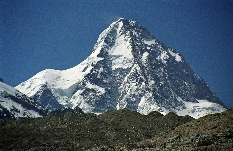
The Shaksgam Valley is the valley of the Shaksgam or Muztagh river, which rises on the northern flank of the Karakoram and runs north-westward to join the Yarkand river, whose waters end in the Tarim Basin of Xinjiang. It lies between the main Karakoram crest to the south — the wall of K2 and the Gasherbrums — and the Aghil range to the north, crossed by the Aghil Pass. Together with the neighbouring Raskam area it makes up what is called the Trans-Karakoram Tract, and its whole political significance comes from the fact that a country that did not own it gave it to another country that had no claim to it.
Two separate things have to be held together to answer this. The first is a legal-historical fact: on 2 March 1963 Pakistan and China signed a boundary agreement covering the frontier between Xinjiang and the areas of Kashmir under Pakistani control, and by it Pakistan relinquished the Shaksgam tract to China. The agreement itself acknowledged that the arrangement was provisional and would be reopened once the Kashmir dispute was settled — an admission that the signatories knew the title was not theirs to settle. India rejected the agreement immediately and has never varied from that position. The second is current affairs: in May 2024 India lodged a protest over Chinese construction activity in the valley, and it is that protest which turned a dormant map fact into an examinable current-affairs item. UPPSC's phrasing — 'a strategic key region, that is part of Pakistan-occupied Kashmir' — is lifted almost directly from the Indian official line, which is your signal that the statement is meant to be read as correct.
- The Shaksgam Valley forms part of the Trans-Karakoram Tract, which Pakistan ceded to China under the Sino-Pakistan Boundary Agreement of 2 March 1963. India rejects the agreement as illegal and void and claims the tract as part of the Union Territory of Ladakh.
- In May 2024 India formally protested against Chinese infrastructure construction in the Shaksgam Valley, restating that the area is Indian territory and that it does not accept China's occupation of it.
- Geographically the valley is drained by the Shaksgam (Muztagh) river, a tributary of the Yarkand river of the Tarim basin; it is bounded to the south by the main Karakoram crest and to the north by the Aghil range, crossed by the Aghil Pass.
- The tract lies immediately north of the Siachen region, which is why Indian assessments describe it as strategically sensitive rather than merely remote.
- The 1963 agreement described the boundary it drew as provisional, to be renegotiated by the sovereign authority over Kashmir once the dispute was settled — an acknowledgement built into the text itself.
- Treating Shaksgam and Aksai Chin as the same place. Aksai Chin was taken by China directly from Indian-claimed Ladakh; the Shaksgam tract came to China from Pakistan by the 1963 agreement. Different route, different date, same Indian rejection.
- Answering territorial questions from the map of present control rather than from India's stated claim. In an Indian public examination, PoK, Gilgit-Baltistan, Aksai Chin and the Trans-Karakoram Tract are all Indian territory under illegal occupation.
- Assuming that a place-name from physical geography cannot be a current-affairs question. Shaksgam appeared on this paper because of a specific protest in May 2024.
UPPSC pairs an old territorial fact with a recent diplomatic event and asks you to certify both, as here; UPSC prefers to test the same region through physical geography — which glacier feeds which river, which range lies where — or through a 'which of the following is/are correctly matched' on passes and ranges. Prepare the region both ways.
Siachen Glacier is situated to the
- (a) East of Aksai Chin
- (b) East of Leh
- (c) North of Gilgit
- (d) North of Nubra Valley
Answer(d) North of Nubra Valley
The neighbouring block of the same map. Siachen sits in the eastern Karakoram just south of the Trans-Karakoram Tract, so fixing Siachen relative to the Nubra valley also fixes where the Shaksgam valley lies — one crest further north.
Consider the following pairs: Glacier — River 1. Bandarpunch : Yamuna 2. Bara Shigri : Chenab 3. Milam : Mandakini 4. Siachen : Nubra 5. Zemu : Manas Which of the pairs given above are correctly matched?
- (a) 1, 2 and 4
- (b) 1, 3 and 4
- (c) 2 and 5
- (d) 3 and 5
Answer(a) 1, 2 and 4
Tests the Karakoram through its drainage, which is the cleanest way to hold this region in the head: Siachen feeds the Nubra on the Indian side of the crest, while on the far side the glaciers feed the Shaksgam and so the Yarkand, away from India altogether.
Which one of the following (Passes - States/U.T.) is correctly matched?
- (a) Mana – Himachal Pradesh
- (b) Aghil – Arunachal Pradesh
- (c) Niti – Uttarakhand
- (d) Diphu – Ladakh
Answer(c) Niti – Uttarakhand
The Aghil Pass appears there as a distractor mismatched to Arunachal Pradesh — Aghil in fact crosses the Aghil range on the far side of the Shaksgam valley. The commission clearly keeps trans-Karakoram place-names in its question bank, so learn the passes of the far north with their real locations.
Valley of Kashmir is situated between
- (a) Kangara and Dhauladhar ranges
- (b) Pir-Panjal and Himadri ranges
- (c) Mahabharat and Dhauladhar ranges
- (d) Pir-Panjal and Mahabharat ranges
Answer(b) Pir-Panjal and Himadri ranges
Builds the same north-western Himalayan frame from the other end: Kashmir valley between the Pir Panjal and the Himadri, then Ladakh and Zanskar, then the Karakoram, and only beyond the Karakoram the Shaksgam. Range order is what makes these questions quick.
- practice — not a real PYQ
The Shaksgam Valley was ceded to China by Pakistan under an agreement signed in which year?
- (a)1948
- (b)1954
- (c)1963
- (d)1972
Answer(c) 1963 — the Sino-Pakistan Boundary Agreement of 2 March 1963 transferred the Trans-Karakoram Tract, including the Shaksgam Valley, to China. India rejects the agreement as illegal and void.
- practice — not a real PYQ
Consider the following statements about the Shaksgam Valley: 1. It lies to the north of the main Karakoram range. 2. The Shaksgam river is a tributary of the Yarkand river. Which of the statements given above is/are correct?
- (a)1 only
- (b)2 only
- (c)Both 1 and 2
- (d)Neither 1 nor 2
Answer(c) Both 1 and 2 — the valley lies north of the main Karakoram crest, between it and the Aghil range, and the Shaksgam (Muztagh) river flows into the Yarkand river, which drains to the Tarim Basin in Xinjiang.