
The Gobi Desert is spread across which of the following countries ? 1. Mongolia 2. China 3. Russia 4. Kazakhstan Select the correct answer from the code given below :
- (a)Only 1 and 2
- (b)Only 1, 2 and 3
- (c)Only 1, 2 and 4
- (d)Only 1
Correct — A, Only 1 and 2. The Gobi is a two-country desert: it occupies the southern third of Mongolia and reaches across the border into northern China, where its Chinese portion lies mainly in the Inner Mongolia Autonomous Region and spills into Gansu and Ningxia. It covers roughly 1.3 million square kilometres in all. Its northern limit stops well short of Russia — the Altai mountains and the Mongolian steppe belt intervene — and it comes nowhere near Kazakhstan, which lies far to the west beyond the Altai and the Dzungarian basin. So statements 1 and 2 are correct and statements 3 and 4 are not, which is option (a).
- (b)Only 1, 2 and 3 — It adds Russia, a natural guess because Russia shares a long border with Mongolia. But the Gobi lies in the SOUTH of Mongolia, along the Chinese frontier, while Russia adjoins Mongolia in the north. Between the desert and the Russian border lie the Altai and Khangai mountains and a broad belt of Mongolian steppe and forest-steppe, so the Gobi never reaches Russian territory.
- (c)Only 1, 2 and 4 — It adds Kazakhstan, presumably because Kazakhstan is a large, dry Central Asian state. But it is separated from the Gobi by the Altai and Tian Shan ranges and the Dzungarian basin, and its own arid lands — such as the Betpak-Dala — are distinct deserts, not part of the Gobi.
- (d)Only 1 — It restricts the Gobi to Mongolia. Mongolia does hold the desert's northern half, and the name is Mongolian, but a very large share of the Gobi lies inside China, chiefly in the Inner Mongolia Autonomous Region. Leaving China out understates the desert by roughly half.
The Gobi is a cold, mid-latitude desert of the East Asian interior, stretching in an arc across southern Mongolia and northern China. Its aridity has two causes working together. First it lies in a deep rain shadow: the Himalaya and the Tibetan Plateau stand between it and the Indian Ocean and strip the monsoon winds of their moisture before they can travel that far north. Second it is about as far from any ocean as land on Earth gets, so continentality reinforces the dryness and produces a violent temperature range. That is why the Gobi behaves nothing like the Sahara — winter temperatures plunge far below freezing and snow and frost are ordinary events.
The question is really asking where the Gobi stops, and the two wrong candidates are chosen to sound reasonable. Russia is offered because it is Mongolia's other neighbour; Kazakhstan because it is a big, arid, Central Asian country. Fixing the desert's position kills both at once — the Gobi hugs the Mongolia–China border, so it runs along Mongolia's SOUTHERN edge and cannot touch Russia in the north, and Kazakhstan is a thousand kilometres and two mountain systems away to the west. The safe mental label is simply: Gobi = southern Mongolia plus northern China, and nothing else.
- The Gobi spreads across southern Mongolia and northern China, its Chinese share lying mainly in the Inner Mongolia Autonomous Region, and covers about 1.3 million square kilometres
- It is larger than Australia's Great Sandy Desert but smaller than the Arabian Desert and far smaller than the Sahara
- It is a cold, rain-shadow desert — the Himalaya and Tibetan Plateau block moisture-bearing winds from the Indian Ocean, and the great distance from any sea deepens the aridity
- Winter temperatures fall far below freezing and snow and frost occur, so it is a cold desert, unlike the hot Sahara or Arabian deserts
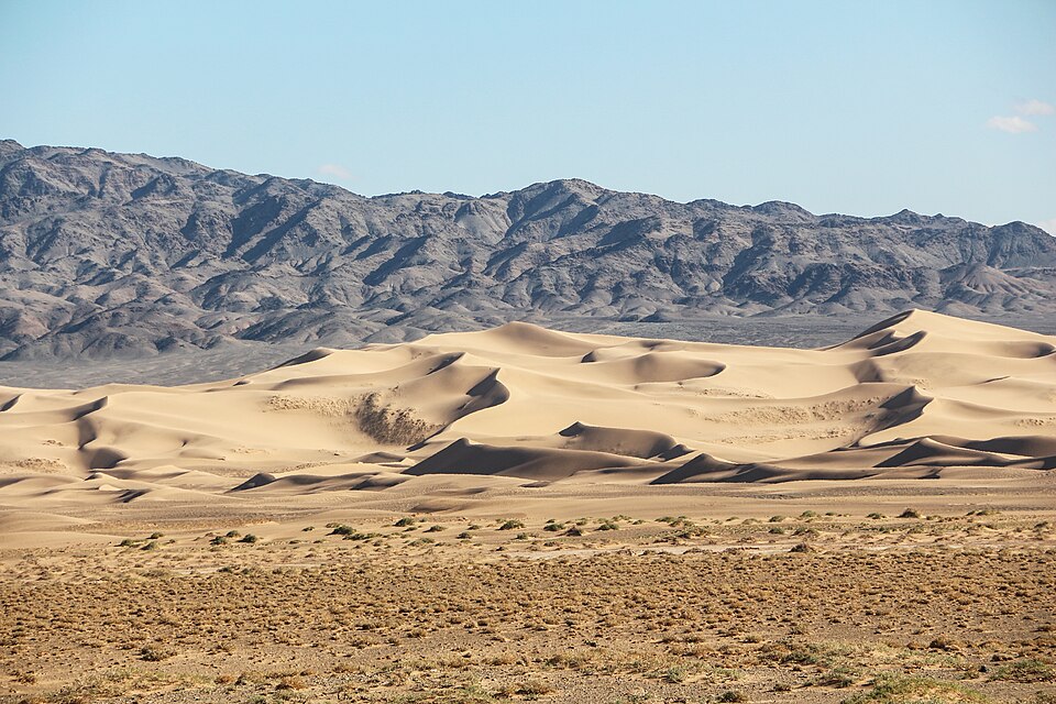
- Most of the Gobi is bare rock and gravel plain rather than sand sea; Khongoryn Els in southern Mongolia is one of its few extensive dune fields
- 'Gobi' is a Mongolian word for a waterless or semi-desert place; the desert is bounded by the Altai and Khangai mountains and the Mongolian steppes to the north and the Tibetan Plateau to the south-west
- The Gobi has been expanding southward through desertification, which China has sought to check with large-scale shelterbelt tree planting
- Adding Russia because it borders Mongolia — the Gobi lies along Mongolia's southern, Chinese frontier, not its northern Russian one
- Adding Kazakhstan because it is large, Central Asian and dry; its arid lands are separate deserts, cut off from the Gobi by the Altai and Tian Shan
- Confusing the Gobi with the Taklamakan, a different desert lying in the Tarim Basin of Xinjiang and entirely within China
- Picturing the Gobi as a sea of sand and a place of great heat — it is mostly rock and gravel, and it is a cold desert with severe winters
UPPSC has now asked the Gobi twice from different angles — by size ranking against other world deserts in 2023, and by the countries it covers here. UPSC prefers to match a landform to its country in a list, or to ask for the climatic reason a particular desert belt exists.
Match List I with List II and select the correct answer using the code given below the lists : List I (Geographic feature) A. Great Victoria Desert B. Grand Canyon C. Lake Winnipeg D. Southern Alps List II (Country) 1. Australia 2. Canada 3. New Zealand 4. USA Code :
- (a) A-1 B-2 C-4 D-3
- (b) A-1 B-4 C-2 D-3
- (c) A-3 B-2 C-4 D-1
- (d) A-3 B-4 C-2 D-1
Answer(b) A-1 B-4 C-2 D-3
The same skill in match-list form — pinning a named physical feature to the country that holds it, with a desert leading the list. Getting the Great Victoria Desert to Australia is precisely the exercise of getting the Gobi to Mongolia and China, and both questions punish the candidate who recognises the name but has never located it on a map.
Consider the following deserts and arrange them in increasing order of their size (from smallest to largest) - (I) Great Sandy desert (II) Arabian desert (III) Sahara desert (IV) Gobi desert Select the correct answer using the code given below -
- (a) I, IV, II, III
- (b) II, I, III, IV
- (c) II, I, IV, III
- (d) I, II, IV, III
Answer(a) I, IV, II, III
The same desert in the same exam, approached by size instead of location: there the candidate had to slot the Gobi between the Great Sandy and the Arabian deserts in an increasing-size sequence. Together the two questions build the full profile UPPSC keeps returning to — how big the Gobi is, and which two countries it lies in.
- practice — not a real PYQ
The Gobi Desert is best described as which of the following?
- (a)A hot desert lying under the trade winds
- (b)A cold, rain-shadow desert in a continental interior
- (c)A coastal desert produced by a cold offshore current
- (d)A polar desert
Answer(b) A cold, rain-shadow desert in a continental interior — the Himalaya and Tibetan Plateau cut off moisture from the Indian Ocean and its distance from any sea makes winters bitterly cold.
- practice — not a real PYQ
The Taklamakan Desert is located in which country?
- (a)Mongolia
- (b)China
- (c)Kazakhstan
- (d)Uzbekistan
Answer(b) China — it fills the Tarim Basin in Xinjiang and is a separate desert from the Gobi, which lies further north-east along the Mongolian border.