
Match List - I with List - II and select the correct answer from the code given below the lists. List - I (State) A. Tamil Nadu B. Rajasthan C. Nagaland D. Madhya Pradesh List - II (Highest Peak) 1. Dhupgarh 2. Doddabetta 3. Guru Shikhar 4. Saramati
- (a)A-2, B-3, C-1, D-4
- (b)A-3, B-2, C-1, D-4
- (c)A-3, B-2, C-4, D-1
- (d)A-2, B-3, C-4, D-1
Correct — D, A-2, B-3, C-4, D-1. Tamil Nadu (A) is topped by Doddabetta (2), about 2,637 m, the highest point of the Nilgiri Hills, just outside Ooty. Rajasthan (B) is topped by Guru Shikhar (3), about 1,722 m, near Mount Abu in Sirohi district — the highest peak of the entire Aravalli Range. Nagaland (C) is topped by Saramati (4), about 3,826 m, in Kiphire district right on the Indo-Myanmar border, the tallest of the Naga Hills. Madhya Pradesh (D) is topped by Dhupgarh (1), about 1,352 m, at Pachmarhi in the Satpura Range — and it topped undivided Madhya Pradesh as well, since nothing in the part that became Chhattisgarh reaches that height. Only option (d) makes all four of these pairings.
- (a)A-2, B-3, C-1, D-4 — The first half is right — Tamil Nadu with Doddabetta and Rajasthan with Guru Shikhar — but it then swaps the last two, handing Dhupgarh to Nagaland and Saramati to Madhya Pradesh. Dhupgarh is a Satpura summit at Pachmarhi in Madhya Pradesh, and Saramati sits on the Nagaland–Myanmar frontier; at about 3,826 m it is more than twice Dhupgarh's height and could not belong to a peninsular state.
- (b)A-3, B-2, C-1, D-4 — Every pair is wrong. It gives Tamil Nadu Guru Shikhar and Rajasthan Doddabetta — reversing the Aravalli peak and the Nilgiri peak — and then also reverses Nagaland and Madhya Pradesh. Guru Shikhar is an Aravalli summit near Mount Abu, so it cannot belong to a southern state.
- (c)A-3, B-2, C-4, D-1 — This is the intended trap. It correctly gives Nagaland Saramati and Madhya Pradesh Dhupgarh, but reverses the first two, pairing Tamil Nadu with Guru Shikhar and Rajasthan with Doddabetta. A candidate who is sure of the two easier pairs and careless about the first two will mark it. Doddabetta is a Nilgiri peak in the Dravidian south; Guru Shikhar belongs to the Aravallis of Rajasthan.
Each of these four peaks is the high point of a different Indian relief unit. Doddabetta belongs to the Nilgiris, the knot where the Western and Eastern Ghats meet. Guru Shikhar tops the Aravallis, one of the oldest fold mountain systems on earth, now worn down to a residual range. Dhupgarh tops the Satpuras, the block mountains between the Narmada and Tapi rift valleys. Saramati belongs to the Naga Hills of the Purvanchal — the young, folded Indo-Myanmar arc that is an eastward extension of the Himalayan orogeny, which is why it towers over the three peninsular summits.
You can crack this without memorising all four heights, by reading the names. 'Dodda betta' is Kannada for 'big hill', which places it in the Nilgiris of the Dravidian south — Tamil Nadu. 'Guru Shikhar' carries the Mount Abu association every candidate has met, so Rajasthan. 'Saramati' is unmistakably a Naga name, so Nagaland. Dhupgarh is then left for Madhya Pradesh. A second check is height: the only extra-peninsular entry in the list is the Nagaland one, and Saramati at about 3,826 m is by far the tallest of the four — a peninsular block mountain worn down over hundreds of millions of years cannot reach that.
- Doddabetta, about 2,637 m, near Ooty is the highest peak of the Nilgiri Hills and of Tamil Nadu; the name means 'big mountain' in Kannada
- Guru Shikhar, about 1,722 m, near Mount Abu in Sirohi district is the highest peak of the Aravalli Range and of Rajasthan
- Saramati, about 3,826 m, in Kiphire district on the Nagaland–Myanmar border is the highest peak of Nagaland and of the Naga Hills
- Dhupgarh, about 1,352 m, at Pachmarhi is the highest peak of the Satpura Range and of Madhya Pradesh — and was the high point of undivided MP too: Chhattisgarh's highest ground, Nandiraj in the Bailadila range at roughly 1,276 m, falls short of it
- Ranking the four: Saramati > Doddabetta > Guru Shikhar > Dhupgarh — the young folded Indo-Myanmar range easily out-tops the ancient peninsular blocks
- Doddabetta is not the highest peak of South India: Anamudi in Kerala's Idukki district, about 2,695 m, is the highest point of peninsular India
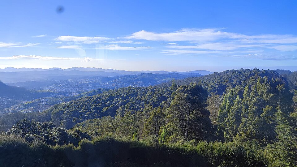
- Assuming Doddabetta is the highest peak of South India — Anamudi in Kerala, about 2,695 m, is higher and is the highest point of peninsular India
- Placing Guru Shikhar in Gujarat because Mount Abu lies close to the Gujarat border; it is in Sirohi district, Rajasthan
- Looking for Madhya Pradesh's highest point in the Vindhyas — Dhupgarh is a Satpura summit, at Pachmarhi
- Assuming the 2000 reorganisation moved Madhya Pradesh's high point — it did not. Chhattisgarh took away no summit taller than Dhupgarh, so Dhupgarh topped the undivided State as well
UPPSC almost always sets this as a state-to-peak or state-to-range match list, and has now used the very same four states twice. UPSC prefers a single pair to be validated — 'Saramati Peak : Nagaland, is the pair correctly matched?' — or asks in which state a named peak lies.
In which State is the Guru Shikhar Peak located?
- (a) Rajasthan
- (b) Gujarat
- (c) Madhya Pradesh
- (d) Maharashtra
Answer(a) Rajasthan
Exactly pair B of this match list, asked on its own. UPSC wanted the state that holds Guru Shikhar and offered Gujarat, Madhya Pradesh and Maharashtra as the traps — the same confusion UPPSC builds into option (c) here by handing Guru Shikhar to Tamil Nadu.
Consider the following pairs : 1. Dampa Tiger Reserve : Mizoram 2. Gumti Wildlife Sanctuary : Sikkim 3. Saramati Peak : Nagaland Which of the above pairs is/are correctly matched?
- (a) 1 only
- (b) 2 and 3 only
- (c) 1 and 3 only
- (d) 1, 2 and 3
Answer(c) 1 and 3 only
Contains pair C of this list verbatim — 'Saramati Peak : Nagaland' — as one of the pairs to be validated, and it is one of the correct ones. The two questions together confirm the single hardest pairing here, because Saramati is the least familiar of the four names.
'Saddle Peak', the highest peak of Andaman and Nicobar Islands, is located in
- (a) Great Nicobar
- (b) Middle Andaman
- (c) Little Andaman
- (d) North Andaman
Answer(d) North Andaman
The same question type applied to a different unit — the highest peak of an administrative region and precisely where it lies. Saddle Peak for the Andaman and Nicobar Islands is to that question what Doddabetta, Guru Shikhar, Saramati and Dhupgarh are to this one, so it drills the same 'high point of X' list.
Match List-I with List-II and select the correct answer using the codes given below the lists. List-I (State of India) A. Tamil Nadu B. Rajasthan C. Nagaland D. Madhya Pradesh List-II (Highest Peak) 1. Dhupgarh Peak 2. Saramati Peak 3. Gurushikhar Peak 4. Dodda Betta Peak
- (a) A-3 B-2 C-1 D-4
- (b) A-1 B-4 C-3 D-2
- (c) A-4 B-2 C-3 D-1
- (d) A-4 B-3 C-2 D-1
Answer(d) A-4 B-3 C-2 D-1
The same question, four years earlier and almost word for word: the identical four states in List-I and the identical four peaks in List-II, merely renumbered. UPPSC only shuffled the List-II order, so 2021's key (d) A-4 B-3 C-2 D-1 and 2025's key (d) A-2 B-3 C-4 D-1 encode exactly the same four pairings. It is the clearest possible evidence that this match list is worth memorising cold.
- practice — not a real PYQ
Anamudi, the highest peak of peninsular India, is located in which state?
- (a)Tamil Nadu
- (b)Kerala
- (c)Karnataka
- (d)Maharashtra
Answer(b) Kerala — Anamudi (about 2,695 m) stands in the Anaimalai Hills of Idukki district and is higher than Doddabetta, the highest point of Tamil Nadu.
- practice — not a real PYQ
Dhupgarh, the highest point of Madhya Pradesh, lies in which mountain range?
- (a)Vindhya Range
- (b)Satpura Range
- (c)Maikal Range
- (d)Aravalli Range
Answer(b) Satpura Range — Dhupgarh rises above Pachmarhi in the Satpuras, between the Narmada and Tapi valleys, not in the Vindhyas.