
The Asirgarh hills are situated:
- (a)In the western Satpura.
- (b)In the eastern Satpura.
- (c)In the Maikal range.
- (d)In the Baghelkhand plateau.
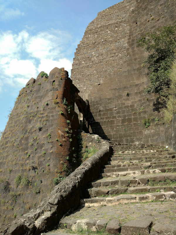
Correct — A, in the western Satpura. Asirgarh is the hill that carries Asirgarh Fort, roughly 20 km north of Burhanpur in Burhanpur district, in the far south-west of Madhya Pradesh. It stands on a spur at the western end of the Satpura system and commands the pass that links the Narmada valley on the north with the Tapti valley on the south — the historic road from northern India into the Deccan, which is why the fort was called Bab-e-Dakhan, the Gateway (or Key) to the Deccan. Its position is unambiguously western: Burhanpur sits on the Tapti in the Nimar–Khandesh gap, well west of the Mahadeo Hills of the central Satpura and far west of the Maikal range at the eastern end.
- (b)In the eastern Satpura. — The eastern arm of the Satpura system lies across Chhindwara, Seoni, Mandla and Dindori, ending in the Maikal hills. Burhanpur and Asirgarh are on the opposite, south-western edge of the state.
- (c)In the Maikal range. — The Maikal range is the easternmost limb of the Satpura, the Amarkantak country where the Narmada and the Son rise. It is a different end of the same range altogether.
- (d)In the Baghelkhand plateau. — Baghelkhand is the north-eastern plateau of Madhya Pradesh — Rewa, Satna, Sidhi, Shahdol — built of Vindhyan sandstone and lying north of the Narmada. It is a separate physiographic unit and not part of the Satpura system at all.
Madhya Pradesh divides physiographically into the Vindhyan scarplands and Malwa plateau north of the Narmada, the Narmada–Son rift valley itself, the Satpura block south of it, and the Baghelkhand and Bundelkhand plateaus in the north-east and north. The Satpura is not one ridge but a west-to-east chain: the Barwani and Rajpipla hills at the western end, the Mahadeo Hills in the centre around Pachmarhi, and the Maikal range in the east around Amarkantak. Asirgarh sits at the western end of that chain, above the gap where the Tapti valley meets the routes north — a saddle so strategically placed that whoever held the fort controlled entry to the Deccan.
Reason from the town, not the hill: Asirgarh means Burhanpur, Burhanpur means the Tapti valley, and the Tapti valley is south-western Madhya Pradesh — therefore western Satpura. Students who know Asirgarh only from history — Akbar's siege, the Mughal march into the Deccan — often place it vaguely 'somewhere in central India' and get pulled towards the Maikal or Baghelkhand options. The reliable anchor is the MPPSC's own west-to-east ordering of the Satpura: Barwani hills, then the Mahadeo range, then the Maikal range.
- Asirgarh Fort stands on a Satpura spur about 20 km north of Burhanpur, in Burhanpur district, Madhya Pradesh
- It commands the pass between the Narmada and Tapti valleys — the main route from north India to the Deccan — hence 'Bab-e-Dakhan', the Gateway or Key to the Deccan
- Akbar besieged and captured Asirgarh in 1601, the last conquest of his reign
- Satpura sub-ranges from west to east: Barwani / Rajpipla hills → Mahadeo Hills → Maikal range
- Dhupgarh, in the Mahadeo Hills near Pachmarhi, is the highest point of Madhya Pradesh at about 1,350 m
- Mixing the Maikal range (eastern end, Amarkantak) with the Mahadeo Hills (central, Pachmarhi)
- Placing Asirgarh in the Vindhyas simply because it is a hill fort — the Vindhyas lie north of the Narmada, Asirgarh south of it
- Treating the Baghelkhand plateau as part of the Satpura system; it is a separate north-eastern unit
MPPSC asks where a named hill, fort or peak of the state sits, and the west-to-east or north-to-south ordering of the Satpura sub-ranges. UPSC prefers the relational form — the Satpura's position relative to the Narmada rift, which hills belong to which range, whether a named hill really is the range's easternmost point.
Consider the following statements: 1. Mahadeo Hills 2. Sahyadri Parvat 3. Satpura Range What is the correct sequence of the above from the north to the south?
- (a) 1, 2, 3
- (b) 2, 1, 3
- (c) 1, 3, 2
- (d) 2, 3, 1
Answer(c) 1, 3, 2 — Mahadeo Hills, then the Satpura Range, then the Sahyadri.
The same skill — placing the Satpura and its sub-ranges in space relative to one another, which is all the Asirgarh question is asking.
Consider the following statements: 1. Amarkantak Hills are at the confluence of Vindhya and Sahyadri Ranges. 2. Biligirirangan Hills constitute the easternmost part of Satpura Range. 3. Seshachalam Hills constitute the southernmost part of Western Ghats. How many of the statements given above are correct?
- (a) Only one
- (b) Only two
- (c) All three
- (d) None
Answer(d) None — all three statements are incorrect.
UPSC testing the limits of the Satpura range — which hills lie at its eastern end and which do not — the mirror image of asking where its western end is.
- practice — not a real PYQ
Asirgarh Fort, historically called the 'Gateway to the Deccan', is located in which district of Madhya Pradesh?
- (a)Khargone
- (b)Burhanpur
- (c)Khandwa
- (d)Betul
Answer(b) Burhanpur — the fort stands on a Satpura spur about 20 km north of Burhanpur town. - practice — not a real PYQ
Dhupgarh, the highest point of Madhya Pradesh, lies in which range?
- (a)Maikal range
- (b)Mahadeo Hills of the Satpura
- (c)Vindhyan range
- (d)Kaimur range
Answer(b) The Mahadeo Hills of the Satpura, near Pachmarhi — at about 1,350 m it is the state's highest point.