
Which is the highest peak in the Kumaon Himalaya?
- (a)Kamet
- (b)Nanda Devi
- (c)Trishul
- (d)Badrinath
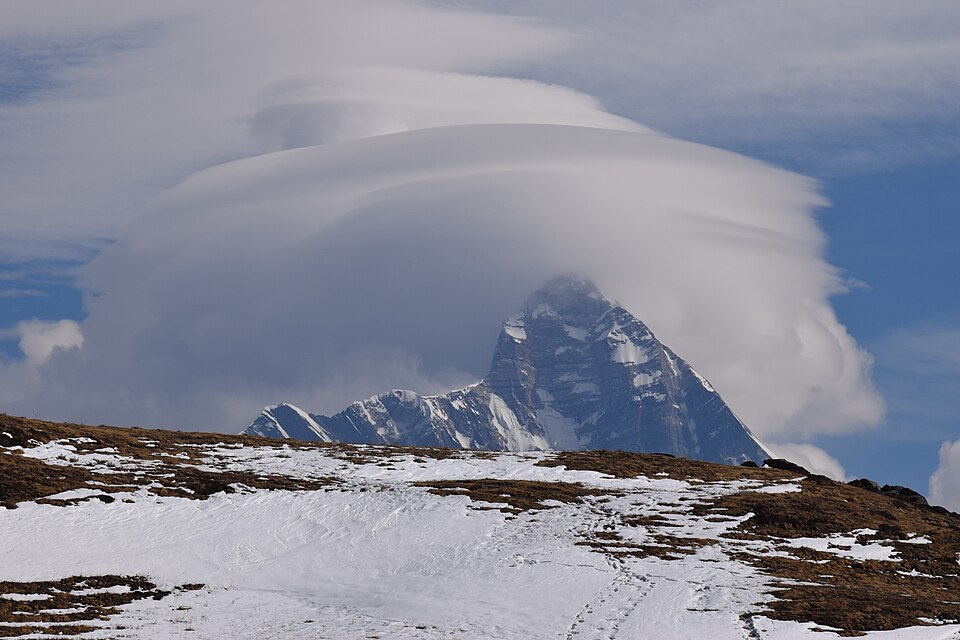
Correct — B, Nanda Devi. At 7,816 m it is the highest summit of the Kumaon Himalaya, the longitudinal division of the Himalaya that runs from the Satluj river in the west to the Kali river in the east. It is also the highest mountain lying entirely within India — Kangchenjunga (8,586 m) is higher but sits on the India–Nepal border. Nanda Devi rises inside the Nanda Devi Sanctuary in Chamoli district, Uttarakhand, ringed by a near-continuous wall of high peaks that kept it unclimbed until 1936.
- (a)Kamet — Kamet (7,756 m), near the Tibet border in the Zaskar range, is Uttarakhand's second-highest peak — genuinely high, but about 60 m short of Nanda Devi.
- (c)Trishul — Trishul is a group of three peaks on the rim of the Nanda Devi Sanctuary; its highest summit, Trishul I (7,120 m), is far below Nanda Devi. Its fame is historical — in 1907 it became the first 7,000 m peak ever climbed.
- (d)Badrinath — Badrinath is best known as the Char Dham shrine on the Alaknanda. The peak of that name belongs to the Chaukhamba massif (about 7,138 m) and is lower than both Nanda Devi and Kamet.
The Himalaya is divided longitudinally by the rivers that cut across it: Kashmir/Punjab Himalaya (Indus to Satluj), Kumaon Himalaya (Satluj to Kali), Nepal Himalaya (Kali to Teesta) and Assam Himalaya (Teesta to Dihang). Each division has a marker peak, and Nanda Devi is the marker for Kumaon. Note that this physiographic 'Kumaon Himalaya' is wider than the Kumaon administrative division of Uttarakhand — it covers Garhwal as well, which is why Kamet, Trishul and the Chaukhamba/Badrinath peaks all fall inside it.
Every option here is a real Uttarakhand peak inside the same division, so you cannot answer by elimination on geography — you need the heights. Anchor one number (Nanda Devi 7,816 m) and rank the rest against it. The second half of this fact, tested just as often, is that Nanda Devi is India's highest peak lying wholly inside the country.
- Kumaon Himalaya = the Himalayan stretch between the Satluj and the Kali rivers
- Nanda Devi, 7,816 m — highest peak of the Kumaon Himalaya and the highest lying entirely within India
- Kangchenjunga (8,586 m) is India's highest peak but straddles the India–Nepal border
- Kamet 7,756 m and Trishul I 7,120 m lie in the same division and are lower
- Nanda Devi National Park with the Valley of Flowers is a UNESCO World Heritage Site and the core of the Nanda Devi Biosphere Reserve
- Calling Kangchenjunga the highest peak 'entirely in India' — it lies on the Nepal border
- Reading 'Kumaon Himalaya' as only the Kumaon division of Uttarakhand; the physiographic division also takes in Garhwal (Satluj to Kali)
- Mixing up Badrinath the pilgrimage town with the Badrinath (Chaukhamba) peak
Asked either as a straight 'highest peak of X' one-liner or as a peak–range matching set. UPSC 2022 tested exactly the pair 'Nanda Devi — Kumaon Himalaya'. Lock the heights of India's top peaks and the four Himalayan divisions together.
Nanda Devi peak forms a part of
- (a) Assam Himalayas
- (b) Kumaon Himalayas
- (c) Nepal Himalayas
- (d) Punjab Himalayas
Answer(b) Kumaon Himalayas
The same fact from the other side — UPSC asked which division Nanda Devi belongs to; MPPSC 2026 asks which peak tops that division.
Consider the following pairs: Peak — Mountains 1. Namcha Barwa — Garhwal Himalaya 2. Nanda Devi — Kumaon Himalaya 3. Nokrek — Sikkim Himalaya Which of the pairs given above is/are correctly matched?
- (a) 1 and 2
- (b) 2 only
- (c) 1 and 3
- (d) 3 only
Answer(b) 2 only — only 'Nanda Devi — Kumaon Himalaya' is correct; Namcha Barwa is in the eastern (Assam) Himalaya and Nokrek is in the Garo Hills of Meghalaya.
Tests the identical peak–division linkage, with 'Nanda Devi — Kumaon Himalaya' as the one correct pair.
- practice — not a real PYQ
Which one of the following is the highest mountain peak lying entirely within India?
- (a)Kangchenjunga
- (b)Nanda Devi
- (c)Kamet
- (d)Trishul
Answer(b) Nanda Devi (7,816 m) — Kangchenjunga is higher but lies on the India–Nepal border. - practice — not a real PYQ
The Himalayan division lying between the Satluj and the Kali rivers is known as the:
- (a)Punjab (Kashmir) Himalaya
- (b)Kumaon Himalaya
- (c)Nepal Himalaya
- (d)Assam Himalaya
Answer(b) Kumaon Himalaya — Satluj in the west to Kali in the east.