
The Nilgiri Hills are located between which of these two ranges ?
- (a)Himalayan and Aravalli
- (b)Vindhyachal and Satpura
- (c)Sahyadris (Western Ghats) and Eastern Ghats
- (d)Satpura and Aravalli
Correct — C, the Sahyadris (Western Ghats) and the Eastern Ghats. The Nilgiris are the knot where the two Ghat systems converge, at the meeting point of Tamil Nadu, Kerala and Karnataka. The Western Ghats run down the west coast and the Eastern Ghats run in broken hill blocks down the east; the Nilgiri massif is the high junction where the two lines come together, which is why the range rises so much higher than either arm nearby — Doddabetta, its highest point, reaches about 2,637 m.
- (a)Himalayan and Aravalli — Both lie in northern/north-western India — the Himalaya along the northern frontier and the Aravalli through Rajasthan. The Nilgiris are in the far south of the peninsula, more than a thousand kilometres away.
- (b)Vindhyachal and Satpura — The Vindhya and Satpura ranges flank the Narmada valley in central India (largely Madhya Pradesh). That is the central highland belt, not the southern Ghat junction.
- (d)Satpura and Aravalli — A central-India range paired with a north-western one. Neither touches the Nilgiris, which sit at the southern end of the peninsular plateau.
Peninsular India is bounded by two hill systems: the Western Ghats (Sahyadri), a continuous, steep fault scarp along the west coast, and the Eastern Ghats, a discontinuous, more eroded chain along the east that is repeatedly cut by rivers like the Godavari and Krishna. The two converge in the south at the Nilgiri Hills — the 'blue mountains' — which form a high plateau block above 2,000 m. South of the Nilgiris the chain is interrupted by the Palghat (Palakkad) Gap, roughly 30 km wide, beyond which it continues as the Anaimalai and Cardamom Hills.
Every framing of this question hangs on one word — junction. UPSC asked it in 2008 as 'which hills are found where the Eastern Ghats and Western Ghats meet', and MPPSC has now asked the mirror image, 'the Nilgiris lie between which two ranges'. Note the trap built into the options: three of them are drawn from central and northern India, so a candidate who only half-remembers 'Nilgiri' as a hill name can be pulled towards the Vindhya-Satpura pair that dominates the MP syllabus.
- The Nilgiris form the junction of the Western Ghats (Sahyadri) and the Eastern Ghats, near the Tamil Nadu–Kerala–Karnataka tri-junction
- Doddabetta (about 2,637 m) is the highest peak of the Nilgiris and of Tamil Nadu
- The Palghat (Palakkad) Gap, about 30 km wide, separates the Nilgiris from the Anaimalai Hills to the south
- The Nilgiri Biosphere Reserve, notified in 1986, was the first biosphere reserve declared in India
- Udhagamandalam (Ooty) is the main hill station; the Toda are the best-known indigenous community of these hills
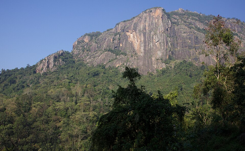
- Calling Doddabetta the highest peak of peninsular India — that is Anamudi (about 2,695 m) in the Anaimalai Hills
- Placing the Nilgiris in central India because three options in the paper come from there
- Assuming the Ghats are continuous — the Eastern Ghats are broken hill blocks, not a single range
Both commissions ask the junction fact directly — 'where do the two Ghats meet' or 'the Nilgiris lie between…' — and then extend it to Doddabetta, Anamudi and the Palghat Gap.
Which of the following hills are found where the Eastern Ghats and the Western Ghats meet?
- (a) Anaimalai Hills
- (b) Cardamom Hills
- (c) Nilgiri Hills
- (d) Shevaroy Hills
Answer(c) Nilgiri Hills
The identical fact asked in reverse — UPSC gives the junction and asks for the hills; MPPSC gives the hills and asks for the two ranges.
Which one of the following is the correct sequence of the given hills starting from the north and going towards the south?
- (a) Nallamalai Hills – Nilgiri Hills – Javadi Hills – Anaimalai Hills
- (b) Anaimalai Hills – Javadi Hills – Nilgiri Hills – Nallamalai Hills
- (c) Nallamalai Hills – Javadi Hills – Nilgiri Hills – Anaimalai Hills
- (d) Anaimalai Hills – Nallamalai Hills – Javadi Hills – Nilgiri Hills
Answer(c) Nallamalai Hills – Javadi Hills – Nilgiri Hills – Anaimalai Hills
Same underlying map skill — knowing where the Nilgiris sit relative to the other peninsular hill blocks, north of the Anaimalais and south of the Eastern Ghats spurs.
- practice — not a real PYQ
The highest peak of the Nilgiri Hills is:
- (a)Anamudi
- (b)Doddabetta
- (c)Mahendragiri
- (d)Kalsubai
Answer(b) Doddabetta, about 2,637 m — Anamudi, in the Anaimalai Hills, is the highest peak of peninsular India. - practice — not a real PYQ
The Palghat Gap separates the Nilgiri Hills from which of the following?
- (a)Cardamom Hills
- (b)Anaimalai Hills
- (c)Shevaroy Hills
- (d)Javadi Hills
Answer(b) Anaimalai Hills — the gap is the major break in the Western Ghats between the Nilgiris and the Anaimalais.