
'Imphal Basin' surrounded by Manipur hills is a fine example of
- (a)Lacustrine plain
- (b)Loess plain
- (c)Glacial plain
- (d)Alluvial plain
Correct — A, lacustrine plain. A lacustrine plain is the flat floor left behind when a lake is filled in with sediment or drained away, and the Imphal basin is the standard Indian textbook example. It is an oval, remarkably level intermontane valley in central Manipur, lying at roughly 790 m above sea level and ringed on every side by the north-south Manipur hill ranges. Enclosed basins of this kind trap the drainage of the surrounding slopes, and this one held a large lake through much of the recent geological past. Silt washed in from the encircling hills gradually filled it, leaving the smooth, waterlogged floor that carries almost all of Manipur's settlement and wet-rice cultivation on about a tenth of the state's area. Loktak Lake, in the south of the basin, is the shrunken survivor of that former water body — the largest freshwater lake in North-East India, a Ramsar site since 1990, celebrated for its phumdis, the floating mats of vegetation, soil and decaying organic matter on which fishermen build huts. The presence of a residual lake inside a flat, hill-girt basin is precisely the signature of a lacustrine plain.
- (b)Loess plain — Loess is fine, wind-blown silt, typically swept off glacial outwash or desert margins and dumped in thick unstratified blankets — the Loess Plateau of northern China along the Huang He is the classic case. It requires a dry, wind-dominated regime with a large dust source. Manipur is a wet, densely forested, monsoonal hill country with no such source, and no significant loess deposits exist there.
- (c)Glacial plain — Glacial plains are till or outwash surfaces left by ice sheets or valley glaciers, as in the North European Plain. The Imphal basin sits at only about 790 m in the sub-tropical North-East, far below any Pleistocene snowline in this latitude, and shows none of the moraines, erratics or outwash fans that a glacial origin would leave.
- (d)Alluvial plain — The intended trap, and the one that is partly true. The floor of the basin does carry alluvium brought down by the Imphal, Iril, Thoubal and Nambul rivers, so a candidate who sees flat, fertile, river-watered land reaches for 'alluvial'. But an alluvial plain is built by rivers depositing across an open plain, while this is a closed intermontane depression whose flatness comes from the infilling of a standing lake — with Loktak still there as the remnant. Indian physiography texts therefore classify it as lacustrine, and the question's phrase 'surrounded by Manipur hills' is the deliberate clue that the basin is enclosed.
Plains are classified by the agent that made them: rivers give alluvial plains, wind gives loess plains, ice gives glacial (till and outwash) plains, the sea gives coastal or marine plains, and standing water gives lacustrine plains. A lacustrine plain forms where a basin holds a lake long enough for inflowing streams to lay down horizontal beds of silt and clay across its floor; when the lake finally silts up, is drained by headward erosion, or shrinks with a change in climate, that floor is exposed as an unusually flat, fine-grained, often poorly drained plain. Enclosed intermontane basins in tectonically active hill country are ideal settings, which is why the Imphal valley of Manipur and the Vale of Kashmir are India's two textbook lacustrine plains.
The question is decided by the two words 'basin' and 'surrounded'. An enclosed depression ringed by hills cannot be the work of an open river system, of ice at that latitude and altitude, or of desert wind — but it is exactly where a lake would sit. The confirming detail is Loktak, still occupying the low southern corner of the valley: a lake left in a flat basin is the visible tail end of the lacustrine process. Candidates go wrong by reasoning from fertility and flatness alone, which point to alluvium; the safer habit is to reason from the landform's confinement. The parallel case worth memorising is the Kashmir valley, whose Karewa beds — the terraces on which saffron is grown — are the deposits of a large Pleistocene lake, with Wular Lake as the surviving remnant.
- The Imphal valley is a flat, oval intermontane basin at about 790 m in central Manipur, occupying roughly a tenth of the state's area but holding the bulk of its population and its wet-rice farming.
- Loktak Lake, the largest freshwater lake in North-East India, is the surviving remnant of the lake that once filled the basin; it was designated a Ramsar site in 1990 and placed on the Montreux Record in 1993.
- Phumdis are Loktak's floating mats of vegetation, soil and organic matter; the largest of them carries Keibul Lamjao National Park, the world's only floating national park and the last natural home of the sangai, Manipur's state animal.
- The basin is drained southward by the Imphal or Manipur river, which leaves India and joins the Chindwin, a tributary of the Irrawaddy, in Myanmar.
- India's other classic lacustrine plain is the Vale of Kashmir, where the Karewa deposits are the beds of a former Pleistocene lake and Wular Lake is the remnant.
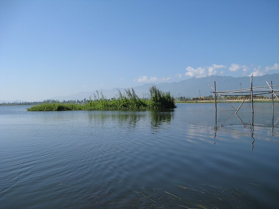
- Answering 'alluvial' from flatness and fertility alone; the enclosing hills and the surviving lake are what identify the basin as lacustrine.
- Confusing Loktak with the largest freshwater lake in India — Wular in Jammu and Kashmir usually takes that title, while Loktak is the largest in the North-East.
- Placing Loktak in the Barail range or in Assam; it lies in Manipur, an error UPSC itself planted as a distractor in 2013.
UPSC has repeatedly approached this basin through its lake — asking what phumdis are and testing whether candidates can place Loktak in the right state — while UPPSC asks the landform classification directly, so learn the Imphal basin and Loktak as one package: the plain, the remnant lake, the floating mats and the national park.
Some people in Manipur live in houses built on floating islands of weeds and decaying vegetation held together by suspended silt. These islands are called
- (a) Tipis
- (b) Barkhans
- (c) Phumdis
- (d) Izba
Answer(c) Phumdis
The same feature approached from the water rather than the land — the phumdis float on Loktak, the residual lake of the Imphal basin, which is the very evidence that makes the basin a lacustrine plain.
Consider the following pairs: 1. Nokrek Biosphere Reserve : Garo Hills 2. Loktak Lake : Barail Range 3. Namdapha National Park : Dafla Hills Which of the above pairs is/are correctly matched?
- (a) 1 only
- (b) 2 and 3 only
- (c) 1, 2 and 3
- (d) None
Answer(a) 1 only
Tests the location of the same lake — the pair is wrong precisely because Loktak lies in the Imphal basin of Manipur, not in the Barail range, so both questions turn on placing this basin correctly on the North-East map.
Match List – I with List – II and select the correct answer using the codes given below the lists : List – I (Lake) A. Sala Lake B. Badkhal Lake C. Loktak Lake D. Kaliveli Lake List – II (Location) 1. Arunachal Pradesh 2. Haryana 3. Manipur 4. Tamil Nadu Codes :
- (a) A-1, B-2, C-3, D-4
- (b) A-2, B-1, C-3, D-4
- (c) A-1, B-3, C-2, D-4
- (d) A-1, B-4, C-2, D-3
Answer(a) A-1, B-2, C-3, D-4
UPPSC came back to Loktak the very next year in a lake-to-state matching set, confirming that the commission treats the Imphal basin and its remnant lake as a recurring anchor for North-East physiography.
- practice — not a real PYQ
Keibul Lamjao National Park, the only floating national park in the world, is the last natural habitat of which one of the following animals?
- (a)Hangul
- (b)Sangai
- (c)Hoolock gibbon
- (d)Pygmy hog
Answer(b) Sangai — the brow-antlered deer of Manipur, which lives on the phumdis of Keibul Lamjao in Loktak Lake and is the state animal; the hangul belongs to Kashmir's Dachigam, the hoolock gibbon to the North-Eastern forests generally, and the pygmy hog to the grasslands of Assam.
- practice — not a real PYQ
The Karewa deposits of the Kashmir valley, on which saffron is famously grown, are best described as
- (a)wind-blown loess deposits
- (b)glacial moraine ridges
- (c)lacustrine deposits of a former lake
- (d)weathered basaltic lava flows
Answer(c) lacustrine deposits of a former lake — the Karewas are the silt and clay beds laid down in a large Pleistocene lake that once filled the Vale of Kashmir, later uplifted and dissected into terraces, with Wular Lake surviving as its remnant.