
According to India State of Forest Report (ISFR) 2021, which of these districts of Madhya Pradesh has forest cover less than 10 percent (% of the geographical area of the district) ?
- (a)Ashoknagar
- (b)Morena
- (c)Bhind
- (d)Guna
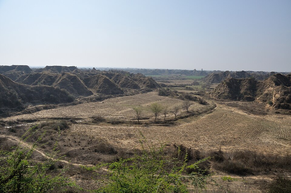
Correct — C, Bhind. Bhind lies in the Chambal ravine (beehad) belt of northern Madhya Pradesh: a landscape of gullied badlands and intensively cropped alluvium, where the tree-bearing land is mostly scrub rather than forest. In the Forest Survey of India's district table for the previous cycle (ISFR 2019) Bhind carried just 106.75 sq km of forest cover in a geographical area of 4,459 sq km — 2.39% — against 412.91 sq km of scrub, one of the largest scrub figures in the State. ISFR 2021 likewise keeps Bhind below the 10% line, while the other three districts sit comfortably above it.
- (a)Ashoknagar — Well above 10%. FSI's district table for the preceding cycle put Ashoknagar at 689.04 sq km of forest cover in 4,674 sq km — about 14.7% of its geographical area.
- (b)Morena — The tempting trap: Morena shares the same Chambal ravine country as Bhind, so it feels equally barren. But its forest cover was 740.17 sq km in 4,989 sq km — roughly 14.8% on FSI's district table (ISFR 2019 cycle) — comfortably over the 10% mark.
- (d)Guna — The most wooded of the four: about 1,329.74 (ISFR 2019 district table) sq km of forest cover in a geographical area of 6,390 sq km, near 21% — nowhere close to under 10%.
FSI counts as 'forest cover' every patch of land of one hectare or more with a tree canopy density of 10% or more — whatever its ownership or legal status. That is a satellite-measured physical fact, and it is different from 'recorded forest area', the legally notified forest of the State (about 94,689 sq km in Madhya Pradesh). ISFR reports forest cover State-wise and district-wise, both in absolute sq km and as a percentage of geographical area, and the two rankings do not match: a district can be large and still thinly wooded.
Madhya Pradesh's forest is not spread evenly. The southern and eastern hill districts (Balaghat, Sheopur in the north-west, Umaria, Mandla, Dindori) run above 40% of their area, while the Malwa plateau farm belt and the Chambal plains — Ujjain, Shajapur, Ratlam, Bhind, Rajgarh — sit in low single digits. If you know that Bhind and Morena are the ravine districts you are halfway there; the finishing move is remembering that Morena still clears 10% on FSI's own table, and Bhind does not.
- FSI definition: forest cover = land ≥ 1 hectare with tree canopy density ≥ 10%, irrespective of ownership or legal status (different from recorded forest area).
- ISFR 2021: Madhya Pradesh has the largest forest cover of any State — about 77,493 sq km, roughly 25% of its geographical area.
- Bhind (geographical area 4,459 sq km) sits in the Chambal ravine belt; FSI's district table records only about 2-3% of it under forest cover — among the lowest in the State.
- MP's least-forested districts are the Malwa/Chambal plains — Ujjain, Shajapur, Ratlam, Bhind, Rajgarh (all under 3% of geographical area on the ISFR 2019 district table); the most-forested are Balaghat, Sheopur, Umaria and Mandla (above 40%).
- Treating 'forest cover' and 'recorded forest area' as the same number
- Assuming a district famous for ravines and a river sanctuary (Morena) must be the least forested
- Quoting ISFR 2019 or ISFR 2023 figures for a question that names ISFR 2021 — the district numbers move between cycles
MPPSC asks district-level superlatives from the latest ISFR (which district has the most/least forest cover as a % of area); UPSC stays at State level — ranking States by percentage of forest cover, or testing the FSI definitions themselves.
Consider the following States: 1. Chhattisgarh 2. Madhya Pradesh 3. Maharashtra 4. Odisha With reference to the States mentioned above, in terms of percentage of forest cover to the total area of State, which one of the following is the correct ascending order?
- (a) 2-3-1-4
- (b) 2-3-4-1
- (c) 3-2-4-1
- (d) 3-2-1-4
Answer(c) 3-2-4-1
Same ISFR metric — forest cover as a percentage of geographical area — applied to States; MPPSC applies it one level down, to districts.
Which of the following districts has maximum forest area as a percentage of the geographical area?
- (a) Ratlam
- (b) Sheopur
- (c) Ujjain
- (d) Indore
Answer(b) Sheopur
The mirror image of this question — MPPSC 2022 asked for the MP district with the highest forest cover as a share of geographical area, off the same FSI district table.
- practice — not a real PYQ
The Forest Survey of India counts a patch of land as 'forest cover' if it is at least one hectare in extent and has a tree canopy density of at least:
- (a)5 per cent
- (b)10 per cent
- (c)25 per cent
- (d)40 per cent
Answer(b) 10 per cent — canopy density of 10% or more over an area of one hectare or more, irrespective of ownership or legal status. - practice — not a real PYQ
In terms of forest cover as a percentage of its geographical area, which one of the following States ranks the highest?
- (a)Madhya Pradesh
- (b)Mizoram
- (c)Maharashtra
- (d)Odisha
Answer(b) Mizoram — over 80% of its geographical area is under forest cover; Madhya Pradesh leads on absolute forest area, not on percentage.