 View answer copy →
Anudeep DurishettyAIR 1CSE 2017
Answered a very similar question
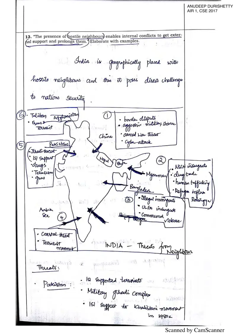
Their question: “Hostile neighbours enabling and prolonging internal conflicts (with examples)”
Anudeep's Q13 maps neighbour-wise threats and how hostile neighbours prolong internal conflicts, the external-state/non-state-actor demand of 2021 Q17.
Key learnings from their answer
- ›He draws clean labelled India maps to localise the issue, the Maoist 'Red Corridor' marking Bastar, Gadchiroli and Nallamala hills (Q14), solar-irradiance zones with a very-high/high/moderate/low legend (Q6), neighbour-wise security threats (Q13), and dedicated freight corridors WDFC/EDFC (Q15). -> For any spatially-rooted GS3 topic (internal security, energy, infrastructure, environment), a small labelled map with named locations adds value-content a paragraph can't, and shows real subject knowledge.
- ›He opens nearly every answer with a one-line textbook definition before any analysis, e.g. 'Food security exists if all people at all times have physical, economic access to safe and nutritious food' (Q1), establishing the concept in the very first line. -> In a 200-word answer, spend your first sentence pinning down the key term precisely; it signals conceptual clarity and earns the easy 'context' marks before you start arguing.