
NISAR satellite is manufactured jointly by Indian Space Research Organisation and:
- (a)Japan Aerospace Exploration Agency
- (b)National Aeronautics and Space Administration
- (c)Russian Federal Space Agency
- (d)European Space Agency
Correct — B, National Aeronautics and Space Administration. NISAR stands for NASA-ISRO Synthetic Aperture Radar, and the name is a description of the division of labour. NASA supplied the L-band radar together with the high-rate telecommunication subsystem, the GPS receivers, the solid-state recorder and the payload data subsystem. ISRO supplied the satellite bus, the S-band radar, the launch vehicle and the launch services. Carrying two radars of different wavelengths on one spacecraft is what makes the mission unusual: the longer L-band waves reach through vegetation to the ground and the ice below, while S-band picks up finer surface detail, and radar of either kind images through cloud and darkness when an optical camera cannot. The satellite flies in a dawn-to-dusk Sun-synchronous orbit at about 747 kilometres and revisits the same ground every twelve days, which is what allows it to measure how much land, ice or infrastructure has moved between passes.
- (a)Japan Aerospace Exploration Agency — India does work with JAXA, but on the Moon rather than on Earth observation — the joint lunar polar exploration mission is the standing example. No Indo-Japanese radar imaging satellite of this kind exists.
- (c)Russian Federal Space Agency — The Russian connection in Indian spaceflight is older and lies elsewhere. Aryabhata was launched by the Soviet Union in 1975, Rakesh Sharma flew aboard Soyuz T-11 in 1984, and Russian cryogenic technology shaped the early GSLV programme.
- (d)European Space Agency — ESA's usual role with Indian missions is ground-station and tracking support rather than joint manufacture of a payload. ESA is a partner on the James Webb Space Telescope, which is where candidates most often meet it, and that is a different mission entirely.
A synthetic aperture radar builds a sharp image from a small antenna by using the motion of the spacecraft itself: successive echoes gathered along the orbit are combined as though they had come from one very long antenna. Because it supplies its own illumination, it works at night; because its wavelength is far longer than that of light, it sees through cloud and haze. Repeat-pass interferometry then compares two images of the same place taken at different times and detects ground movement down to the centimetre — the technique used to watch faults, subsiding land, glaciers and dams.
At the time of this examination in 2023 NISAR was still being built, and the question was testing a name in the news rather than a flown mission. That has since changed: NISAR lifted off on 30 July 2025 aboard a GSLV from the Satish Dhawan Space Centre at Sriharikota. The cost split is worth carrying as a sense of scale — ISRO's share is about 788 crore rupees against NASA's roughly 1.1 billion dollars — and so is the mission's purpose, which is the measurement of change: ecosystem disturbance, ice-sheet retreat, and the ground deformation that accompanies earthquakes, volcanoes and landslides. For an aspirant to a force with disaster-response duties, that last list is the part of the mission that matters most.
- NISAR is the first satellite to carry two synthetic aperture radars of different frequencies, L-band and S-band, on one platform.
- NASA provided the L-band radar and the data handling and telecommunication systems; ISRO provided the bus, the S-band radar and the launch.
- It flies in a Sun-synchronous dawn-to-dusk orbit at about 747 kilometres, inclined at 98.5 degrees, with a twelve-day repeat cycle.
- Radar imaging works through cloud and at night, which matters for a country whose disasters cluster in the monsoon.
- The launch took place on 30 July 2025 from Sriharikota, two years after this paper was set.
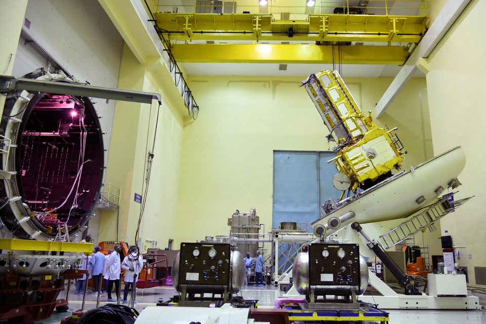
- Guessing the partner from the acronym alone; NISAR spells out the answer only if you know what the first two letters stand for.
- Assuming any joint space mission with India must involve Russia because of the older Soviet-era links.
- Treating radar imaging as a kind of photography — the two behave very differently in cloud and at night.
Asked as a straight current-affairs identification, where the mission is named and the candidate has to supply the partner agency.
The satellites of which one of the following countries have helped in the preparation of a detailed and complete map of Antarctica?
- (a) Canada
- (b) France
- (c) Russia
- (d) USA
Answer(a) Canada
The same technology, an earlier generation. The first complete radar mosaic of Antarctica came from Canada's RADARSAT-1, flown as a joint mapping campaign with NASA, and it shows why radar is the instrument of choice for ice: it works through cloud and through the polar night.
Consider the following statements about James Webb Space Telescope (JWST): 1. It is the largest observatory ever launched into space. 2. It has been developed by NASA in partnership with the European Space Agency and the Canadian Space Agency. Which of the statements given above is/are correct?
- (a) 1 only
- (b) 2 only
- (c) Both 1 and 2
- (d) Neither 1 nor 2
Answer(c) Both 1 and 2
The same style of question about a different flagship. Large space missions are almost always shared between agencies, and knowing who brought what to each is a recurring demand across all these papers.
- practice — not a real PYQ
The two radar frequencies carried by the NISAR satellite are
- (a)L-band and S-band
- (b)C-band and X-band
- (c)K-band and Ku-band
- (d)P-band and C-band
Answer(a) L-band and S-band — NASA supplied the L-band instrument and ISRO the S-band, making it the first dual-frequency radar imaging satellite of its kind.
- practice — not a real PYQ
A synthetic aperture radar satellite is especially useful in the Indian monsoon season because it
- (a)needs no electrical power
- (b)can image the surface through cloud cover and at night
- (c)produces colour photographs
- (d)flies in a geostationary orbit
Answer(b) can image the surface through cloud cover and at night — radar supplies its own illumination and its long wavelengths pass through cloud, which optical sensors cannot do.