
Which one among the following statements about 'Drumlin' is correct ?
- (a)It is a streamlined hill moulded in glacial drift on the till plains.
- (b)It is a city located in central Europe.
- (c)It is a river.
- (d)It is a narrow road in Tibet.
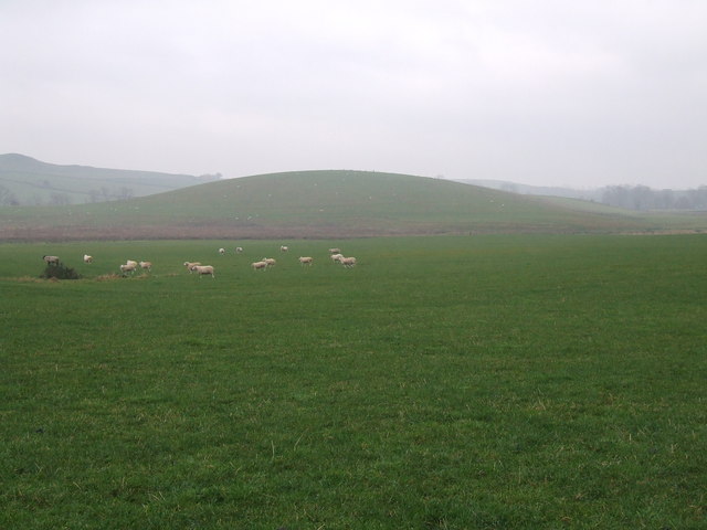
Correct — A, it is a streamlined hill moulded in glacial drift on the till plains. A drumlin is a low oval hill built of glacial till — the unsorted mixture of clay, sand, gravel and boulders that an ice sheet carries and dumps — laid down beneath moving ice and then shaped by the ice riding over it. NCERT describes them as smooth oval-shaped ridge-like features composed mainly of glacial till with some masses of gravel and sand, up to about a kilometre long and thirty metres high, with their long axes lying parallel to the direction of ice movement. The end that faced the oncoming ice, called the stoss end, is blunter and steeper because moving ice pushed against it, while the other end tapers away into a tail. That asymmetry makes a drumlin a direction indicator: a drumlin field records which way the ice was flowing. Because they occur in swarms of scores or hundreds of near-identical mounds, the resulting country is known as basket-of-eggs topography.
- (b)It is a city located in central Europe. — No such city exists. The word is a landform term of Irish origin, from a word meaning a little ridge, and the classic drumlin fields are in Ireland, Scotland and around the North American Great Lakes — glaciated country rather than central Europe.
- (c)It is a river. — Close to the opposite of what a drumlin does to drainage. A drumlin swarm is a field of obstacles that blocks and deranges surface flow, which is why drumlin country is characteristically dotted with small lakes and boggy hollows between the mounds.
- (d)It is a narrow road in Tibet. — Filler with nothing behind it. Glacial landforms certainly occur in Tibet and across the Himalaya, but drumlin is the name of a depositional landform, not of a route.
Glaciers build as well as cut, and their depositional landforms are grouped by what the material is and how it was laid down. Till is unsorted debris dropped directly by ice; moraines are ridges of it, named lateral, medial, terminal or ground according to position; outwash plains are the sorted sand and gravel spread by meltwater beyond the ice front; eskers are long winding ridges of stratified sand and gravel deposited by streams flowing in tunnels within or beneath the ice. A drumlin belongs to the till family, moulded under the ice rather than dumped at its edge.
Two neighbouring landforms are worth holding beside a drumlin, because examiners use both as distractors. An esker also runs roughly along the direction of ice flow, but it is a narrow sinuous ridge of sorted meltwater gravel rather than a broad mound of unsorted till. A roche moutonnee is made of bedrock rather than debris, and its asymmetry runs the other way — smoothed and gently sloping on the side that faced the ice, steep and craggy on the far side where blocks were plucked away. Get the asymmetries the right way round and the two can never be confused: a drumlin is blunt where it met the ice, a roche moutonnee is smooth there.
- A drumlin is an oval hill of glacial till formed under a moving ice sheet, typically up to about 1 km long and 30 m high.
- Its long axis lies parallel to the direction of ice movement, and the blunt steep stoss end faced the oncoming ice.
- Drumlins occur in swarms, producing the landscape called basket-of-eggs topography.
- Till is unsorted glacial debris; eskers, by contrast, are built of sorted sand and gravel laid down by meltwater streams under the ice.
- A roche moutonnee is a bedrock form whose gentle side faces up-ice, the reverse of a drumlin's asymmetry.
- Confusing a drumlin with an esker; one is unsorted till moulded under ice, the other is sorted gravel laid by a meltwater stream.
- Getting the stoss and lee ends the wrong way round, and so reading the ice direction backwards.
- Treating drumlins as isolated hills when their defining habit is to occur in swarms.
Asked as a term-identification item, with one real definition and three options that are not landform definitions at all — a format that rewards simply knowing the vocabulary.
Basket-of-eggs topography is related to
- (a) Drumlins.
- (b) Eskers.
- (c) Cirques.
- (d) Moraines.
Answer(a) Drumlins.
The same landform reached through the landscape it builds. Because drumlins occur in swarms of near-identical oval mounds, a field of them looks like eggs laid in a basket, and that image is the phrase examiners most often use to test the term.
Fine-grained bed of an ephemeral lake in a desert is also known as
- (a) Playa
- (b) Oasis
- (c) Drumlin
- (d) Natural levee
Answer(a) Playa
A companion item that uses this term as a wrong option, which is how the confusion usually arises. A playa is a desert depositional feature and a drumlin a glacial one, so the two belong to entirely different agents of deposition.
- practice — not a real PYQ
The long axis of a drumlin lies
- (a)at right angles to the direction of ice movement
- (b)parallel to the direction of ice movement
- (c)always north to south
- (d)parallel to the nearest river
Answer(b) parallel to the direction of ice movement — which is what allows a drumlin field to be used as a record of the way the ice was flowing.
- practice — not a real PYQ
Which one of the following glacial landforms is built of sorted sand and gravel laid down by meltwater rather than of unsorted till?
- (a)Drumlin
- (b)Ground moraine
- (c)Esker
- (d)Terminal moraine
Answer(c) Esker — a winding ridge deposited by a stream flowing in a tunnel within or beneath the ice, so its material is water-sorted; the other three are dumped directly by the ice.