
In India, Cardamom Hills are regarded as a continuation of the
- (a)Eastern Ghats
- (b)Mizo Hills
- (c)Naga Hills
- (d)Western Ghats
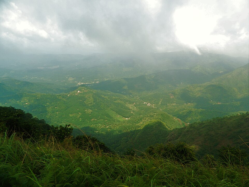
Correct — D, Western Ghats. The Cardamom Hills, called the Yela Mala locally, form the southern end of the Western Ghats, running across the Kerala-Tamil Nadu border south and east of the Anaimalai. Anaimudi, at about 2,695 metres the highest peak in peninsular India, stands at the knot where the Anaimalai, the Palani and the Cardamom hills meet, and the range continues southward to the Shencottah gap and the Agasthyamalai beyond it. The name comes from the spice the slopes have grown for centuries under the shade of the evergreen forest.
- (a)Eastern Ghats — The Eastern Ghats are a broken chain running down the eastern edge of the peninsula — the Nallamala, Javadi, Shevaroy and Mahendragiri hills. They meet the Western Ghats at the Nilgiris, well to the north of the Cardamom Hills.
- (b)Mizo Hills — The Mizo or Lushai Hills belong to the Purvanchal ranges in the north-east, where Phawngpui, the Blue Mountain, is the high point. They are more than two thousand kilometres from Kerala.
- (c)Naga Hills — Also part of the Purvanchal, on the Nagaland-Myanmar border, with Saramati as the highest peak. Nothing links them to the Cardamom Hills but the word hills.
The Western Ghats run about 1,600 kilometres from the Tapi valley to Kanniyakumari, broken only at the Palghat gap and the Shencottah gap. South of the Palghat gap the chain rises again into the Anaimalai, the Palani and the Cardamom hills, which is why the Cardamom Hills are described as a continuation rather than a separate range. The whole belt is a biodiversity hotspot and carries the higher rainfall on its windward western face.
The item can be solved by geography alone. Two options are north-eastern ranges and can be dropped without any knowledge of Kerala. That leaves a choice between the Eastern and Western Ghats, and the decisive fact is that cardamom is a wet, shade-loving crop of the high evergreen slopes — the Eastern Ghats are lower, drier and discontinuous. UPSC has used the Cardamom Hills as a distractor more than once, pairing them wrongly with the Coromandel Coast and with the Eastern Ghats.
- The Cardamom Hills, or Yela Mala, lie in south-eastern Kerala and adjoining Tamil Nadu.
- Anaimudi, about 2,695 metres, is the highest peak of peninsular India and stands at the junction of the Anaimalai, Palani and Cardamom hills.
- The Palghat gap separates the Nilgiris from the ranges to their south; the Shencottah gap lies further south again.
- The Nilgiris are where the Eastern and Western Ghats meet.
- Periyar Tiger Reserve lies in the Cardamom Hills, and the Periyar and Pamba rivers rise there.
- Placing the Cardamom Hills on the Coromandel Coast, a pairing UPSC has planted before.
- Assuming the Nilgiris are the southern end of the Western Ghats; the chain continues past them.
A single-fact placement item, with two of the four options drawn from a different corner of the country.
Consider the following pairs: Hills : Region 1. Cardamom Hills : Coromandel Coast 2. Kaimur Hills : Konkan Coast 3. Mahadeo Hills : Central India 4. Mikir Hills : North-East India Which of the above pairs are correctly matched?
- (a) 1 and 2
- (b) 2 and 3
- (c) 3 and 4
- (d) 2 and 4
Answer(c) 3 and 4
The same hills used as a planted error. That item is wrong precisely where this one is right — the Cardamom Hills belong to the southern Western Ghats and not to the Coromandel Coast.
Consider the following statements about physical features of India : 1. The southern point of the Peninsular Plateau is formed by the Nilgiri Hills where the Eastern and the Western Ghats meet 2. The Cardamom Hills may be regarded as a continuation of the Eastern Ghats Which of the statements given above is/are correct ?
- (a) 1 only
- (b) 2 only
- (c) Both 1 and 2
- (d) Neither 1 nor 2
Answer(a) 1 only
The identical claim tested in its false form. That paper's second statement calls the Cardamom Hills a continuation of the Eastern Ghats and is keyed wrong for exactly the reason this question is answered with the Western Ghats.
- practice — not a real PYQ
Anaimudi, the highest peak of peninsular India, stands at the junction of which three hill groups?
- (a)Anaimalai, Palani and Cardamom
- (b)Nilgiri, Shevaroy and Javadi
- (c)Satpura, Maikal and Mahadeo
- (d)Nallamala, Velikonda and Palkonda
Answer(a) Anaimalai, Palani and Cardamom — the three ranges south of the Palghat gap meet at Anaimudi.
- practice — not a real PYQ
The Eastern Ghats and the Western Ghats meet at
- (a)The Nilgiri Hills
- (b)The Cardamom Hills
- (c)The Palani Hills
- (d)The Shevaroy Hills
Answer(a) The Nilgiri Hills — the junction lies around the Udhagamandalam plateau.