
UNNATI (Agri-GIS) project of Madhya Pradesh Government is for:
- (a)Providing financial assistance to farmers for purchasing smartphones
- (b)Leveraging technology like satellite imagery and drone data to facilitate informed decision-making in agriculture
- (c)Promoting the cultivation of genetically modified crops
- (d)Establishing a network of agricultural universities across the state
Correct — B, Leveraging technology like satellite imagery and drone data to facilitate informed decision-making in agriculture. UNNATI — 'UNified Network for Agriculture Technology Initiative,' also called the Agri-GIS project — is a Madhya Pradesh government initiative under the Farmer Welfare and Agriculture Development Department that uses remote-sensing and Geo-ICT tools (satellite imagery, drone data, GIS and GPS) for crop and land monitoring, yield estimation and evidence-based agricultural planning across the state.
- (a)Providing financial assistance to farmers for purchasing smartphones — Not UNNATI's purpose — UNNATI is a remote-sensing/GIS data platform, not a device-subsidy scheme.
- (c)Promoting the cultivation of genetically modified crops — Unrelated — UNNATI is about geospatial, technology-based agricultural monitoring, not crop biotechnology policy.
- (d)Establishing a network of agricultural universities across the state — Confuses UNNATI (a GIS/remote-sensing data project) with agricultural education infrastructure, a separate domain.
UNNATI ('UNified Network for Agriculture Technology Initiative'), also known as the Agri-GIS project, is Madhya Pradesh's state-wide platform combining satellite imagery, drone-based data, and GIS/GPS tools to support the state's Farmer Welfare and Agriculture Development Department. It supports uses such as crop-area estimation, yield assessment, and faster, more objective crop-insurance claim settlement.
Exams increasingly test 'technology-in-governance' schemes — the trap is confusing a data/monitoring platform like UNNATI with a subsidy or infrastructure scheme; read the option carefully for WHAT the scheme actually does (collects and uses geospatial data) rather than assuming it hands out money or builds institutions.
- UNNATI stands for 'UNified Network for Agriculture Technology Initiative'; also called the Agri-GIS project.
- It uses satellite imagery, drone data, GIS and GPS for agricultural decision-making, planning and risk reduction.
- It is run by Madhya Pradesh's Farmer Welfare and Agriculture Development Department.
- A key use-case is technology-based crop-yield estimation to support faster, more objective crop-insurance claim settlement.
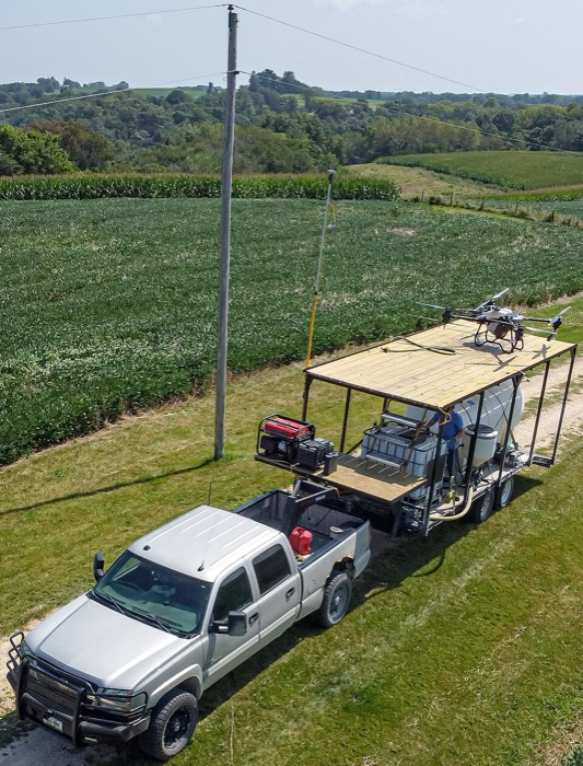
UNNATI turns remote-sensing data into decision-ready agricultural information for Madhya Pradesh.
- Mistaking UNNATI for a farmer subsidy/financial-assistance scheme rather than a data/technology platform
- Confusing UNNATI (a state-level MP Agri-GIS platform) with national programmes like PM-KISAN or PMFBY
MPPSC likes naming a specific MP scheme/project and asking what it actually DOES — read for the underlying technology or purpose (here: satellite + drone-based GIS for agriculture) rather than guessing from the name alone.
Consider the following activities : 1. Spraying pesticides on a crop field 2. Inspecting the craters of active volcanoes 3. Collecting breath samples from spouting whales for DNA analysis At the present level of technology, which of the above activities can be successfully carried out by using drones ?
- (a) 1 and 2 only
- (b) 2 and 3 only
- (c) 1 and 3 only
- (d) 1, 2 and 3
Answer(d) 1, 2 and 3
Shares the 'technology (drones/remote sensing) applied to agriculture' concept — UPSC tests drone capability for tasks including spraying pesticides on crop fields, the same remote-sensing-in-agriculture idea that underlies MP's UNNATI (Agri-GIS) platform.
- practice — not a real PYQ
UNNATI, Madhya Pradesh's Agri-GIS project, is implemented under which state department?
- (a)Farmer Welfare and Agriculture Development Department
- (b)Department of Science and Technology
- (c)Department of Revenue
- (d)Department of Cooperation
Answer(a) Farmer Welfare and Agriculture Development Department, Government of Madhya Pradesh.
- practice — not a real PYQ
Which of the following technologies does Madhya Pradesh's UNNATI (Agri-GIS) project use for agricultural decision-making?
- (a)Satellite imagery and drone data
- (b)Blockchain-based land records only
- (c)5G telecom towers
- (d)Nuclear-powered irrigation pumps
Answer(a) Satellite imagery and drone data — combined with GIS/GPS tools for crop and land monitoring.