Mapping
1.Tuvalu Pacific Island Vulnerability (Pacific Island)
IUCNIUCN membership · Polynesian atolls · Sea-level rise
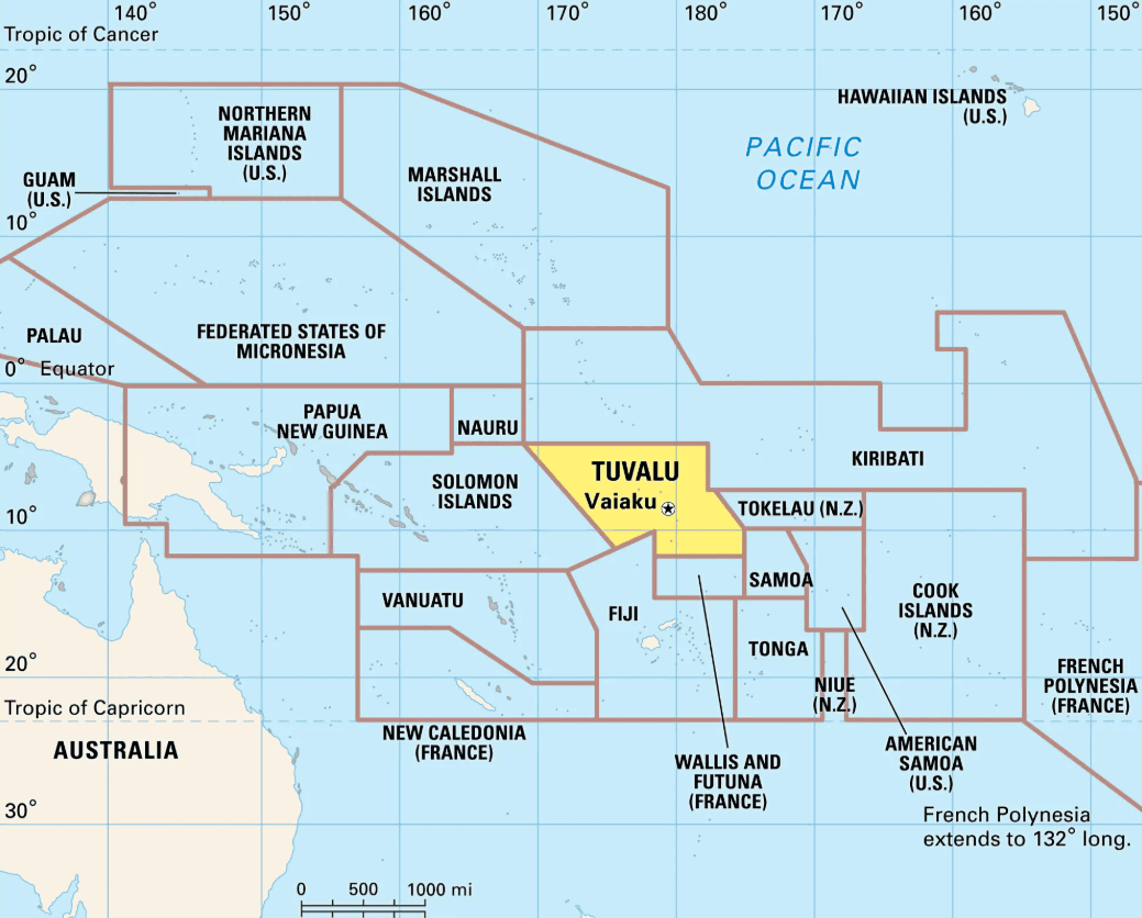
What & Where
Polynesian micro-state of nine Pacific islands; admitted as 90th IUCN State Member.
Land spans only 26 sq km, scattered over 676 km; EEZ nearly 900,000 sq km.
Elevation merely 4–5 m; coral-reef ecosystems face acute sea-level-rise threat.
Quick Facts for MCQs
Geography & Ecology
- Coral reefs harbour diverse fish, invertebrates, migratory species.
- Porous soils, no rivers; population depends on rainwater cisterns and shallow wells.
- EEZ of 900,000 sq km offers significant tuna fisheries potential.
Climate Vulnerability
- Sea-level rise erodes coasts, inundates agriculture, contaminates groundwater.
- Low elevation 4–5 m makes nation exemplar for climate-induced displacement risk.
- Westerly storms, king tides regularly breach seawalls, damage infrastructure.
International & Policy
- Independence in 1978 separated from British Gilbert & Ellice Islands colony.
- IUCN membership 2023 positions Tuvalu for global conservation funding and networks.
- Small Island Developing State leverages UNFCCC negotiations demanding 1.5 °C limit.
Key Data Points
| Feature | Data-Point |
|---|---|
| IUCN membership rank | 90th State Member |
| Region | West-central Pacific |
| Island composition | 5 atolls, 4 reef islands |
| Total land area | 26 sq km |
| Chain length | ~676 km |
| Exclusive Economic Zone | ~900,000 sq km |
| Capital | Vaiaku, Funafuti Atoll |
| Independence year | 1978 |
| Average elevation | 4–5 m above sea |
| Annual rainfall | 2,500–3,100 mm |
| Main crops | Coconut, breadfruit, taro |