
UPSC Current Affairs

13 topicsGS-1: 2GS-2: 4GS-3: 7
0/13 done
GS-3Economy

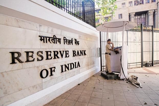
1.RBI Accommodative Monetary Stance (Monetary Policy)

DH
Illustration for RBI Accommodative Monetary Stance (Monetary Policy)

What & Where

Policy Accommodative stance is an RBI monetary approach to spur activity via low rates and high liquidity

Process Maintains easy credit through repo cuts, OMOs, LTROs, CRR tweaks and guidance to banks

Geography Applied across India during weak growth phases with inflation inside 2-6 % target band

Quick Facts for MCQs

Objectives

  • Credit Aim to boost loan availability for private investment
  • Borrowing Lower cost of capital to trigger spending by firms and households
  • Demand Support aggregate demand revival across stressed sectors

Tools

  • Repo Cutting policy repo reduces banks’ funding cost
  • Liquidity OMOs and LTROs inject durable and long-term funds
  • Reserves CRR reduction frees bank resources for lending

Economic Impact

  • Growth Higher consumption and CAPEX lift GDP trajectory
  • Assets Excess liquidity can inflate equities and real estate prices
  • Inflation Extended accommodation risks price pressures and external value erosion

Key Data Points

FeatureData-Point
DefinitionExpansionary monetary stance with low interest and ample liquidity
Adopted whenGDP below potential, inflation subdued or within target
Primary authorityRBI Monetary Policy Committee
Key rate leverRepo rate reductions
Liquidity leversOMOs, LTROs, temporary CRR cuts
Additional measureMoral suasion for banks to raise lending
Short-term gainHigher consumption, investment, employment
Key riskProlonged ease may fuel inflation and rupee weakness

Related UPSC Prelims PYQs

GS1 2011PYQ 1

The lowering of Bank Rate by the Reserve Bank of India leads to

GS1 2015PYQ 2

When the Reserve Bank of India reduces the Statutory Liquidity Ratio by 50 basis points, which of the following is likely to happen?

GS-1History

2.Daulatabad Fort Historical Significance (Medieval Fort)

The Hindu
Illustration for Daulatabad Fort Historical Significance (Medieval Fort)

What & Where

Hill-fort in Chhatrapati Sambhajinagar, Maharashtra; called Devgiri until Muhammad bin Tughlaq renamed it Daulatabad, 14th century.

Capital for Yadavas, Tughlaqs, Bahmanis, Nizam Shahis, Mughals, brief Marathas, later Nizams of Hyderabad.

UNESCO-nominated heritage noted for tri-layer defences, Indo-Islamic monuments, strategic ecology on basalt hill.

Quick Facts for MCQs

Administrative & Safety

  • ASI initiating damage assessment, drafting fort-specific disaster-management plan post-2025 fire.
  • UNESCO tentative listing heightens conservation priority, mandates periodic reporting.

Architectural Layout

  • Fortification triple-ring with moats, bastions, iron-spiked gates deterring elephants and siege towers.
  • Andheri tunnel zig-zag, dark, perforated for hot-oil ambushes.
  • Hill-top accessed via serpentine ascent limiting cavalry charge.

Monument Highlights

  • Chand Minar 30-storey red-sandstone shaft, Indo-Islamic mouldings modelled on Qutub Minar.
  • Bharat Mata Mandir retains 106 pillars from original mosque hypostyle hall.
  • Chini Mahal showcases blue-tile fragments, later Aurangzeb’s high-value prison.

Military Assets

  • Cannon network covers 360° ranges; Mendha reputed to breach enemy ramparts.
  • Bastions sited at angular intervals ensuring interlocking fields of fire.
  • Stores for water, grain enable long-duration resistance against sieges.

Key Data Points

FeatureData-Point
DistrictChhatrapati Sambhajinagar, Maharashtra
Original nameDevgiri (Hill of Gods)
Renamed byMuhammad bin Tughlaq
Fortification layersAmbarkot, Mahakot, Kalakot
Defensive tunnelAndheri
Victory towerChand Minar
Chand Minar year1435 CE
Former Jama MasjidNow Bharat Mata Mandir
Masjid built1318 CE under Qutub-ud-din Mubarak
Palace prisonChini Mahal by Aurangzeb
Cannon tally≈ 288 pieces
Famous cannonMendha / Qila Shikan
Managing bodyArchaeological Survey of India
Recent incident2025 fire; ASI damage assessment
GS-1Mapping

3.Taiwan Strait Strategic Significance (Strategic Strait)

WION
Illustration for Taiwan Strait Strategic Significance (Strategic Strait)

What & Where

Strait: narrow sea passage between Taiwan Island and China’s Fujian coast.

Linkage: connects South China Sea (south) to East China Sea (north) within Western Pacific.

Geopolitics: perennial flashpoint amid PRC-Taiwan tensions and heavy international naval presence.

Quick Facts for MCQs

Physical Geography

  • Shelf: shallow continental shelf facilitates rich fisheries, complex currents.
  • Underwater bank: prominent feature just north of Penghu Islands.
  • Rivers: Min & Jiulong deposit sediment and nutrients into western strait.

Strategic Significance

  • Trade-lane: busy route for East Asian shipping and energy imports.
  • Flashpoint: core of US-China-Taiwan security calculus; frequent overflights & transits.
  • Surveillance: regular US freedom-of-navigation operations challenge PRC claims.

Recent Developments

  • Exercise: August 2024 saw PLA’s largest drills encompassing entire strait.
  • Carrier: Shandong operated east of Taiwan, simulating encirclement tactics.
  • Response: heightened alerts by Taipei; regional allies monitor via ISR assets.

Key Data Points

FeatureData-Point
Connecting seasSouth China Sea ↔ East China Sea
Bordering landmassesFujian Province (PRC) & Taiwan Island
Shelf typePart of Asian continental shelf
Main Chinese rivers drainingMin River, Jiulong River
Nearby island groupPenghu (Pescadores) Islands to the north-west
Key military user (2024 drill)PLA Navy’s Shandong aircraft carrier

Related UPSC Prelims PYQs

GS1 2022PYQ 1

Which one of the following statements best reflects the issue with Senkaku Islands, sometimes mentioned in the news?

GS-3Environment

4.Marine Litter Environmental Threat (Ocean Plastic)

Down to Earth
Illustration for Marine Litter Environmental Threat (Ocean Plastic)

What & Where

Definition: Human-generated waste, mainly plastic, reaching oceans via rivers, drains, coastal activities

Key types: Single-use plastics, microplastics, ghost fishing gear; plastics constitute >80 % of debris

Core geography: Detected from Arctic ice to deep-sea trenches; India’s 7,500 km coast heavily exposed

Quick Facts for MCQs

Environmental Impact

  • Bioaccumulation: Microplastics enter food web, threaten biodiversity and human health
  • Navigation loss: Fouled propellers, damaged nets, tourism decline raise economic costs
  • Species mortality: Turtles, seabirds ingest plastic; entanglement leading global non-fish fatalities

International Instruments

  • Honolulu Commitment 2011: Multistakeholder pledge to curb land-sea waste inputs
  • UNEP Clean Seas 2017: Urges national bans on single-use plastics, promotes citizen pledges
  • GESAMP & GPML: UN scientific platforms aiding microplastic research and best practices

Indian Gaps

  • Policy vacuum: No standalone Marine Litter Act; action plan still in draft
  • Sector bias: Enforcement focuses on shipping, ignores riverine solid waste inflows
  • Land-sea disconnect: Urban drains funnel untreated trash, largely unchecked

Way Forward

  • National law: Model after Japan, EU Marine Strategy for land-sea continuum coverage
  • Community action: Replicate Kerala Suchitwa Sagaram fisherfolk clean-ups nationwide
  • Circular economy: Strengthen EPR traceability, incentivise coastal recycling & biodegradable substitutes

Key Data Points

FeatureData-Point
Plastic share in marine debris>80 %
Global plastic output last decadeExceeded entire 20th-century production
Annual deaths, marine mammals (ghost gear)≈ 650,000
Annual deaths, all marine animals>1 million
2050 forecastMore plastic by weight than fish
MARPOL Annex V1983, bans ship plastic dumping
UNCLOS pollution mandateArt-194, 1994 entry
SDG 14.1 deadline2025 for pollution reduction
India marine-specific lawNone; relies on Plastic Waste Rules 2016
EPR status in IndiaPatchy, state-wise inconsistency

Related UPSC Prelims PYQs

GS1, NDA_GAT 2019PYQ 1

पर्यावरण में निष्क्रिय हो जाने वाली ‘सूक्ष्ममणिकाएँ’ (Micro-beads) के विषय में अत्यधिक चिंता क्यों है?

GS1, NDA_GAT 2022PYQ 2

Which among the following has initiated a nationwide flagship campaign ‘Puneet Sagar Abhiyan’ to clean seashores/beaches and other water bodies of plastic and other waste materials?

GS-3Environment

5.Climate Losses in Asia-Pacific (Climate Losses)

Down to Earth

What & Where

UNESCAP Economic and Social Survey 2025 measures climate-linked macroeconomic losses across 30 Asia-Pacific economies

Average Annual Loss (AAL) expresses expected yearly disaster damage as % of GDP via hazard–exposure–vulnerability modelling

Geography: Afghanistan to Fiji; region delivered 60 % of 2024 global growth yet remains climate-vulnerable

Quick Facts for MCQs

Economic Angle

  • Losses: one-third of surveyed states already exceed 6 % GDP annual climate damage
  • Vulnerable list: Afghanistan, Cambodia, Iran, Kazakhstan, Laos, Mongolia, Myanmar, Nepal, Tajikistan, Uzbekistan, Vietnam
  • Urbanisation: rapid coastal growth plus weak infrastructure heightens fiscal and credit risks

Sectoral Risks

  • Agriculture: rice yields may drop 14 % by 2050 across region
  • Energy: coal-centric Indonesia, India, China face revenue and employment shocks from renewable transition
  • Fisheries: tropical stocks could decline 30 % by 2050

India Impact

  • GDP: 24.7 % potential output loss by 2070 under current warming trajectory
  • Labour: 34 million jobs at risk by 2030; 4.5 % GDP from lost labour hours
  • Coastline: 32 % eroded; Mumbai, Kolkata, Sundarbans highly exposed to sea-level rise

Policy & Schemes

  • Circular economy: promote zero-waste cities and Waste-to-Wealth initiatives
  • Innovation: Atal Innovation Mission, Start-up India, GCF funds for carbon capture and renewables
  • Infrastructure finance: align Smart Cities with NAPCC; green SEZs; develop national green taxonomy; utilise Loss & Damage Fund

Key Data Points

FeatureData-Point
Survey edition2025
Countries analysed30
Region-wide AAL4.8 % of GDP
Cambodia AAL≈11 % of GDP
≥7 % AAL nationsFiji, Myanmar, Pakistan
Asia-Pac share of 2024 world growth60 %
India GDP loss forecast 207024.7 % (ADB)
India heat-linked job loss 203034 million (WB)
Indian coastline eroded 1990-201832 %
India extreme-event loss 1993-2023USD 180 bn; 80 000 deaths

Related UPSC Prelims PYQs

GEO_GS 2020PYQ 1

According to the Global Climate Risk Index 2020, published by environmental think tank Germanwatch, in the year 2018 India’s rank in the list of top most climate affected nations is:

GEO_GS 2022PYQ 2

The United Nations has recently warned that 'famine-like conditions have been created by climate change' in which one of the following countries?

GS-3Species

6.One-Horned Rhinoceros Conservation Plan (Rhino Translocation)

DH
Illustration for One-Horned Rhinoceros Conservation Plan (Rhino Translocation)

What & Where

Definition One-horned rhinoceros Rhinoceros unicornis translocation plan aims to ease habitat pressure in Assam

Process Move rhinos from Kaziranga and Pobitora to seven protected areas across five states during 13-year span

Geography Proposed sites include Dibru-Saikhowa Assam, D’Ering Arunachal, Valmiki Bihar, Dudhwa–Pilibhit–Katarniaghat UP, Surai Range Uttarakhand

Quick Facts for MCQs

Translocation Sites

  • Assam Dibru-Saikhowa NP slated to receive five rhinos reintroduced over 13-year timeframe
  • West Bengal Gorumara and Jaldapara to exchange five rhinos every three years with Kaziranga or Pobitora
  • Expansion D’Ering Arunachal, Valmiki Bihar, Dudhwa, Pilibhit, Katarniaghat UP, Surai Range Uttarakhand earmarked for fresh introductions

Biological Features

  • Size Largest Asian rhino species, thick armour-plated skin folds aid predator defence
  • Diet Solitary grazers preferring tall grass, aquatic plants, shrubs, seasonal fruits across swampy terrain
  • Horn Keratin single horn used for display and turf defence, not medically attached to skull bone

Conservation & Policy

  • Goal Reduce overcrowding in Kaziranga and Pobitora ensuring genetic dispersal and risk mitigation from disease or disaster
  • Agency Wildlife Institute of India drafted national action plan serving as roadmap for state forest departments translocations
  • Monitoring Plan calls for periodic health checks, satellite telemetry and community engagement near release landscapes

Key Data Points

FeatureData-Point
Scientific nameRhinoceros unicornis
IUCN statusVulnerable
Typical height5.75–6.5 ft
Typical weightUp to 6,000 lb
Horn length8–25 inches
Largest population siteKaziranga NP Assam ~2,613 (2022)
Highest density sitePobitora WLS Assam 107 rhinos/16 sq km
Main habitat typeTerai grasslands & alluvial floodplains
Action plan horizon13 years
States in new planAssam WB Arunachal Bihar UP Uttarakhand

Related UPSC Prelims PYQs

GS1 1999PYQ 1

"India has the largest population of the Asian X. Today, there are just about 20,000 to 25,000 X in their natural habitat spreading across the evergreen forests, dry thorn forests, swamps and grasslands. Their prime habitats are, however, the moist deciduous forests. The X population in India ranges from Northwest India where they are found in the forest divisions of Dehradun, Bijnor and Nainital districts of UP to the Western Ghats in the states of Karnataka and Kerala and in Tamil Nadu. In Cen

GS-3Species

7.Nilgiri Tahr Census Initiative (Endemic Ungulate)

The Hindu
Illustration for Nilgiri Tahr Census Initiative (Endemic Ungulate)

What & Where

Endemic mountain ungulate Nilgiri Tahr (Nilgiritragus hylocrius), state animal of Tamil Nadu

Restricted to southern Western Ghats, mainly Eravikulam & Mukurthi landscapes at 1,200–2,600 m

Kerala–TN joint census April 2024, 265 blocks, marks 50 years of Eravikulam National Park

Quick Facts for MCQs

Legal & Policy

  • Schedule I tagging grants highest WPA protection, bans hunting and trade
  • State governments coordinate under Project Nilgiri Tahr for surveys, telemetry, reintroductions
  • 50-year Eravikulam NP jubilee used as legal-policy focal point for joint census

Population Stats

  • Combined recent estimate ≈2,056 individuals across Kerala–TN
  • Eravikulam NP holds single largest herd; Mukurthi NP second stronghold
  • Fragmented sub-populations demand metapopulation management approach

Habitat & Ecology

  • Species prefers steep rocky grasslands abutting shola forests for forage and predator escape
  • Climatic adaptation to wet tropical montane zones; sure-footed morphology suits escarpments
  • Keystone grazer; maintains grassland structure aiding other endemics

Scheme & Research

  • Radio-telemetry planned to map dispersal corridors and human-wildlife interfaces
  • Reintroduction targets historic sites like Grass Hills, Silent Valley, Agasthyamalai
  • Census uses block counts, double-observer photographic capture-recapture methods

Key Data Points

FeatureData-Point
IUCN statusEndangered
Wildlife Protection Act slotSchedule I
Activity cycleDiurnal
Sexual dimorphismMales larger, darker
Preferred habitatMontane grassland–shola mosaics
Historic range length~400 km Western Ghats
Present TN population~1,229 animals
Present Kerala population~827 animals
Altitudinal band1,200–2,600 m
State animal ofTamil Nadu
Project Nilgiri Tahr2022–2027
April 2024 census blocks265

Related UPSC Prelims PYQs

GS1 1999PYQ 1

"India has the largest population of the Asian X. Today, there are just about 20,000 to 25,000 X in their natural habitat spreading across the evergreen forests, dry thorn forests, swamps and grasslands. Their prime habitats are, however, the moist deciduous forests. The X population in India ranges from Northwest India where they are found in the forest divisions of Dehradun, Bijnor and Nainital districts of UP to the Western Ghats in the states of Karnataka and Kerala and in Tamil Nadu. In Cen

GS1 2017PYQ 2

In India, if a species of tortoise is declared protected under Schedule I of the Wild Life (Protection) Act, 1972, what does it imply?

GS-2Economy

8.India Withdraws Bangladesh Transshipment Facility (Transshipment Policy)

New Indian Express

What & Where

2020 facility: India’s LCSs & ports allowed Bangladeshi cargo to transit for exports to Nepal, Bhutan, Myanmar, beyond.

Core routes: Benapole–Petrapole LCS, Kolkata Port, Delhi Airport; leveraged India’s multimodal network for quicker third-country access.

Geography stakes: Siliguri Corridor proximity, Northeast connectivity, BBIN sub-region.

Quick Facts for MCQs

Economic Impact

  • Cost spike: Bangladesh loses cheapest land-sea route, raising freight & lead time for Europe/US shipments.
  • India gain: Relieved port/airport congestion, cushions domestic textile exporters from price undercutting.
  • Investor sentiment: Bangladesh’s transit-hub narrative weakened, may deter FDI in logistics.

Domestic Industry

  • AEPC lobbying: Cited unfair advantage to duty-free Bangladeshi RMG entering same freight channels.
  • Market share: Indian apparel sector eyes reclaimed slice of EU/US demand.
  • Political economy: Decision signals prioritising domestic MSME textiles before elections.

Security Dimension

  • China factor: Dhaka courting Chinese infra near Siliguri raised strategic alarm in Delhi.
  • Control lever: Facility withdrawal reasserts India’s logistic chokepoint influence over Bangladesh.
  • Spill-over risk: Action could push Dhaka to deepen Chinese port/rail alternatives.

Diplomacy & Regionalism

  • Message: Calibrated reminder against “geopolitical drift” under Neighbourhood First.
  • Platforms available: BBIN Motor Vehicle Agreement, BIMSTEC connectivity master-plan for renegotiated access.
  • Negotiation ask: Possible conditional reinstatement tied to security audits, reciprocity and capacity-sharing.

Logistics & Infrastructure

  • Bottlenecks: Delhi IGI cargo congestion, rising inland haulage costs flagged by Indian exporters.
  • Alternatives lacking: Bangladesh yet to operationalise high-capacity ports/dry ports to offset Indian corridor loss.
  • Joint builds: Proposed shared dry ports, rail ICDs to decouple security from commerce.

Key Data Points

FeatureData-Point
Launch year2020
WithdrawnApril 2024 (post-AEPC plea)
Key Bangladeshi exportReadymade garments (≈ US $50 bn, 2024)
Major Indian nodes usedKolkata Port, Delhi IGI Airport
Policy tag lineNeighbourhood First
Stakeholder opposingApparel Export Promotion Council, India
Landlocked beneficiariesNepal, Bhutan, parts of NE India
Security flashpointChinese-funded Lalmonirhat airbase near Siliguri Corridor

Related UPSC Prelims PYQs

GS1, NDA_GAT 2020PYQ 1

Consider the following statements:

GS1, NDA_GAT 2024PYQ 2

In February 2024, Government of India has decided to scrap the Free Movement Regime (FMR) between India and:

GS-2MiscQuick Bite

9.150th IPU Assembly Tashkent (Inter-Parliamentary Union)

PIB

What & Where

Inter-Parliamentary Union (IPU): global body of national parliaments advancing peace, rights, democracy via diplomacy.

Founded 1889; headquarters Geneva; network spans 182 Members + 15 Associates (2025).

Core forum: IPU Assembly meets twice yearly; 150ᵗʰ session convened at Tashkent, Uzbekistan.

Quick Facts for MCQs

Mandate & Structure

  • Objective: promote democratic governance, dialogue, capacity-building among legislatures.
  • Agenda areas: democracy, human rights, peace, sustainable development resolutions.
  • Funding: assessed member contributions underpin core programmes.

150th Assembly

  • Focus themes: inclusive democracy, gender representation, inter-parliamentary cooperation.
  • India highlighted Nari Shakti Vandan Act and ethos of Vasudhaiva Kutumbakam.
  • Tribute paid to former PM Lal Bahadur Shastri at Tashkent memorial.

India’s Role

  • Delegation led by Lok Sabha Speaker; proposed regular exchanges with Uzbekistan, Israel, Kazakhstan.
  • Showcased constitutional amendments enhancing women’s representation.
  • Reiterated commitment to parliamentary diplomacy within Central Asian outreach.

Key Data Points

FeatureData-Point
Founded1889
HeadquartersGeneva, Switzerland
Members (2025)182 National Parliaments
Associate Members15
Principal BodyIPU Assembly
Assembly FrequencyTwice a year
150ᵗʰ Assembly VenueTashkent, Uzbekistan
Primary FundingMember contributions
Slogan“For democracy. For everyone.”
GS-3Security

10.Ottawa Landmine Convention Withdrawals (Landmine Treaty)

Indian Express

What & Where

Ottawa Convention 1997 — global ban on use, production, stockpiling, transfer of anti-personnel landmines.

Current hotspot — Poland, Finland, Estonia, Latvia, Lithuania plan withdrawal amid Russia-Ukraine conflict.

Scope limited to personnel mines; anti-vehicle mines outside ambit.

Quick Facts for MCQs

Legal & Policy

  • Withdrawal right provided under Article 20 of Ottawa Convention with six-month notice.
  • Treaty allows retention of minimal mines strictly for training in detection/removal.

Security Dimension

  • States cite rearming threat if a ceasefire leaves Russia with mine stockpiles.
  • NATO eastern flank seeks rapid deployment options including mine use for border defence.

Membership Changes

  • First mass pull-out by EU/NATO members since convention inception.
  • Potential precedent for other frontline countries questioning humanitarian disarmament norms.

Related Treaties

  • Cluster Munitions Convention bans weapons releasing multiple bomblets; hinges on similar humanitarian logic.

Key Data Points

FeatureData-Point
Treaty nicknameMine Ban / Ottawa Convention
Adoption & venue18 Sep 1997, Oslo Diplomatic Conference
Entry into force1 Mar 1999
Signatory dutiesDestroy stockpiles ≤ 4 yrs; clear mined areas; assist victims
Membership tally164 States (Apr 2025)
Non-partiesUS, Russia, India, China, Ukraine, Israel
Weapon coveredAnti-personnel landmines only
Parallel ban treaty2008 Convention on Cluster Munitions
Cluster treaty parties112 States; India not signatory
Recent withdrawalsLithuania (cluster treaty); Poland, Finland, Baltics (Ottawa)

Related UPSC Prelims PYQs

GS1 1998PYQ 1

The recent Land Mines Conference to sign the historic treaty was held in the Capital city of

GS-3Security

11.INDRA-2025 India-Russia Naval Exercise (India-Russia Exercise)

PIB

What & Where

INDRA 2025: 14th bilateral India–Russia naval exercise, continuing INDRA series begun 2003

Two-phase format: Harbour Phase at Chennai port; Sea Phase in adjoining Bay of Bengal waters

Focus: joint maritime threat response, interoperability, rules-based order in Indian Ocean Region

Quick Facts for MCQs

Security Dimension

  • Drills: tactical manoeuvres, anti-air warfare, cross-deck helicopter landings
  • Outcome: improved real-time data-sharing and coordinated multithreat engagement capability
  • Area choice: Bay of Bengal allows blue-water, high-tempo scenarios near busy SLOCs

Defence Diplomacy

  • Exercise reaffirms long-standing India–Russia defence partnership beyond arms trade
  • Builds trust through crew exchanges, ship visits, sports interactions during Harbour Phase
  • Signals commitment to multipolar, rules-based Indo-Pacific security architecture

Comparable Exercises

  • Multilateral: Malabar (Quad), La Perouse (6 nations), KOMODO (36 nations)
  • Bilateral: Varuna (France), AUSINDEX (Australia), SLINEX (Sri Lanka)
  • Theme overlap: all aim at interoperability, maritime domain awareness, freedom of navigation

Key Data Points

FeatureData-Point
Partner naviesIndia & Russia
Edition & Year14th edition, 2025
Harbour Phase venueChennai, Tamil Nadu
Sea Phase areaBay of Bengal
Indian assetsINS Rana, INS Kuthar, P-8I LRMR aircraft
Russian assetsPechanga, Rezkiy, Aldar Tsydenzhapov
Launch year of series2003
Core aimsCounter maritime threats; enhance joint ops; uphold maritime order

Related UPSC Prelims PYQs

GEO_GS, NDA_GAT 2025PYQ 1

Naseem-Al-Bahr, held in October 2024, was a joint maritime exercise between the navies of India and

GEO_GS, NDA_GAT 2021PYQ 2

The maiden Indian Navy – European Union Naval Force (IN-EUNAVFOR) Exercise (2021) was conducted in

GS-2Scheme

12.Panchayat Advancement Index Highlights (Panchayat Performance)

DD News
Illustration for Panchayat Advancement Index Highlights (Panchayat Performance)

What & Where

Composite index benchmarking 2.5 lakh Gram Panchayats on nine SDG themes across rural India

First Panchayat Advancement Index (PAI) report released for 2022-23 by Ministry of Panchayati Raj

Gujarat and Telangana house the largest clusters of high-scoring panchayats

Quick Facts for MCQs

Metrics & Scope

  • Indicators 435 map to 566 data points ensuring granular SDG tracking
  • Data collection leverages Panchayat Enterprise Suite for real-time validation
  • Coverage spans nine themes: poverty, hunger, health, education, gender, water-sanitation, energy, economy, institutions

Performance Tiers

  • Front Runners 699 panchayats scored 75–90 indicating strong multi-sector delivery
  • Performers 77,298 panchayats in 60–75 band show above-average progress
  • Aspirants 1,32,392 panchayats in 40–60 band need focused assistance

State Rankings

  • Gujarat tops both Front Runner and Performer counts demonstrating consistent rural governance
  • Telangana secures second place with 270 Front Runners and 10,099 Performers
  • Eastern and central states dominate Aspirant category signaling regional development gaps

Key Data Points

FeatureData-Point
Launching ministryMinistry of Panchayati Raj
First report year2022-23 cycle, released 2024
Gram Panchayats assessed2,16,285 validated; 11,712 pending
Total indicators435 (331 mandatory + 104 optional)
Unique data points566 aligned with National Indicator Framework
SDG themes coveredNine
Front Runner score band75–90
Achiever score band90 + ; none yet
States with most Front RunnersGujarat 346, Telangana 270
Largest Aspirant countsBihar, Chhattisgarh, Andhra Pradesh

Related UPSC Prelims PYQs

CAPF_GAI 2022PYQ 1

Based on the scoring on SDG (Sustainable Development Goals) India Index, the NITI Aayog has classified various States into certain categories. Which one of the following is not one of the categories?

CAPF_GAI 2021PYQ 2

Which one of the following States ranked first on Sustainable Development Goal India Index, 2020-21 released by NITI Aayog?

GS-2Scheme

13.Modernized Command Area Scheme (Irrigation Modernisation)

PIB

What & Where

PMKSY; national umbrella irrigation mission; pan-India, launched 2015

M-CADWM; modernisation sub-scheme under PMKSY; approved for FY 2025-26

Focus zones; command areas of major, medium, extension, renovation & modernisation (ERM) projects across states

Quick Facts for MCQs

Tech & Schemes

  • Convergence; combines AIBP, IWMP, OFWM for single funding window
  • Digital layer; SCADA-IoT enables real-time water accounting, remote sluice control
  • Pressure network; underground PVC/HDPE pipes replace open channels, reduce seepage losses

Institutional Set-up

  • State Level Sanctioning Committee vets district plans, monitors execution
  • National Steering Committee ensures inter-ministerial coordination, policy tweaks
  • Asset O&M transferred to Water User Societies, can partner FPOs or PACS

Financials

  • Centre allocation; ₹1,600 crore earmarked FY 2025-26, cost-sharing as per PMKSY norms
  • Modernisation aims to utilise idle potential of earlier AIBP canals, improving ROI
  • Expected to attract private agri-tech investment via assured water supply infrastructure

Objectives

  • Utilisation; bridge gap between created and utilised irrigation potential
  • Efficiency; maximise water use efficiency, promote micro-irrigation through pressure systems
  • Sustainability; conserve water, reuse treated waste-water in peri-urban belts

Key Data Points

FeatureData-Point
PMKSY launch year2015
Ministries involvedJal Shakti, Agriculture, Rural Development
Core slogansHar Khet Ko Pani; Per Drop More Crop
M-CADWM approvalUnion Cabinet, April 2025
M-CADWM outlay₹1,600 crore for FY 2025-26
Original programmeCommand Area Development, 1974-75
Key techPressurised piped network, SCADA, IoT monitoring
Water delivery designUp to 1 ha farm outlets
Asset hand-overWater User Societies
ConvergenceAIBP, IWMP, OFWM merged into PMKSY

Related UPSC Prelims PYQs

CAPF_GAI, GEO_GS 2024PYQ 1

Which one among the following statements about PDMC scheme (Per Drop More Crop) is not correct?

CAPF_GAI, GEO_GS 2025PYQ 2

Which one among the following schemes focuses on developing modern infrastructure and optimizing supply chain from farm to retail in Indian agriculture sector?

Ready to practice?

Test your knowledge with our UPSC test series.

Start Free Trial